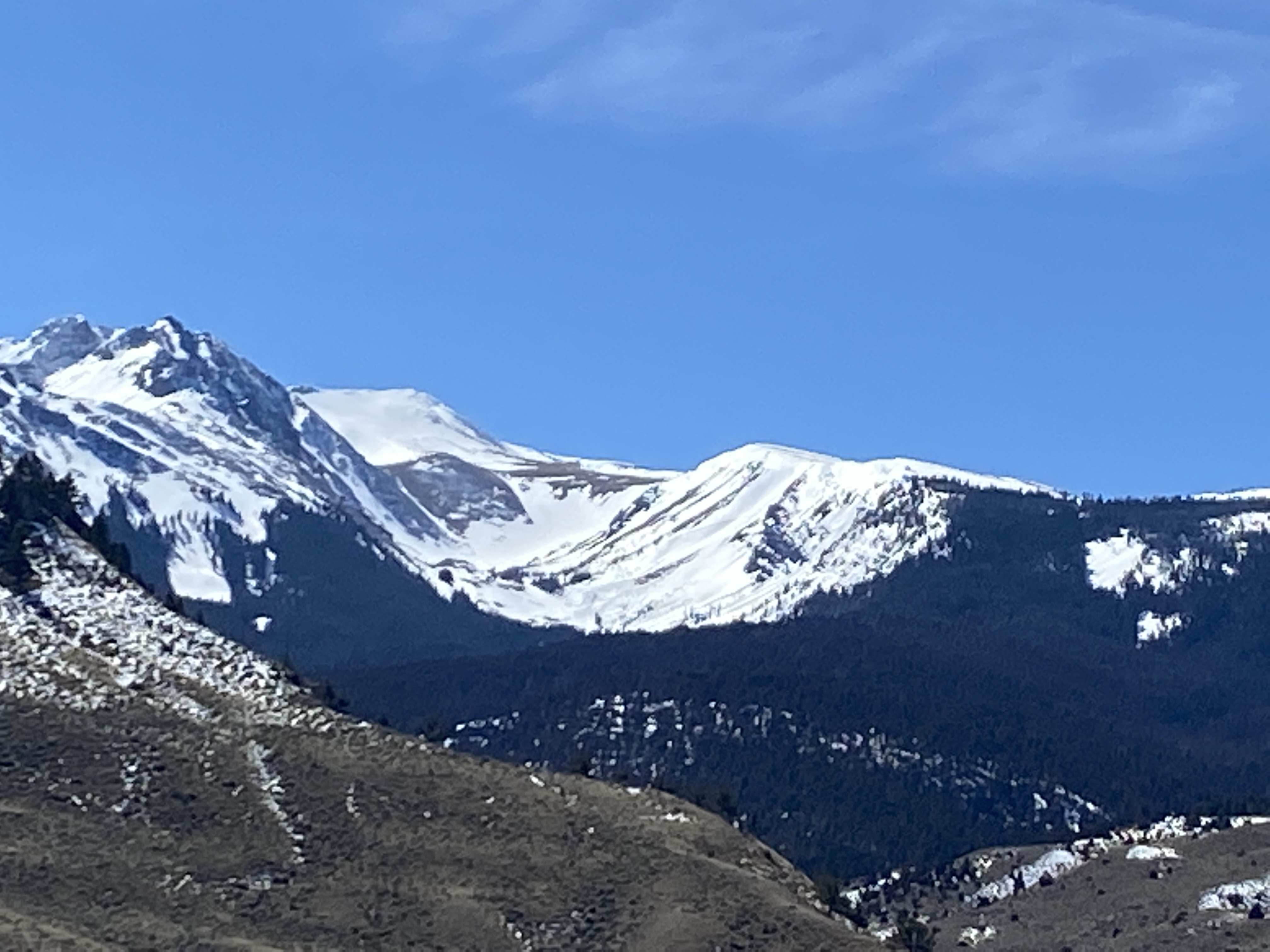
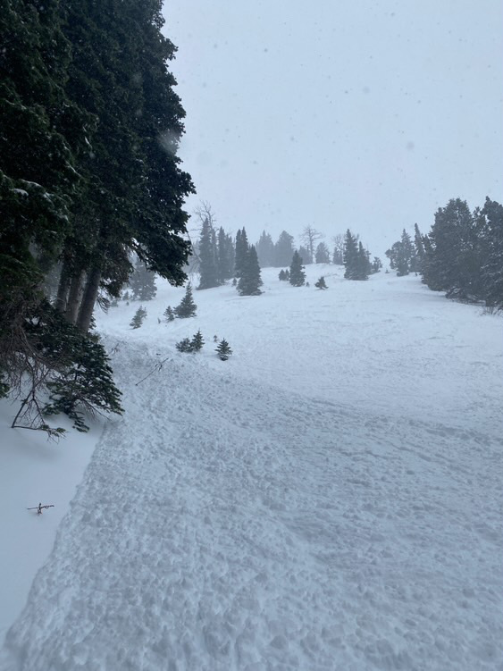
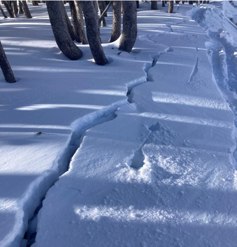
I noticed a couple of wet slides that came off Electric and it’s sun-ridge today. Photo: Anonymous
Trip Planning for Southern Gallatin

Primary Problem: Loose Wet
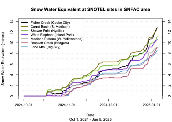
Bottom Line: Cold temperatures refroze the snowpack and will delay the onset of wet snow instability today. As the day warms and the sun hits this weekend’s snow, there will be a few small wet loose avalanches, especially on rocky, south-facing slopes. With only a few inches of recent snow, these avalanches will only be a problem in very steep or extreme terrain where they could sweep a skier or rider off their feet, into obstacles and terrain traps. Redirect to cooler, northerly aspects if you observe pinwheels and small wet slides.Past 5 Days
Thu Apr 10

Moderate
Moderate
Fri Apr 11
Moderate
Moderate
Sat Apr 12
Moderate
Moderate
Sun Apr 13

Low
Low
Today
Low
Low
Relevant Photos
Displaying 1 - 25
-

-

Understanding Avalanche Safety Preparedness – 5-Minute Survey for Motorized Users
We need your input! Eastern Oregon University is conducting a survey to better understand avalanche safety preparedness among motorized backcountry users like you. Your feedback will help us learn more about who is purchasing and practicing with avalanche rescue gear (beacon, probe, shovel) and participating in avalanche education—and why some riders aren’t. The survey is confidential and anonymous.
Your feedback is invaluable in improving avalanche education and awareness. Please take a moment to share your experience and help us make a difference.
https://eoustmhs.qualtrics.com/jfe/form/SV_3L8QKAuZzcxJBLo
Thank you for your time and for being a part of this important effort!
-

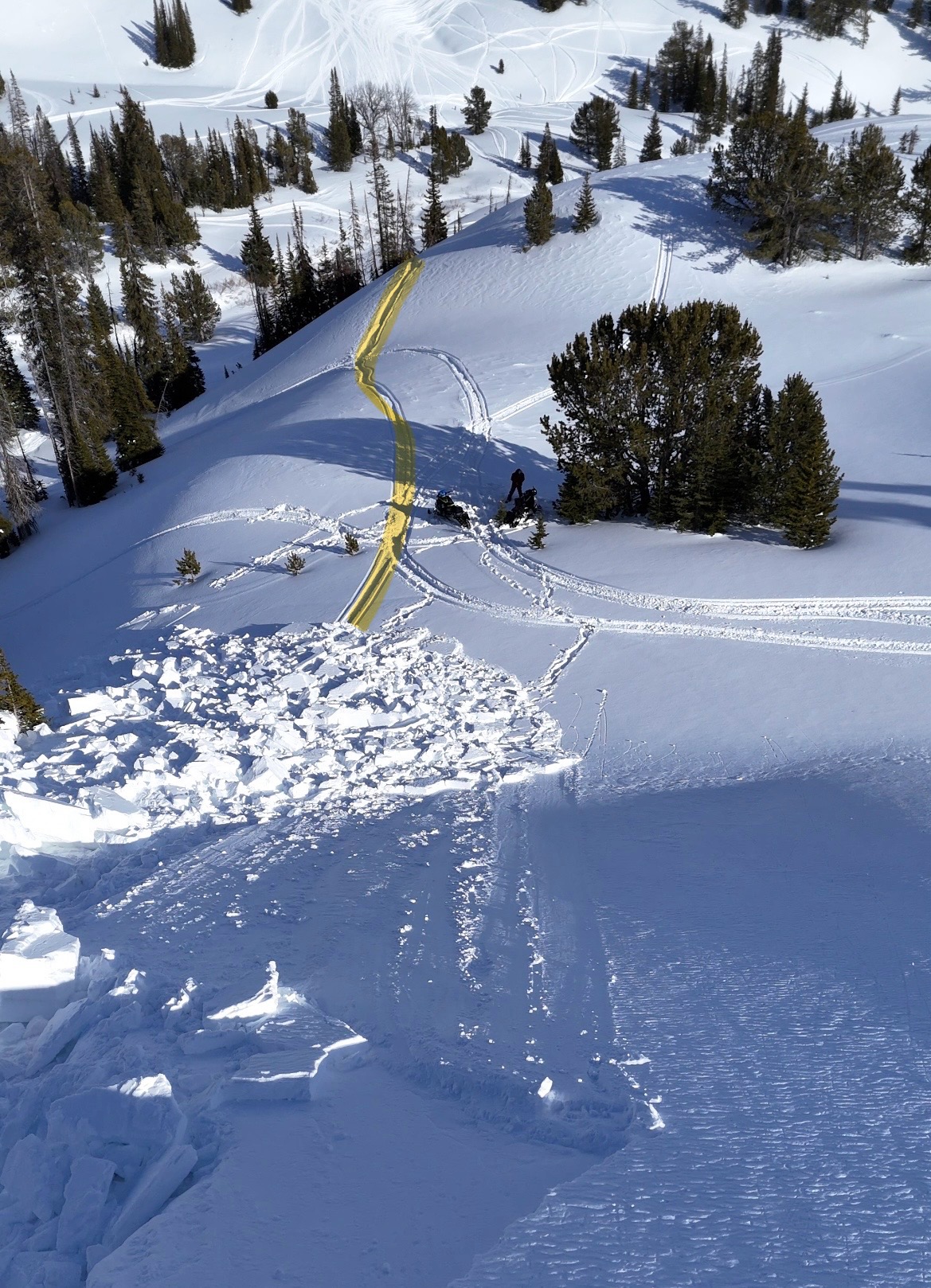
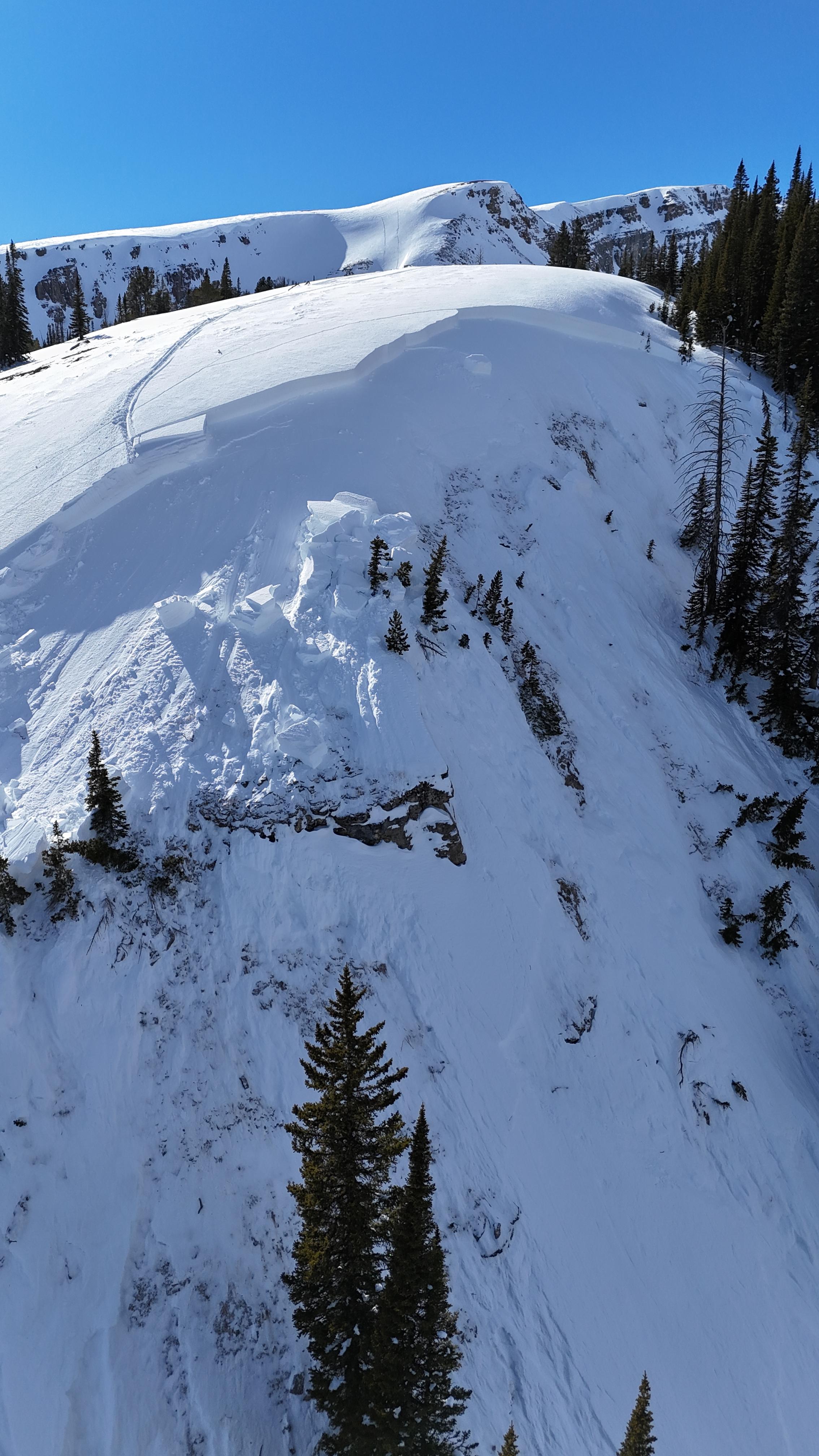
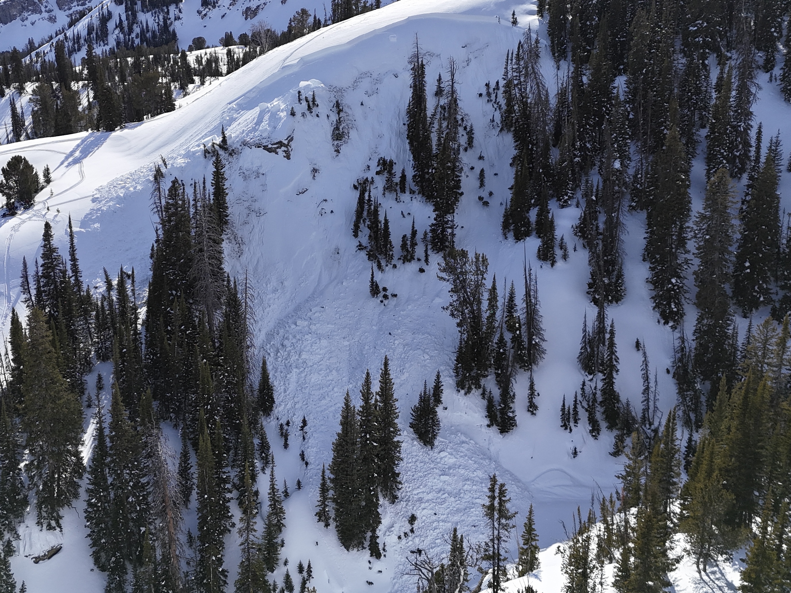
A rider triggered a huge avalanche in the uppermost reaches of Targhee creek on a north facing slope at 9200'
-

A rider triggered a huge avalanche in the uppermost reaches of Targhee creek on a north facing slope at 9200'
-

A rider triggered a huge avalanche in the uppermost reaches of Targhee creek on a north facing slope at 9200'
-

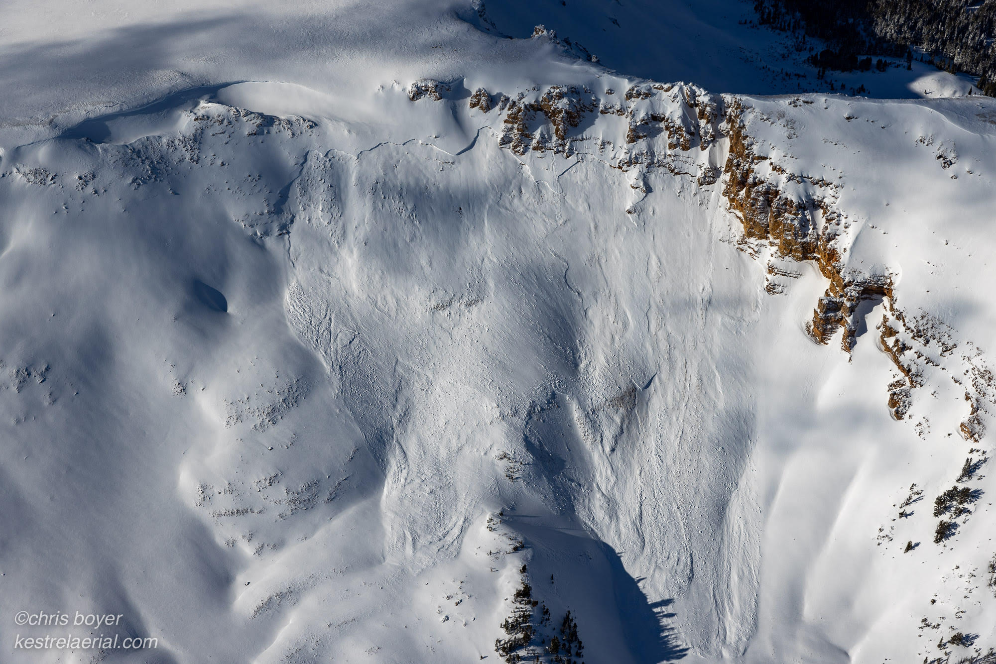
Natural avalanche spotted from the air on Red Mountain, just west of Ernest Miller Ridge
-

-

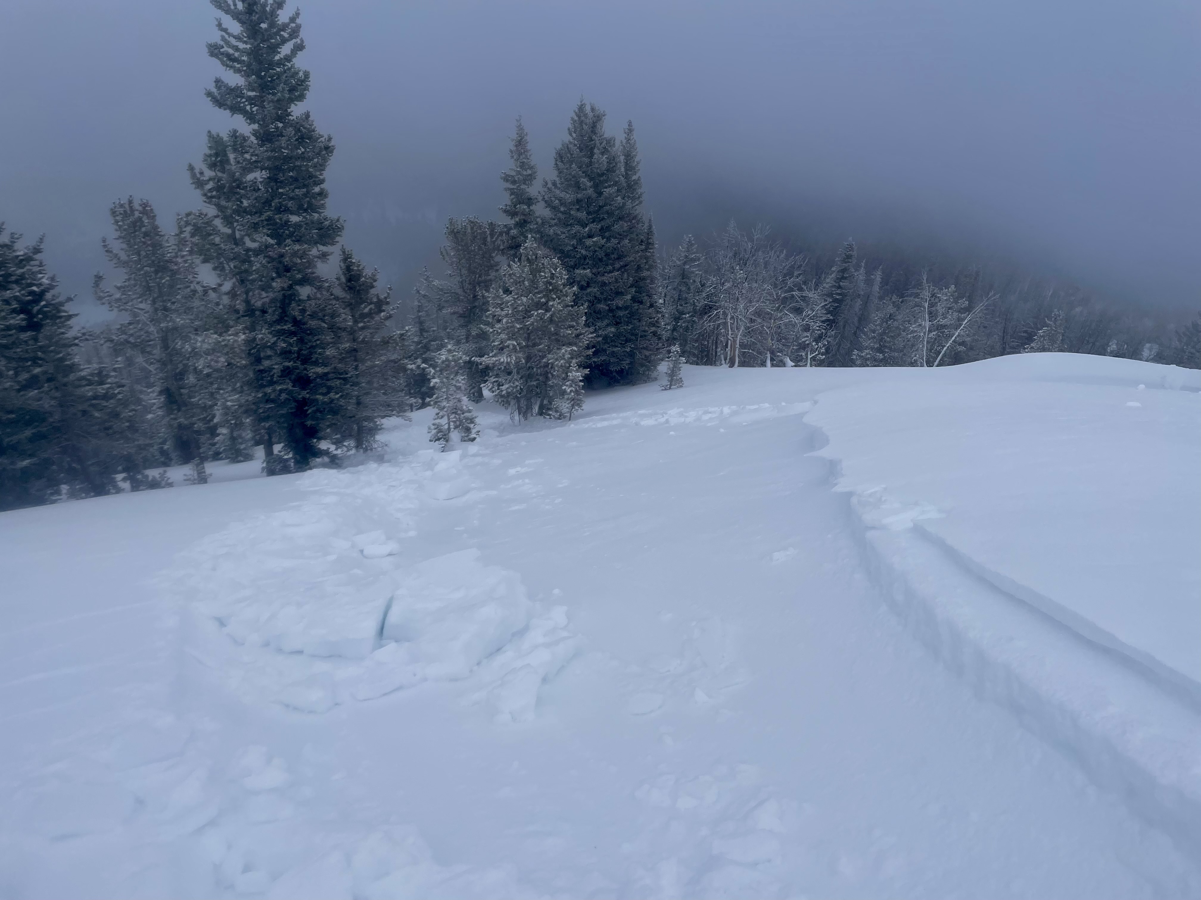
We experienced a remarkable number of thunderous collapses throughout the day (I lost count), one of which triggered an avalanche into Specimen Creek while we were in the flats. Photo: R Parsons
-

From obs on 12/29: "On our way out near the cabin I cut a line close to a creek to see if I could trigger something."
-

From obs on 12/29: "On our way out near the cabin I cut a line close to a creek to see if I could trigger something."
-

Plumes of drifting snow in the Bridger Range as strong winds blasted the mountains. Photo: GNFAC
-

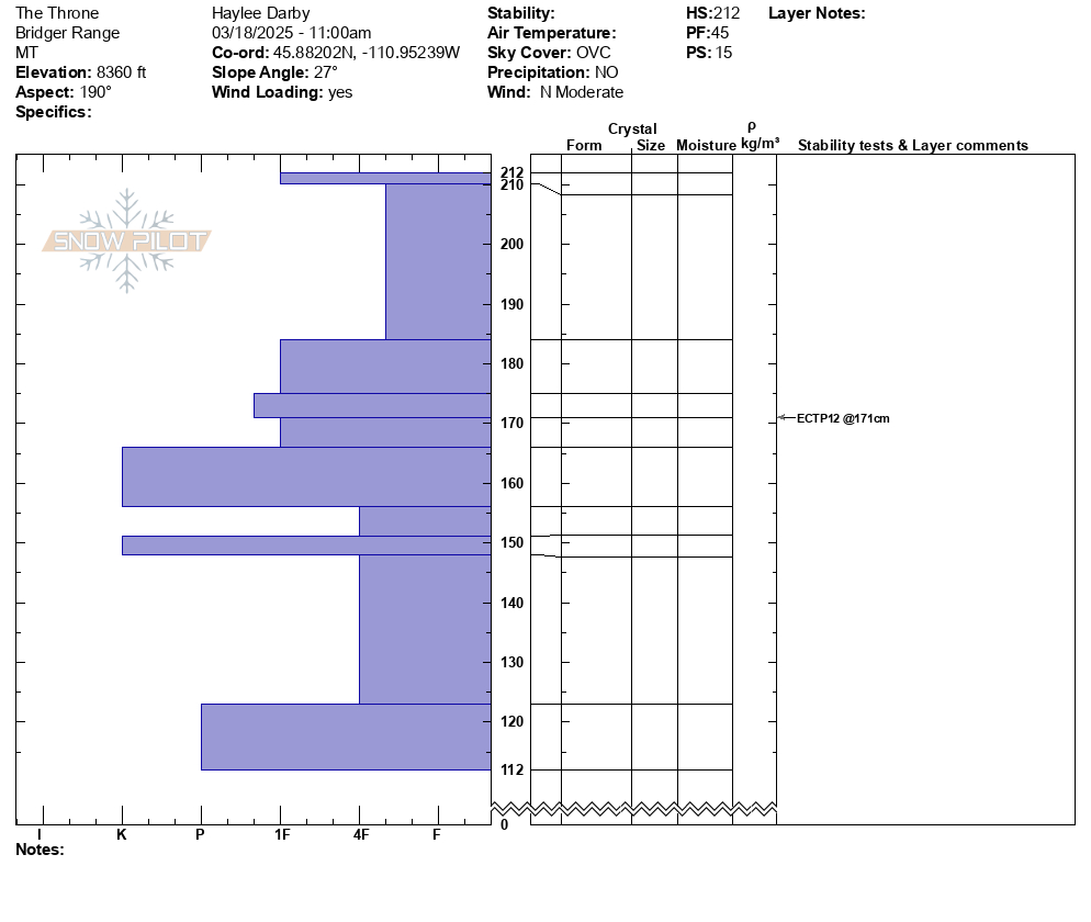
From IG: On 12/15 "Storm slab broke about 200’ above us as skinning up the hallway coming from the north side on the throne." Photo: Anonymous
-

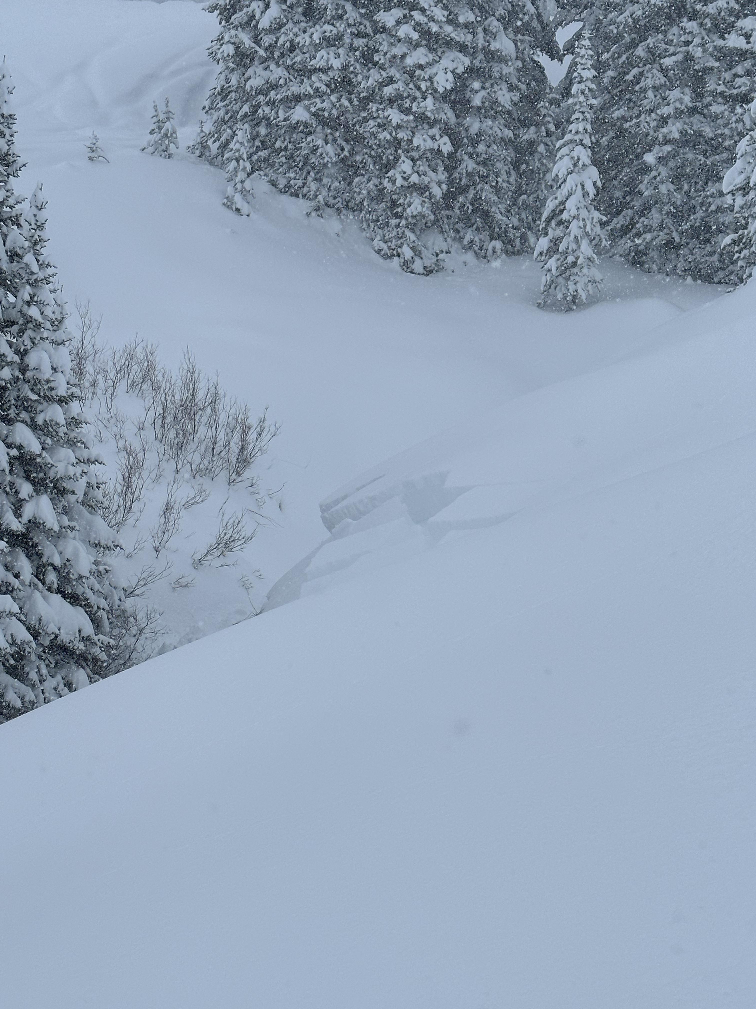
Gusty winds transporting snow in Taylor Fork on Saturday. Triggered a 4-5 inch deep wind slab that propagated about 50 ft at the top of a north east facing slope at 9,500 ft.
Photo: JP
-

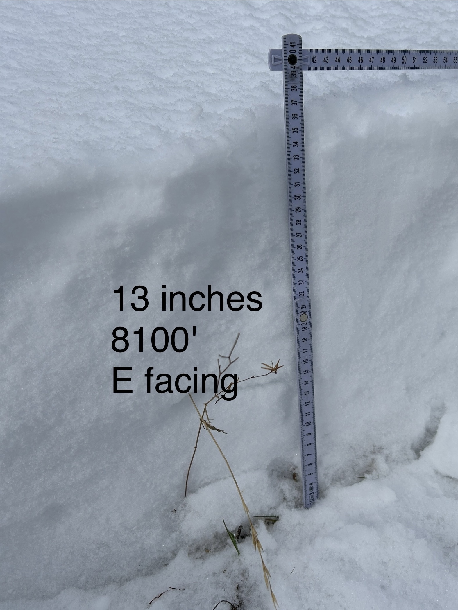
WE facing snow at 8100 ft Cabin Ck
-

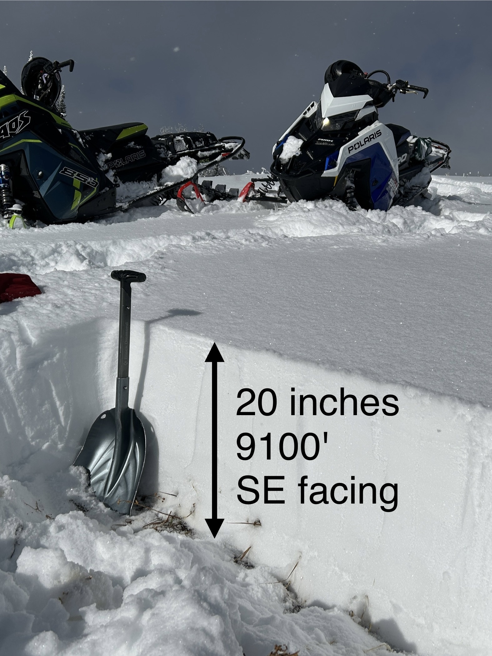
SE facing snow Cabin Creek
-

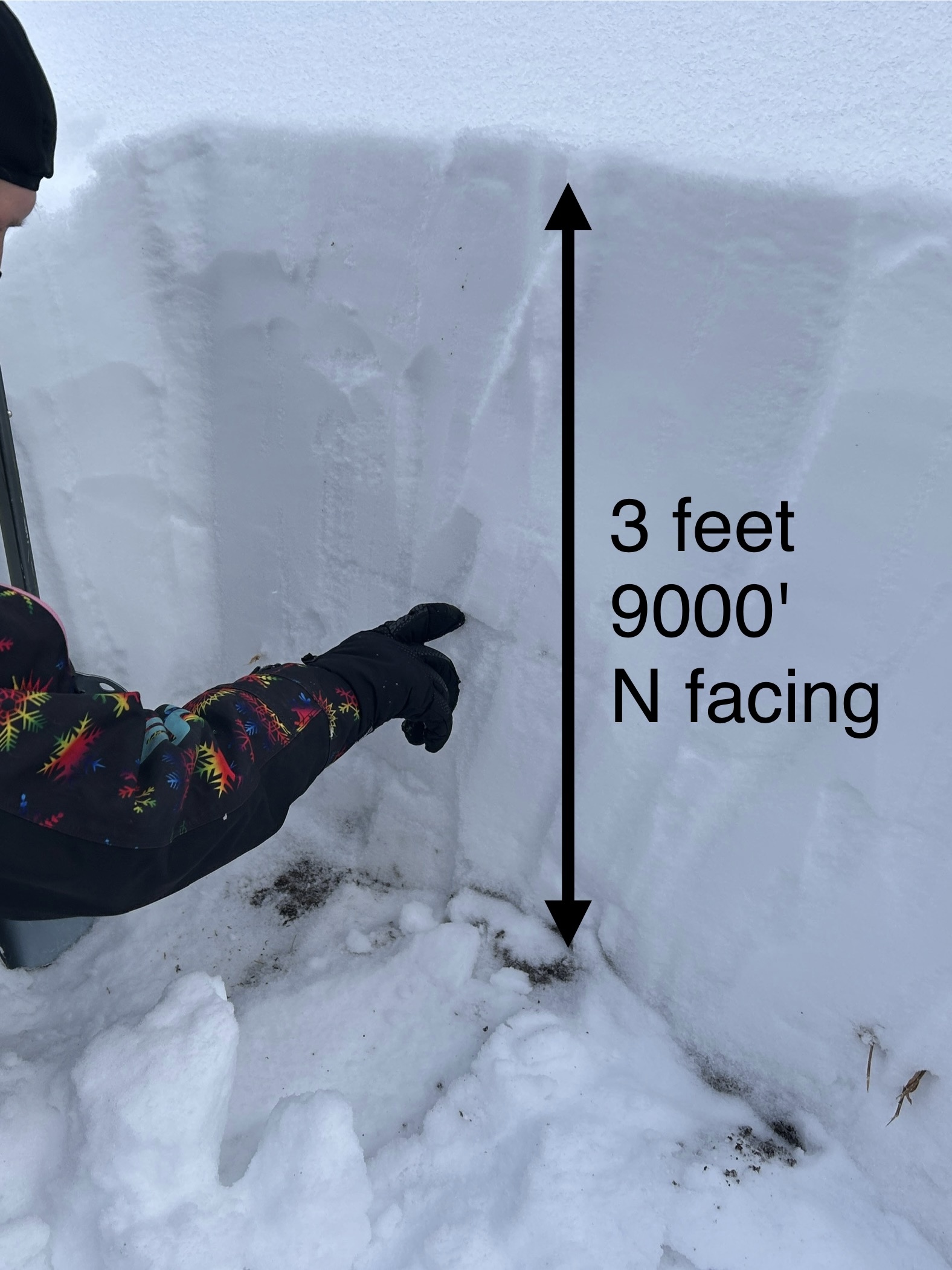
N facing snow Cabin Creek, 9000 ft
-

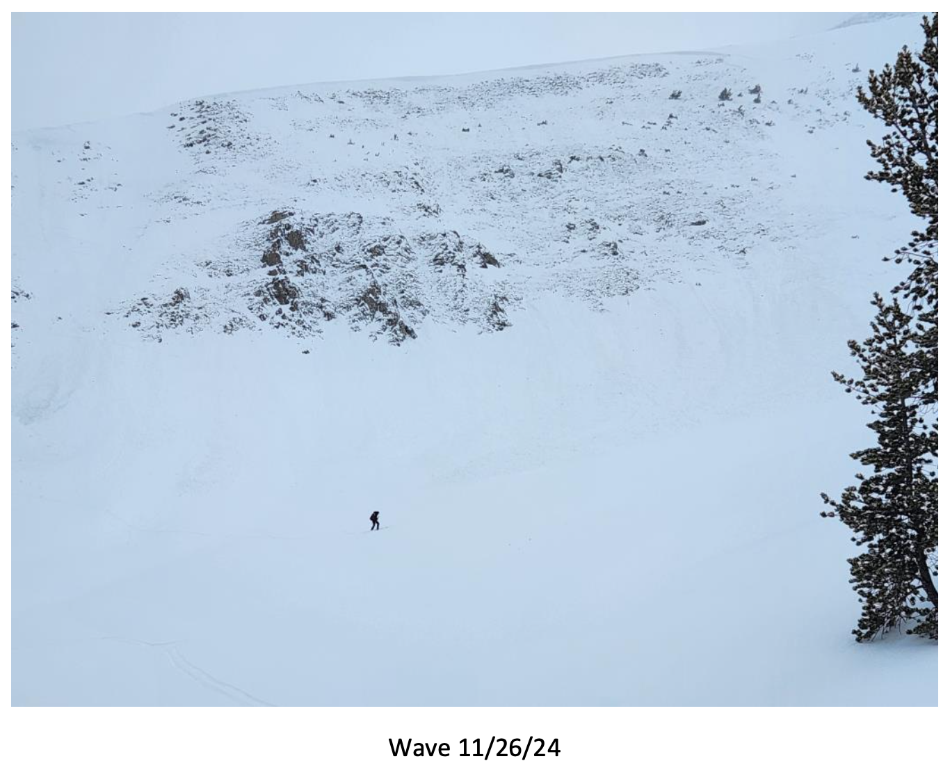
Big Sky Ski Patrol triggered this avalanche during mitigation work in The Wave on 11/26/24... "2-3' deep on an ice crust just above the ground with a 2# shot in the Upper rodeo. Volume was limited as most of the snow was loaded just underneath the cornice, but still produced a sizeable size 2... Other paths in the Lenin region ran meaty wind slabs, full track with no significant step downs." Photo: BSSP
-

Cracking on old, faceted, October snow hundreds of feet long. North facing near treeline. Photo: BSSP
-

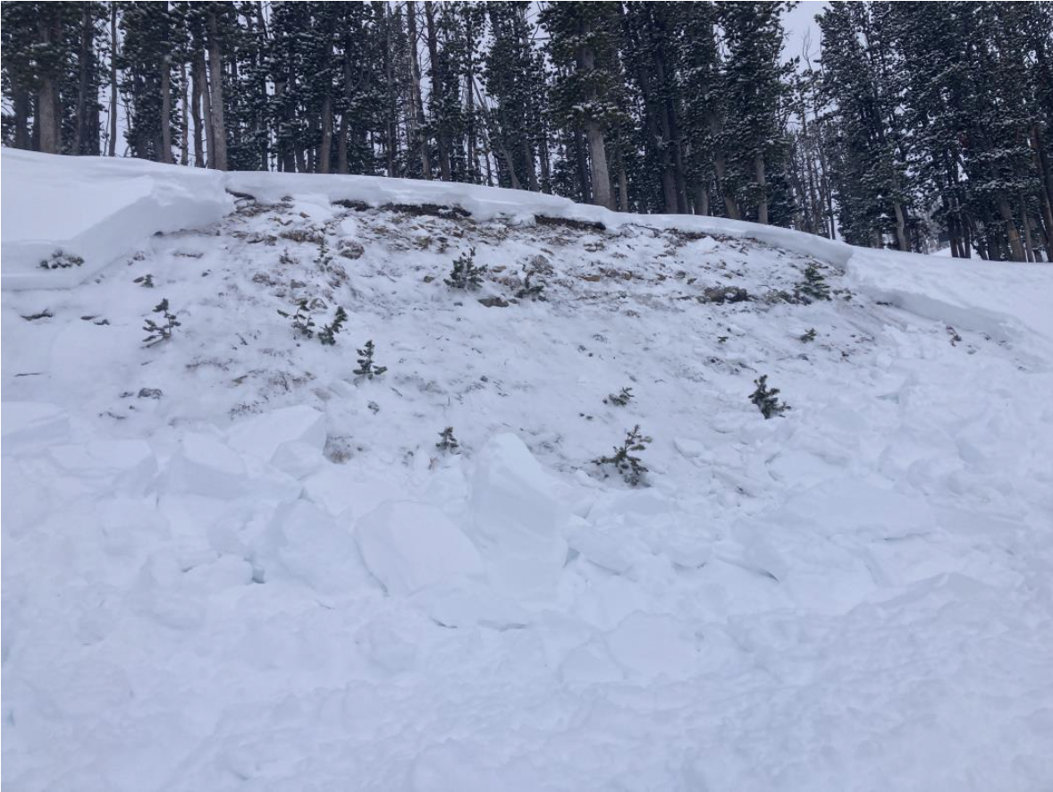
Intentional, human-triggered avalanche by a ski patrol breaking at the ground on a north facing slope near treeline. Photo: BSSP
-

Snowpit at Bridger Bowl on 11/5. Photo: B. VandenBos
-

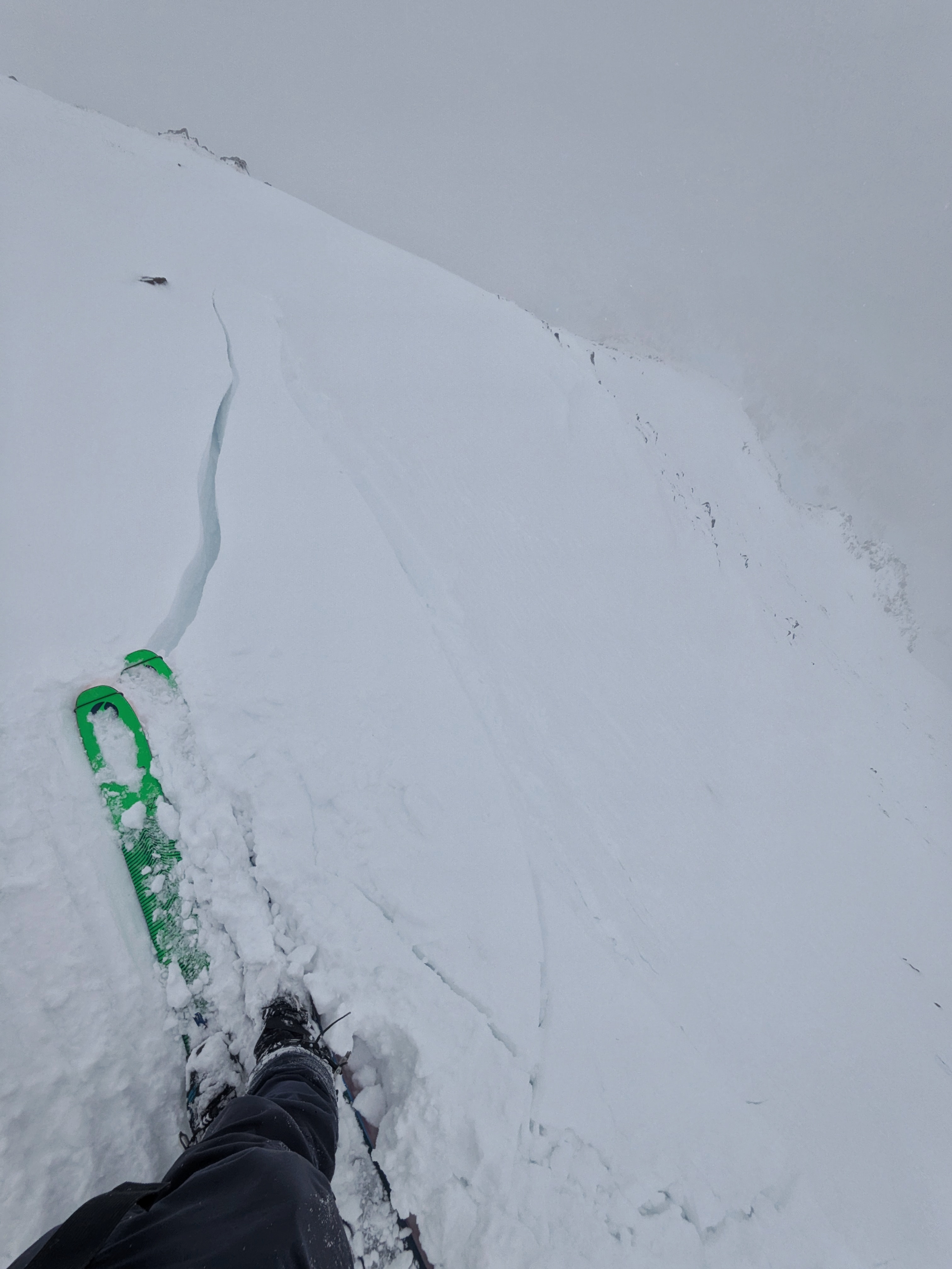
From e-mail: "Photo attached from near top of hyalite peak, 11/2. Cracking in recent hard wind slab, I had to really jump hard to make this. Walked on many other hard slabs that were well bonded. Highly variable snowpack. I think you'd be most likely to get into trouble by popping out a small hard slab pocket like this and getting magic carpeted into some thinly covered terrain." Photo: B. VandenBos
-

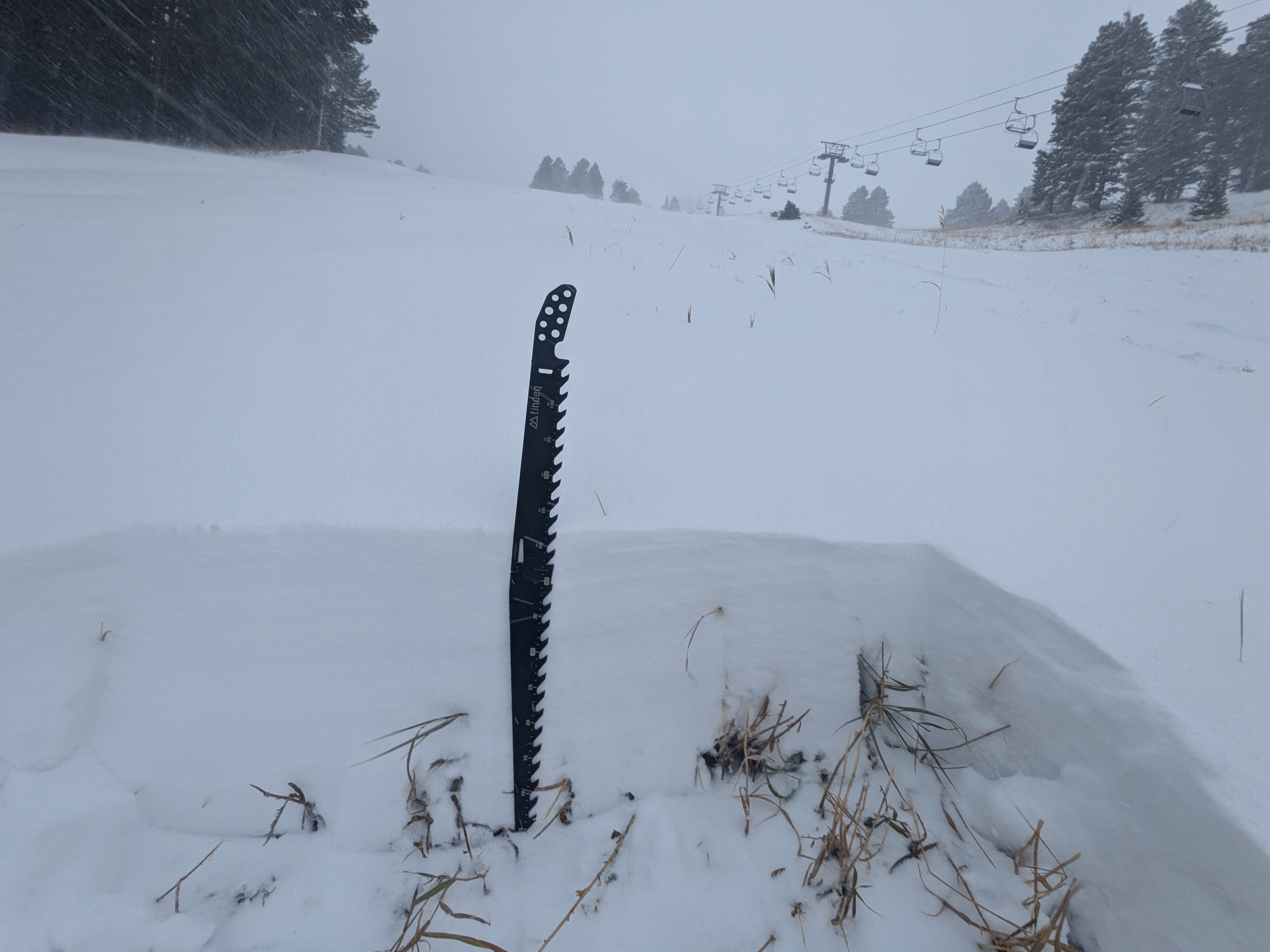
From obs: "1-3 mm faceting in front of the Montage. Clear skys and mid 20 temps"
-

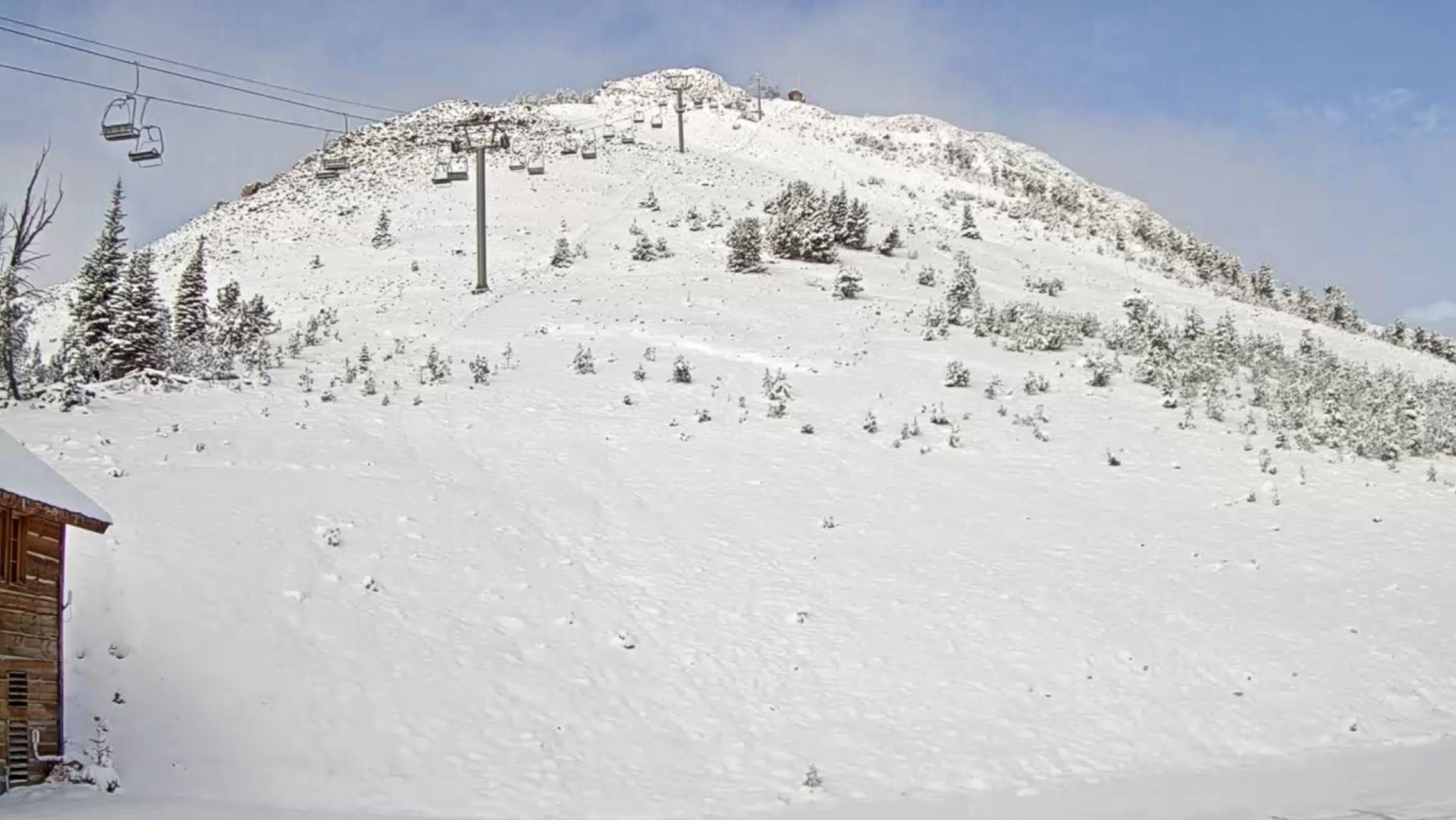
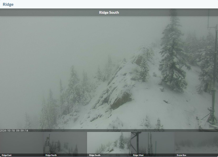
On October 17, rain turned to snow and blanketed the mountains of southwest Montana with a fresh coat of snow. Photo: Yellowstone Club Webcam
-

On October 17, rain turned to snow and blanketed the mountains of southwest Montana with a fresh coat of snow. Photo: Bridger Bowl Webcams
-

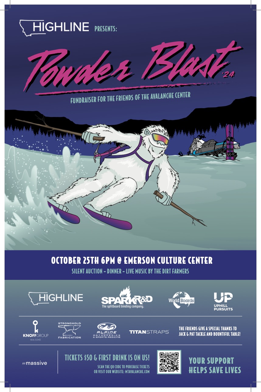
The 26th annual fundraiser for the Friends of the GNFAC is October 25 at the Emerson Cultural Center. More info and tickets at: https://events.eventgroove.com/event/Powder-Blast-2024-101627

Videos- Southern Gallatin
WebCams
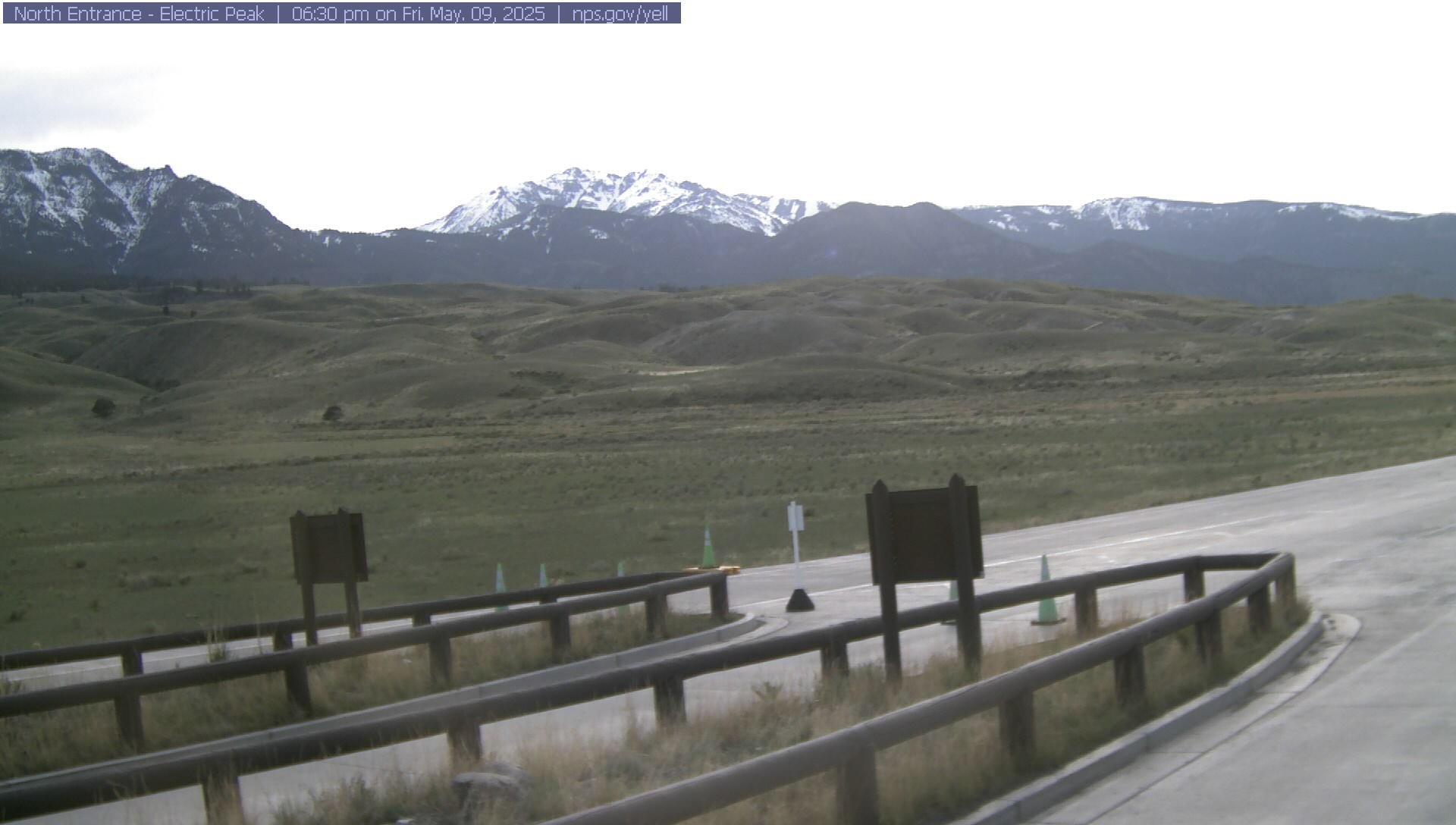
Electric Peak
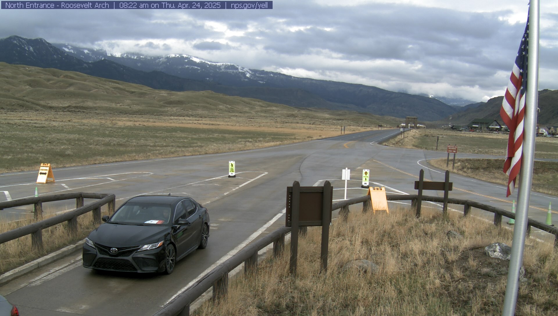
Roosevelt Arch


Weather Stations- Southern Gallatin
Weather Forecast Southern Gallatin
Extended Forecast for17 Miles SE Big Sky MT
Tonight

Low: 26 °F
Mostly Clear
Tuesday

High: 57 °F
Sunny
Tuesday Night

Low: 31 °F
Partly Cloudy
Wednesday
High: 53 °F
Mostly Sunny
then Chance
ShowersWednesday Night
Low: 24 °F
Rain/Snow
Likely then
Snow Showers
LikelyThursday

High: 30 °F
Snow Showers
and BlusteryThursday Night

Low: 18 °F
Chance Snow
ShowersFriday

High: 36 °F
Partly Sunny
Friday Night
Low: 19 °F
Mostly Clear
The Last Word
Our last daily avalanche forecast will be Sunday, April 20th. We will issue updates on Mondays and Fridays through the end of April.