Snow Observations List
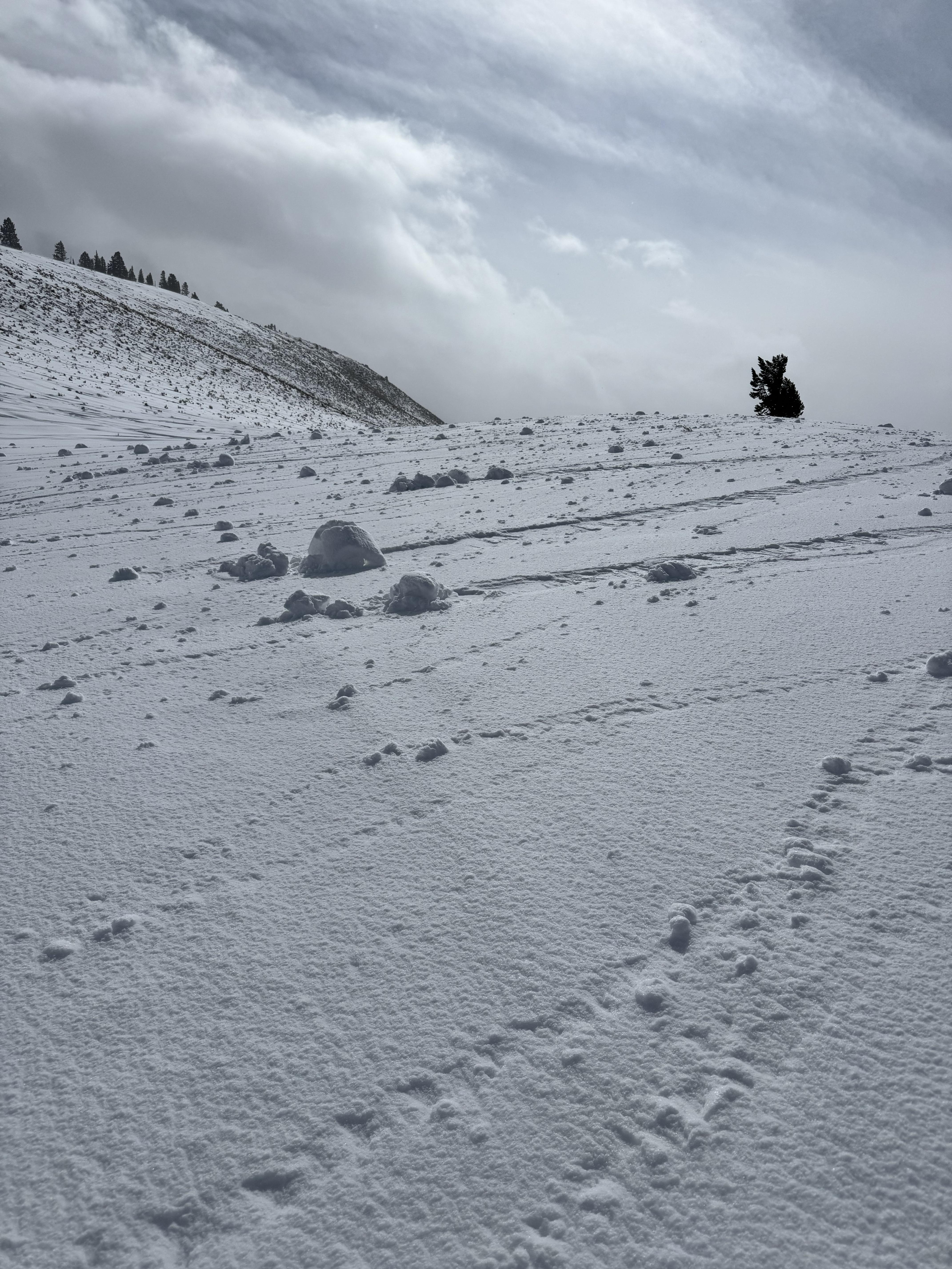
Toured into Margaret's Meadow this afternoon. 2" of dense snow over a 1/2 of graupel, on top of a wind crust. Light winds from the SSE. Light wind loading on the N, and NE aspects. No cracking or collapsing, and new snow seems to be bonding (at leas on lesser angled slopes). Skiing conditions were surprisingly good.
Full Snow Observation ReportToday I triggered a D1 dry loose avalanche on a E facing 35 degree slope, 9300 ft on Mt Henderson. The new snow is very low density and is not bonding well to the old interface. I also observed some more dry loose activity/small wind slabs on Sheep Mt, NE facing, 10400 ft.
Full Snow Observation Report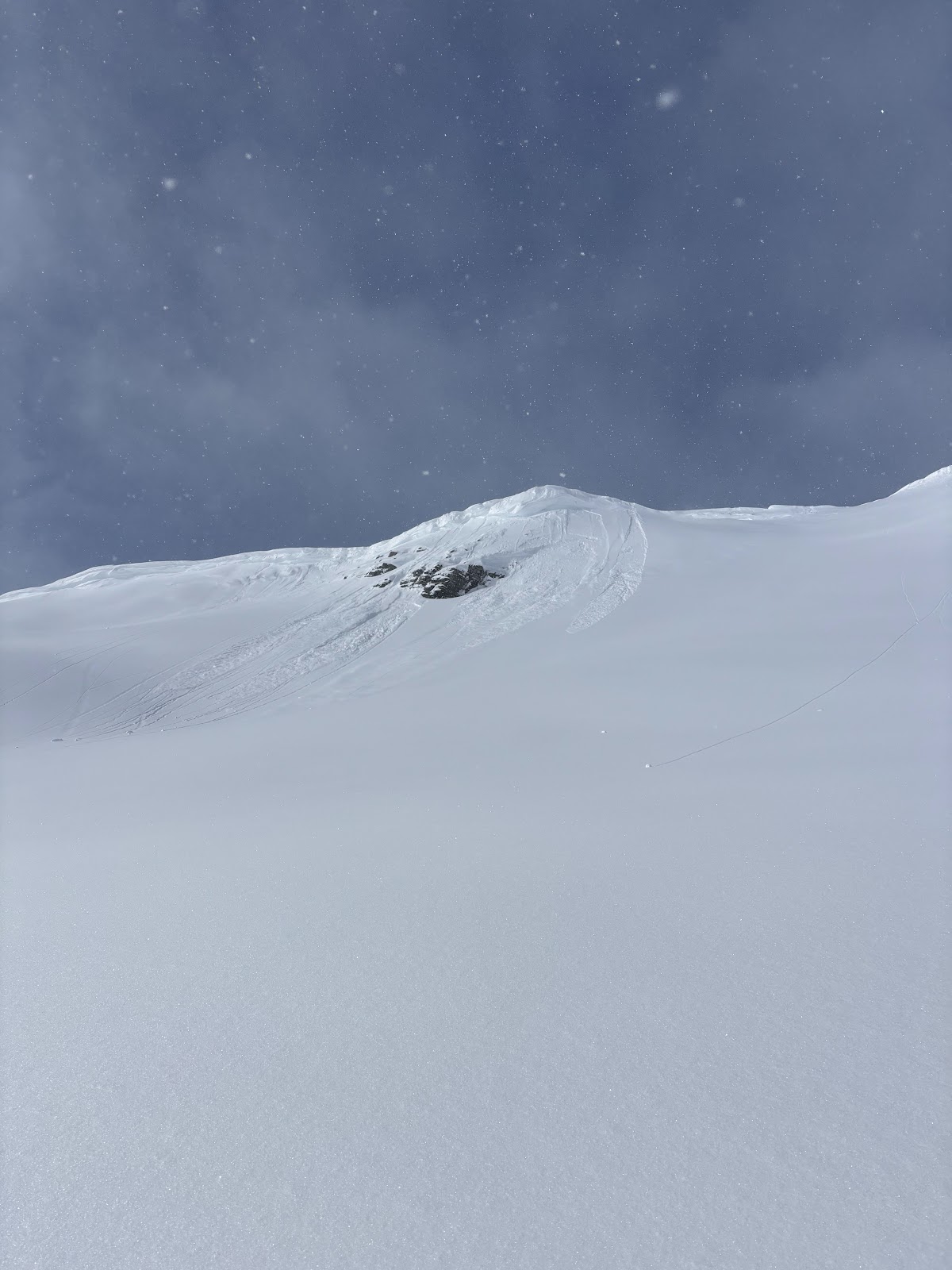
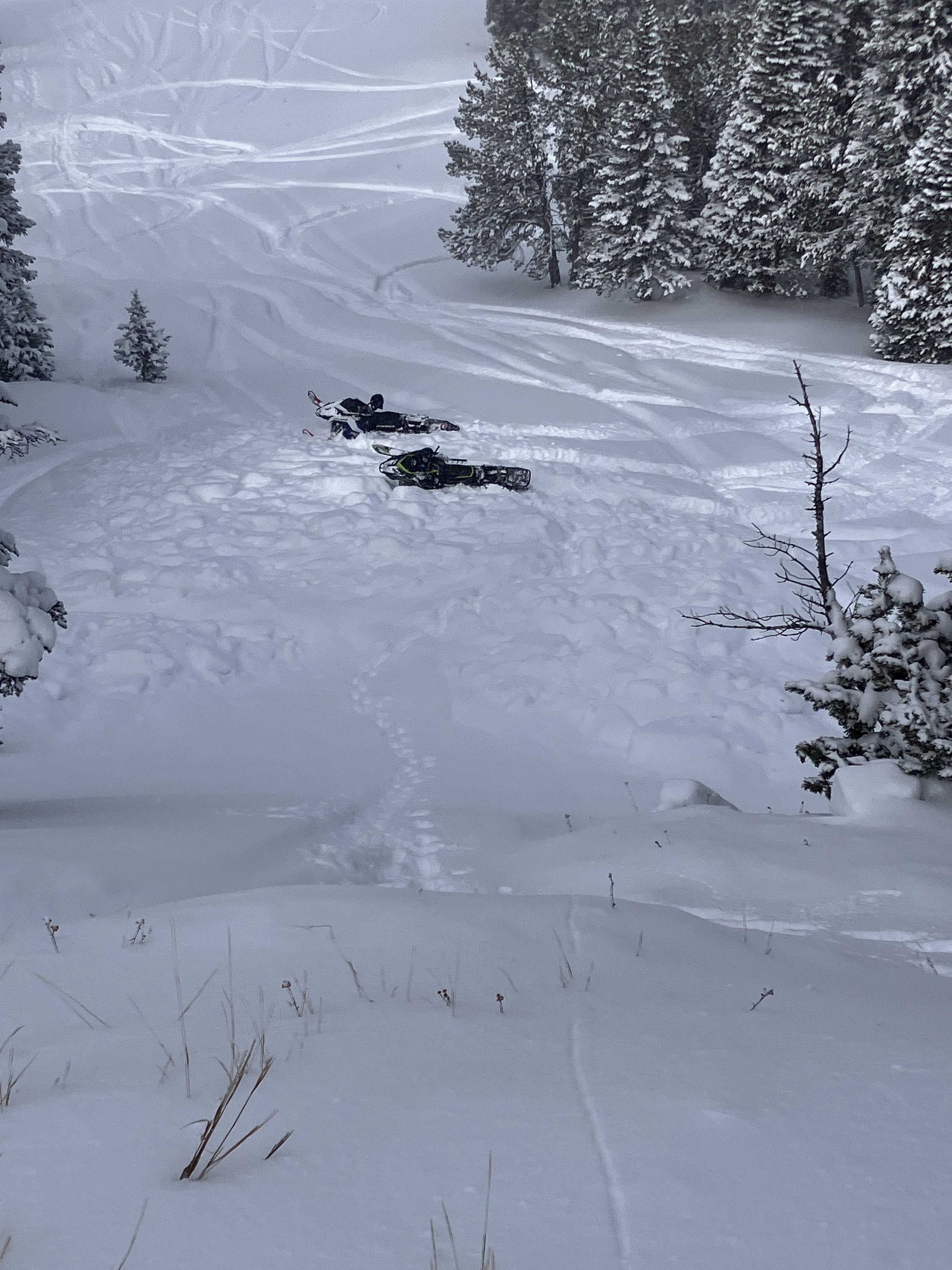
We looked at the avalanche in Sunlight Basin/Taylor Fork that was triggered by a snowmobiler yesterday. It was 50' wide, 100' vertical, 2-3' deep hard slab with 8-9" new snow on top. Broke on weak facets buried in late January. Dirt layer from Feb 4 was visible 6-8" above weak layer. Bed surface was 3" to 1.5' deep of weak, sugary facets. Slope angle was 38-40+ degrees. 8800', WNW aspect.
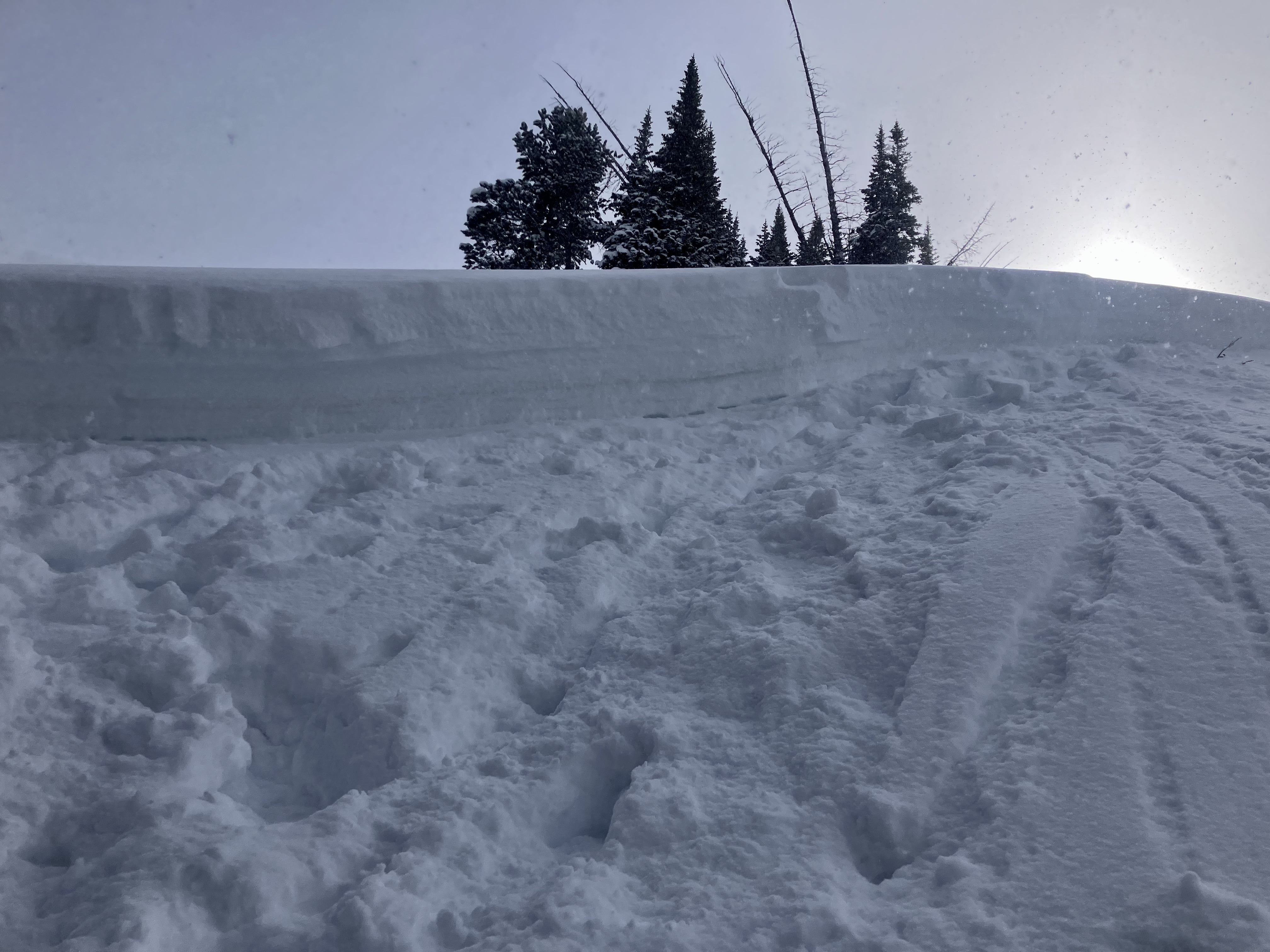
We also rode to the northwest end of Carrot Basin near the wilderness boundary and dug a pit. Snow depth was 5-6 feet. We found the buried weak layers 3 feet deep. It broke and propagated with many extra hits after an ECTX.
Snow fell lightly most of the day up high while it was sunny in the parking lot. Wind was light with a few moderate gusts. There was minimal signs of recent wind, but forecast is for wind to increase and there is a lot of light snow to drift into slabs.
Full Snow Observation Report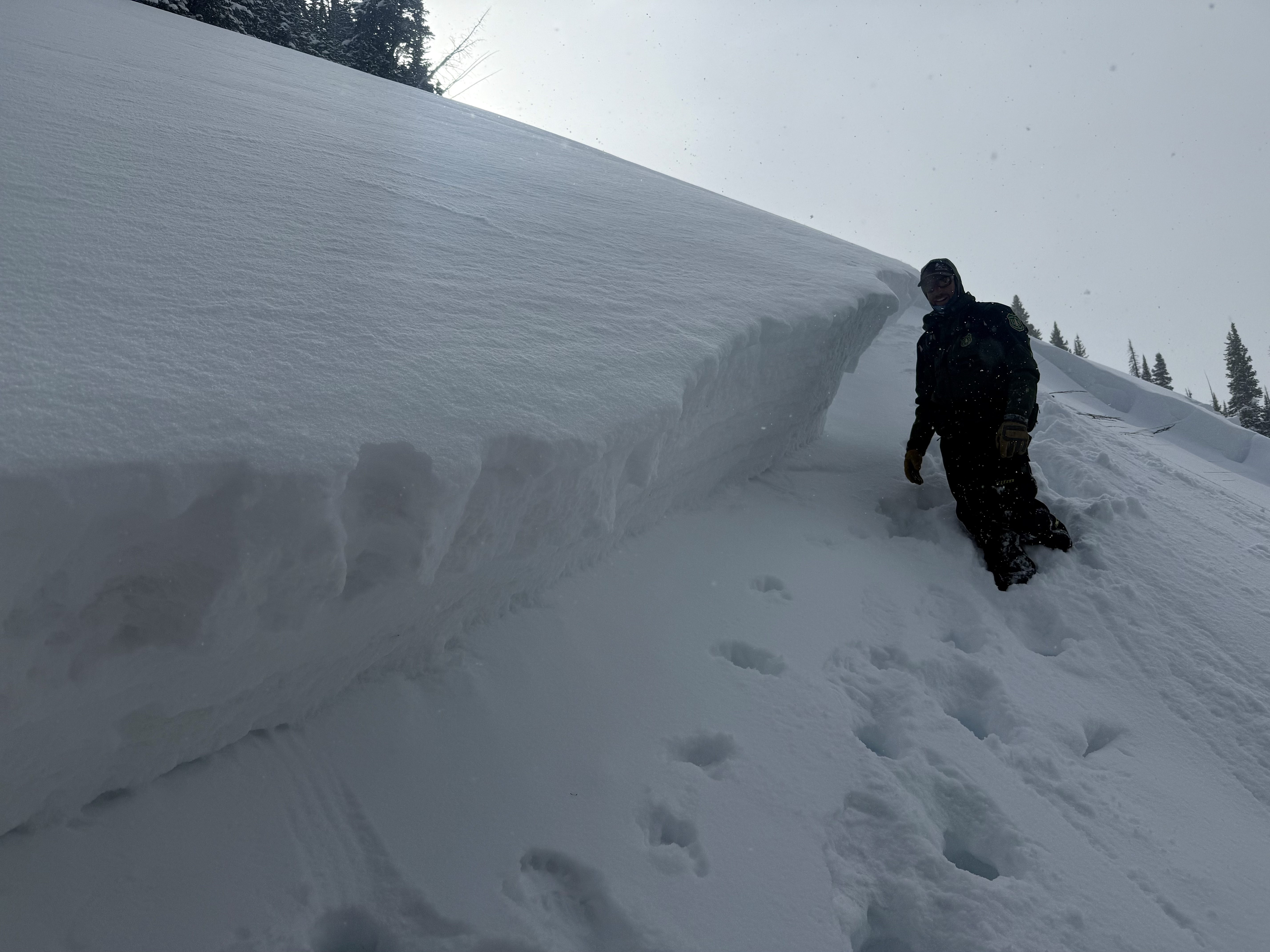

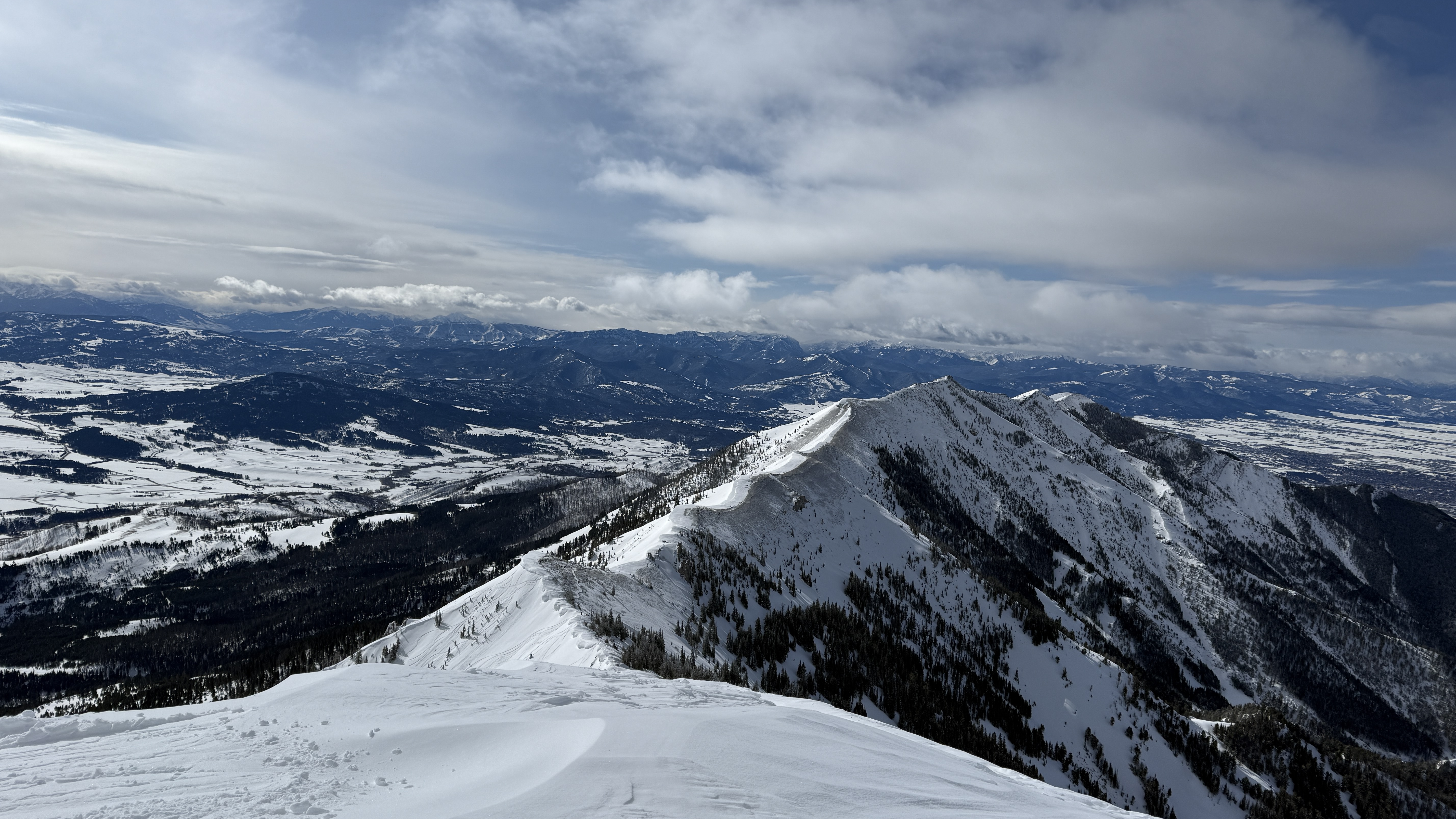
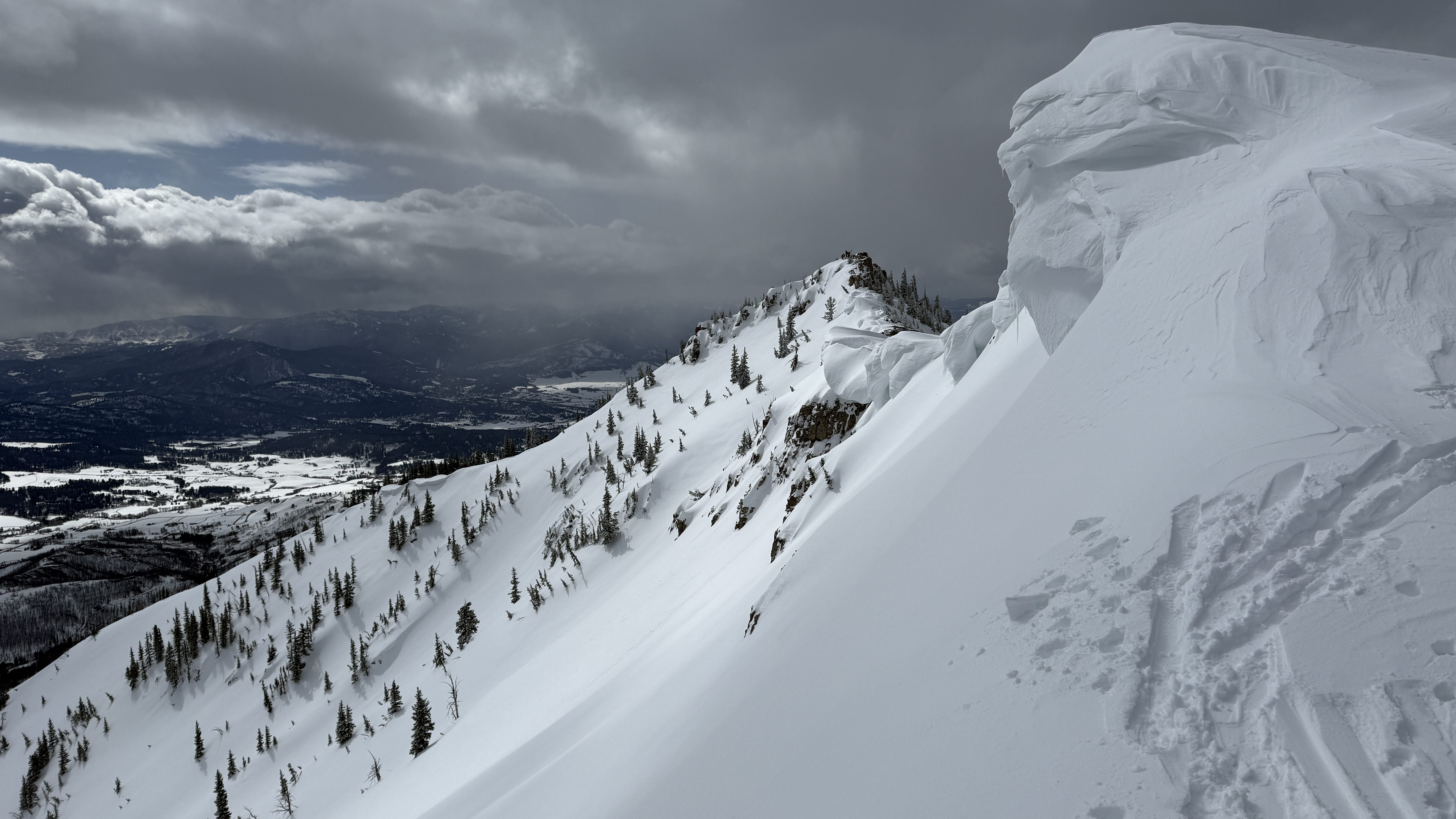
We traversed the ridge south from the Bridger Bowl ski area boundary to Bridger Peak, descended a NE aspect and skinned/traversed back to the ski area boundary. Moderate west winds weren't transporting a significant amount of snow (much of the west side of the ridge was already scoured bare and the remaining snow was already hardened). The sun and clouds were in and out through the day and there were even a few snow flurries, but no accumulation.
Wind Slab avalanches were our primary concern today, but we did not see any as we traversed the ridge and the new snow we encountered was not cohesive.
Dry Loose avalanches (sluffs) ended up being the biggest hazard we encountered. The new snow (approximately 8") was easily sluffing over last weeks crust and was entraining significant volume and running far in steep terrain. It had plenty of power to knock you over or into trees/rocks.
We saw no slab avalanches or signs of instability.
Full Snow Observation ReportMODERATE was great today. Sluffs were predicable and easily managed.
Winds in the Frazier Basin zone were stronger than expected with moderate to strong gusts at the ridge, increasing through the day.
Light flurries <S1 through the morning increasing to S1 by the time of our exit. Tough to gauge accumulation due to the wind but would guess 2-3cm total through the day. New snow from yesterday and today is generally not well bonded to the underlying surfaces which range from windboard, supportable crusts, and old wind slabs depending on aspect/wind exposure, and this made for challenging uphill travel at times.
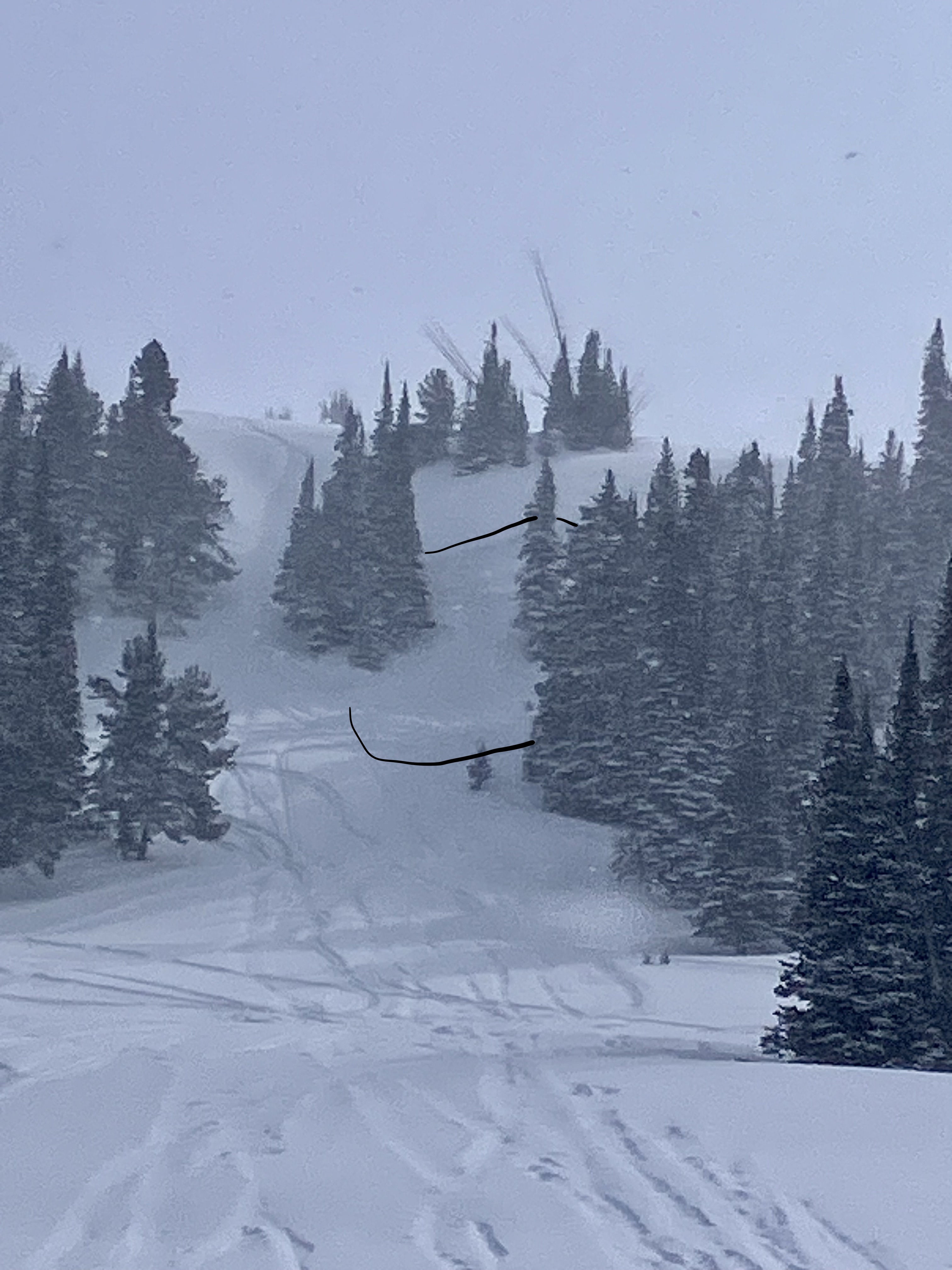
We noticed two large windslab pockets that had released since yesterday’s snow. One at the base of Hardscrabble Peak on a N aspect, the other in one of the SE facing gullies that access the Peak 9299/Hollywood Headwall ridge (see photo).
Full Snow Observation Report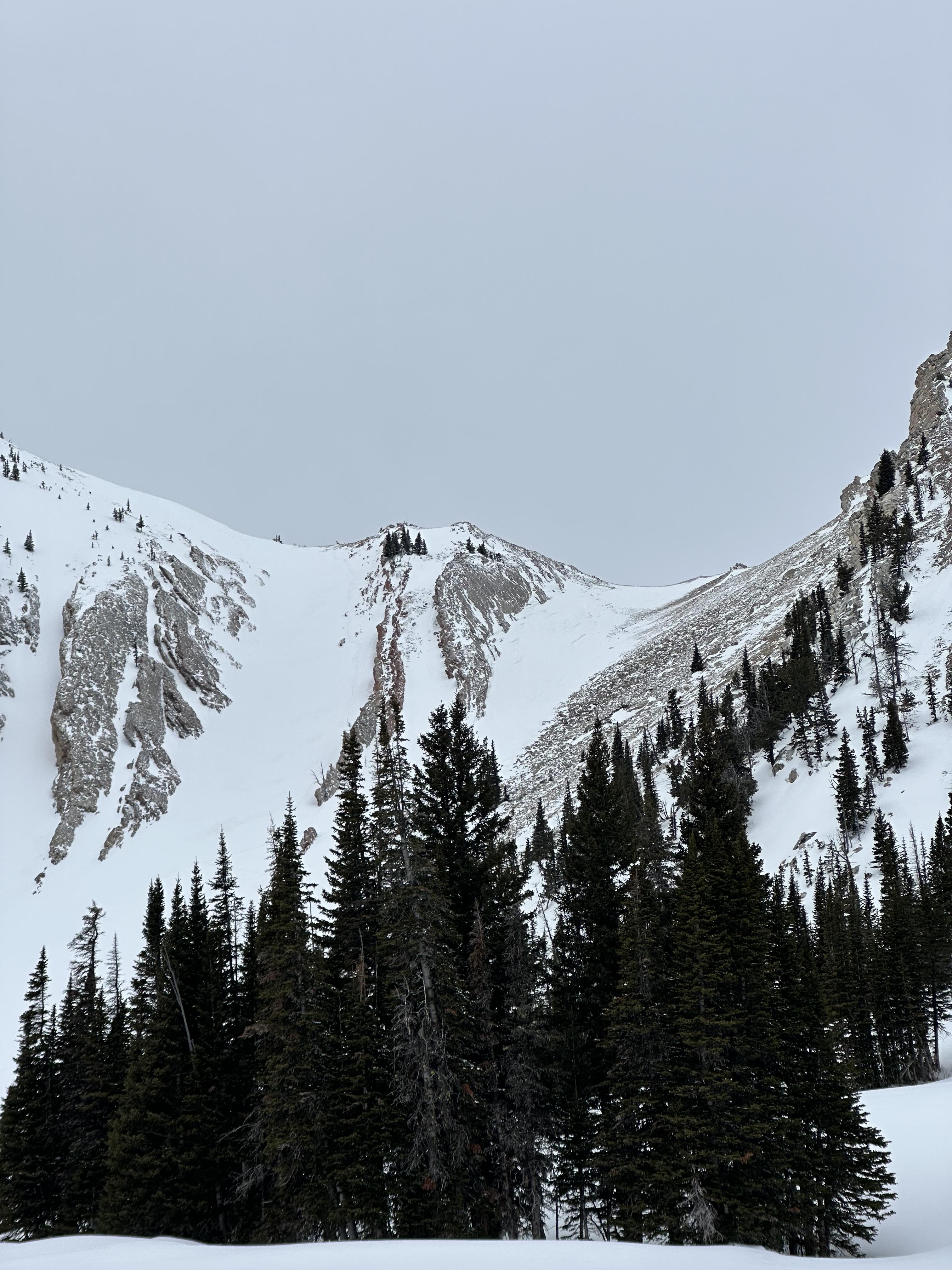
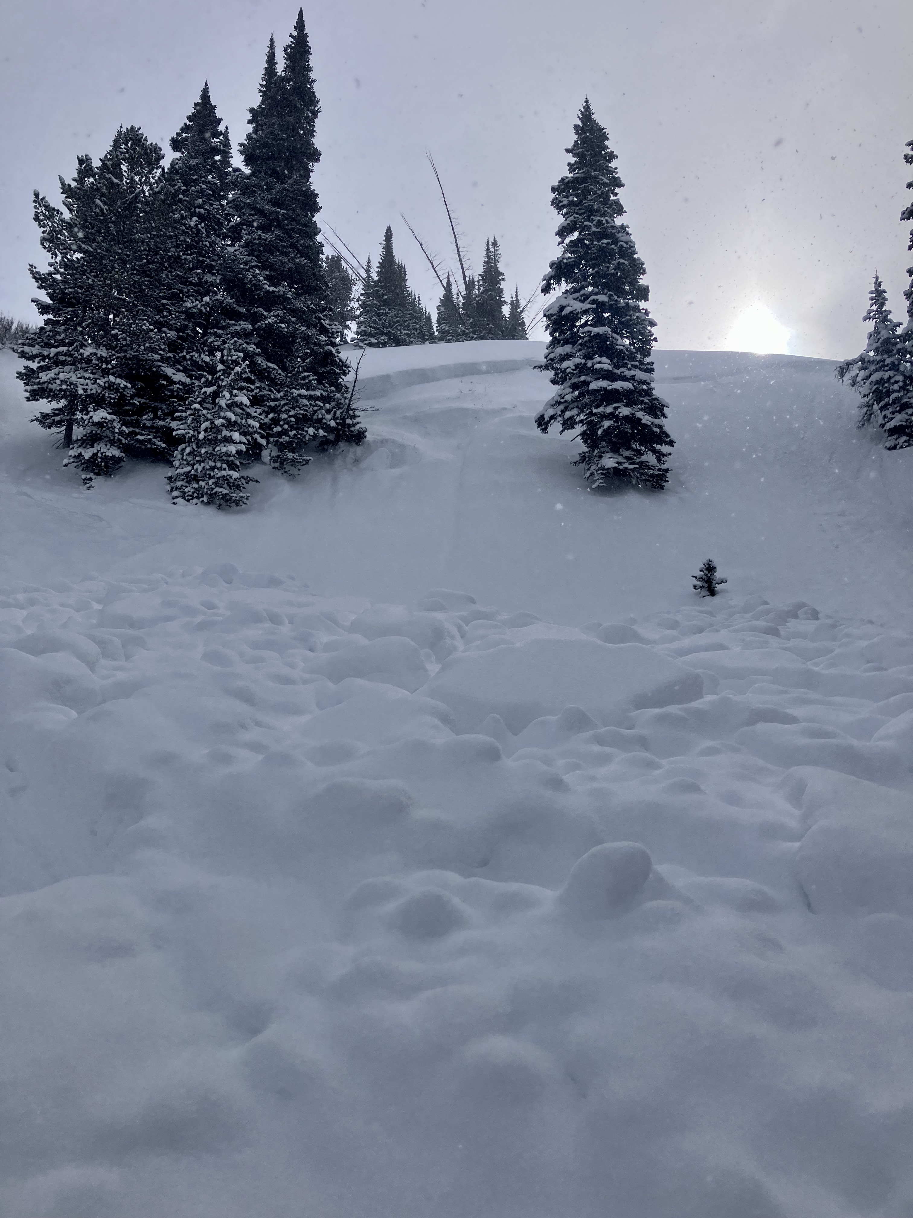
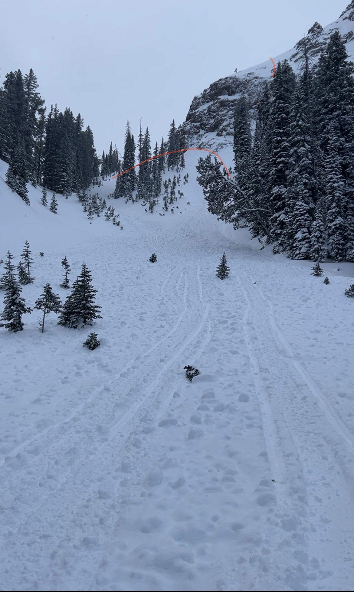
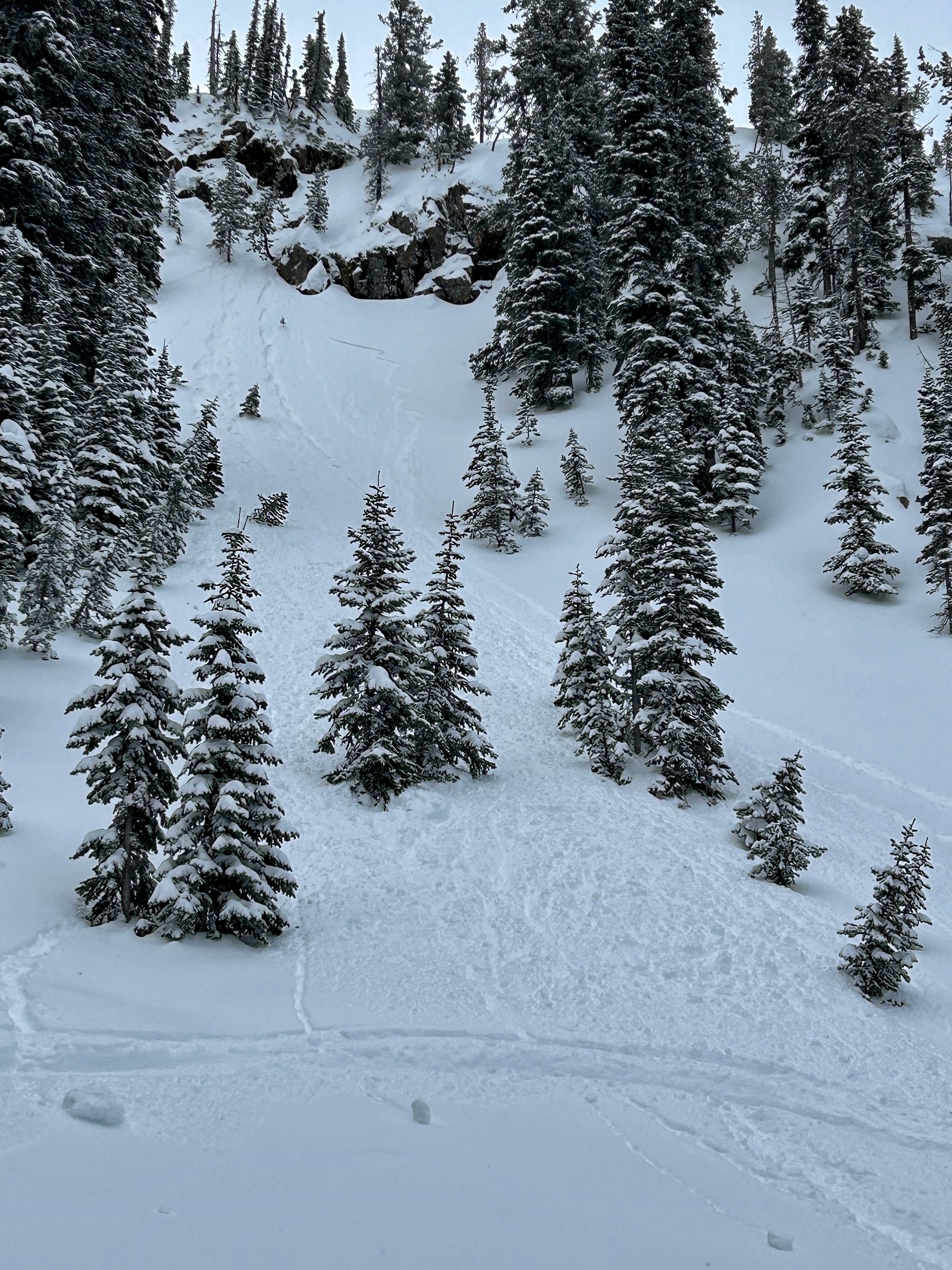
Found 5-8” of fresh low-medium density snow. Triggered multiple small soft storm slabs/sluff which occurred on steeper slopes (40+ degrees).
also noted an interesting crust overlaying a weaker layer that the new snow sat on. This crust wasn’t found everywhere, but just on the sides of rolls facing west or north west (between 9000’-9400’). When probed with a pole it sounded hollow. The crust was thick in nearly every place we found it and didn’t ever collapse under us, but it did shear in hand pits. A thin layer of graupel was also on top of this crust in some areas.
other areas where this crust didn’t exist seemed to either not have refrozen completely before getting snowed on, or never got above freezing in the first place (high elevation north facing). In some areas the new snow bonded very well, in other areas it was easier to get it to sluff off the old crust. Attached is a quick photo of the crust location and the weak snow below it.
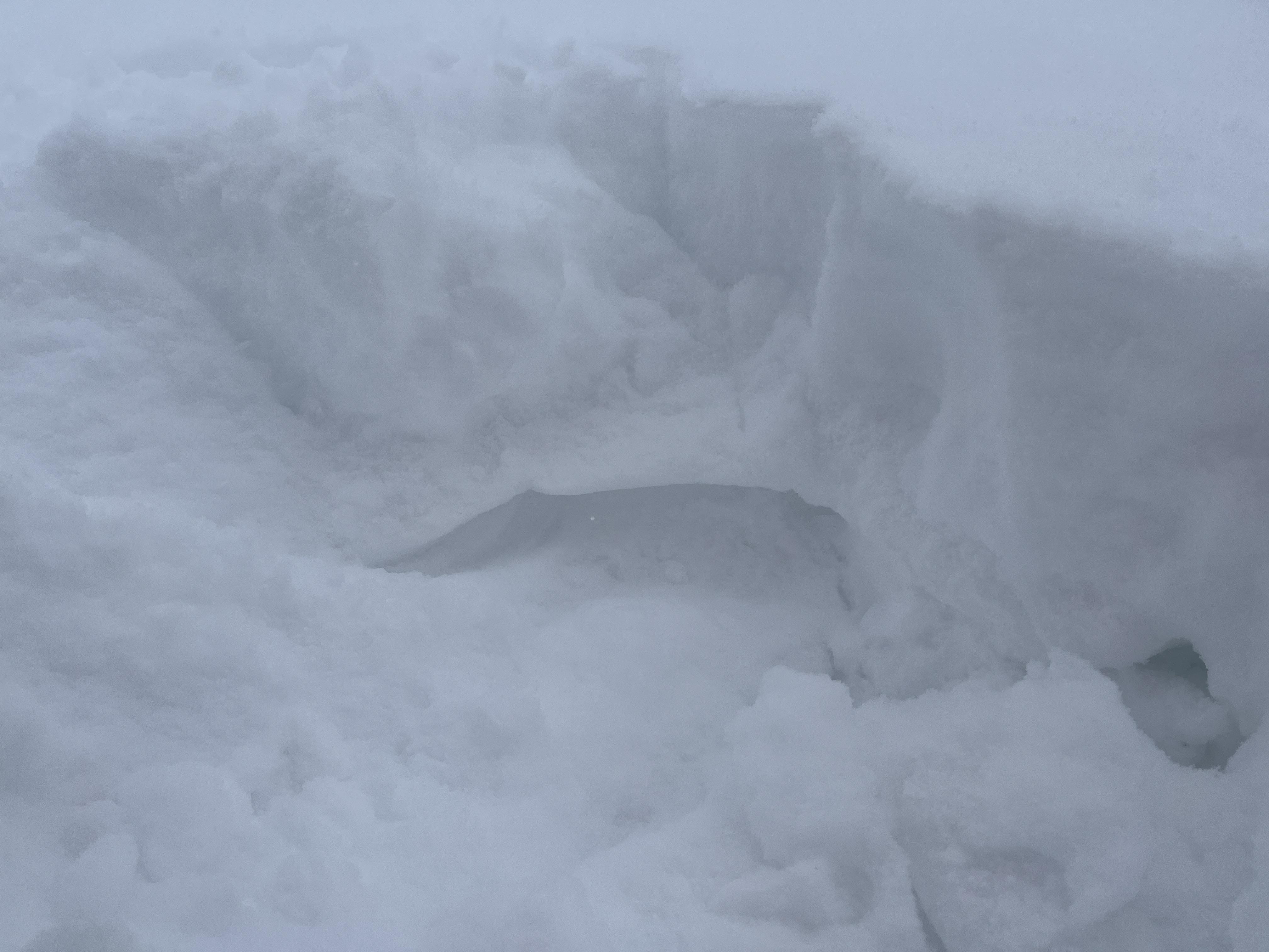
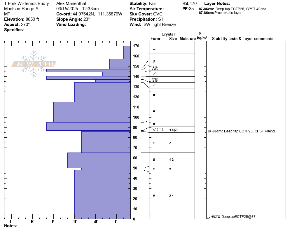
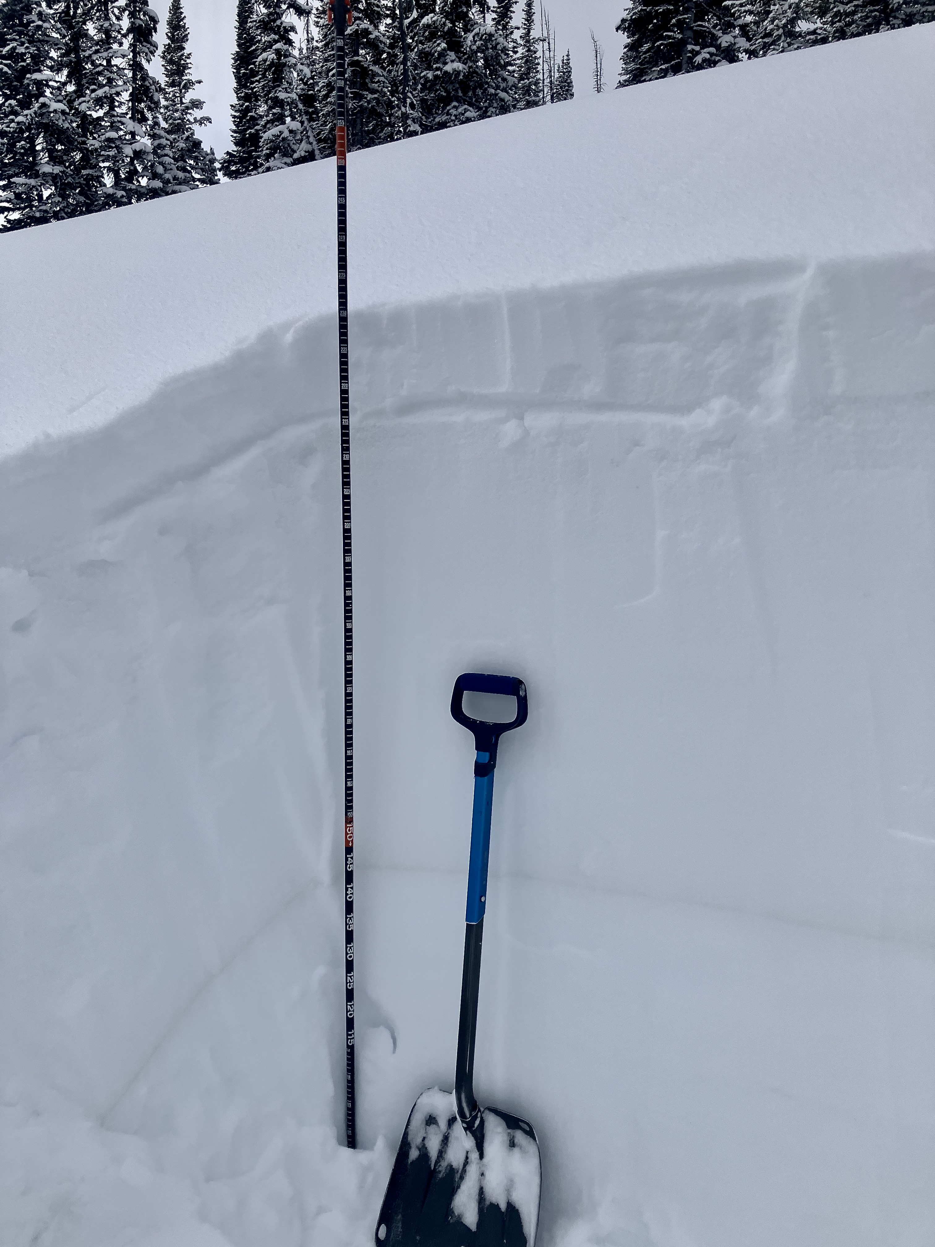
Toured up the south end of Miller Ridge to 9,500'. Dug a pit on a northeast facing slope, 9300' (profile and pic attached). Snow depth was 7-8 feet.
6" of new snow was right side up. Below the new snow was a soft (1F-) melt-freeze crust with soft decomposing and slightly faceted particles below. ECTN13 broke below the crust. Below that the snowpack was 1F to P+ hard and lacked weak layers. The Feb 4 dirt layer was clearly visible.
There was a small natural dry loose on south face of Crown Butte and I triggered a dry loose slide on a test slope near the ridge (video). Wind was calm, even along the ridge near regularly wind-loaded slopes, and there was no snow blowing off ridgelines. I saw no signs of fresh wind-loading, but when the wind blows there will be fresh drifts that will be possible to trigger.
Skies were broken to partly sunny with a few light snow showers. Slopes that received sun got moist at the surface (at least below 9,000').
Full Snow Observation Report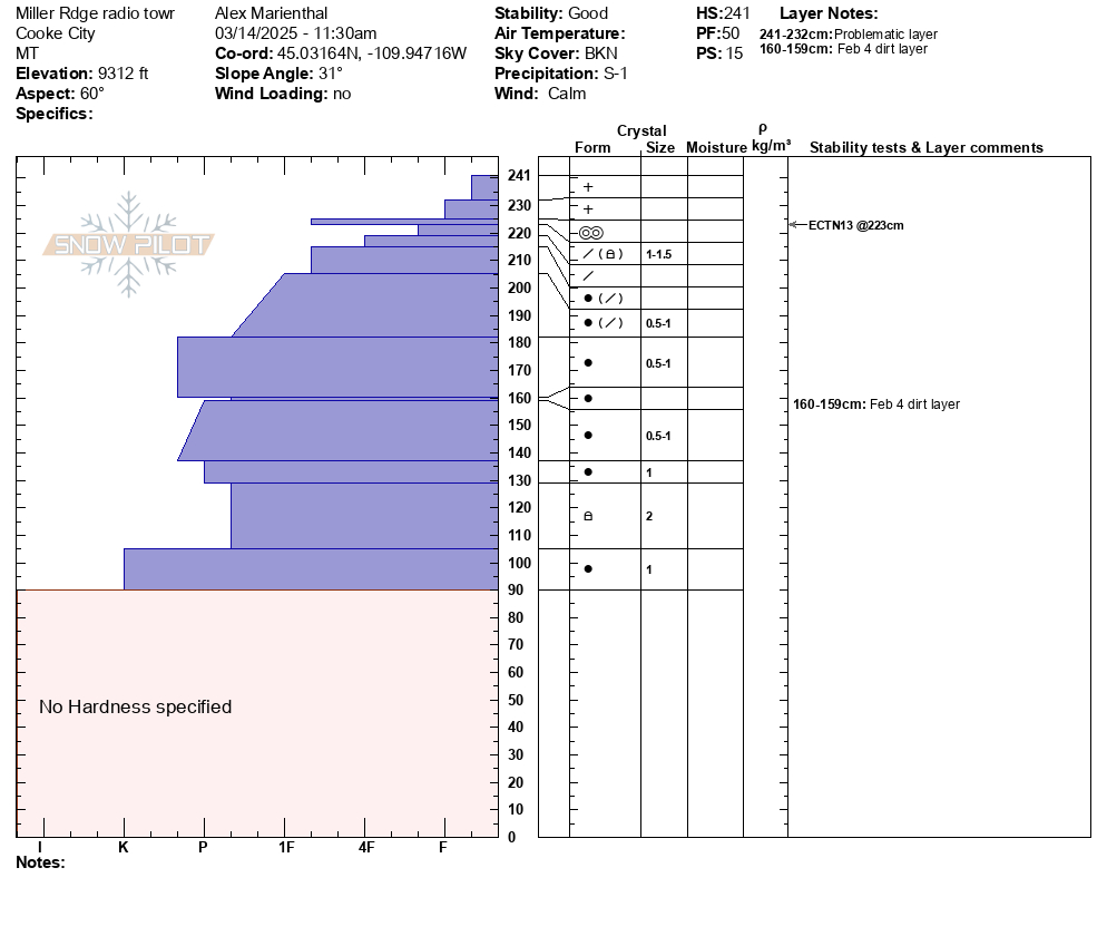

A group of riders saw Mark at the gas station and shared that they had triggered a 4' deep slide in a small pocket in Sunlight Basin of the Taylor Fork area. It was in an area with a relatively shallower snowpack, and broke on weak snow near the bottom of the snowpack. The rider that triggered it was going uphill and got stuck shortly after and noted the snowpack was much deeper there.
Full Snow Observation Report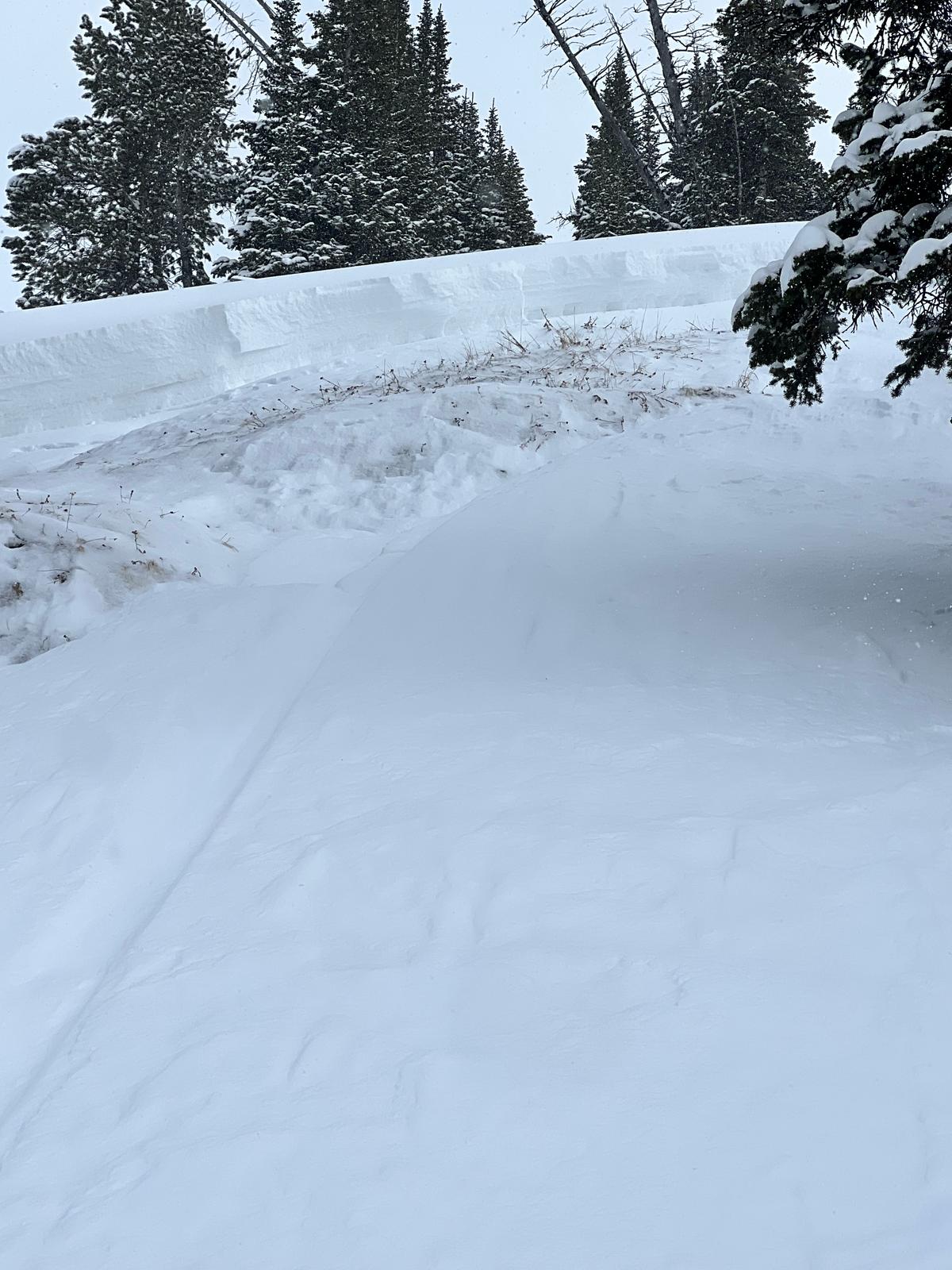
Today I observed multiple small wind slab avalanches off Woody Ridge. NE and E facing, 10000 ft. Max size D1. Also, there was many dry loose slides on Cooke Peak in Hayden Creek.
Full Snow Observation Report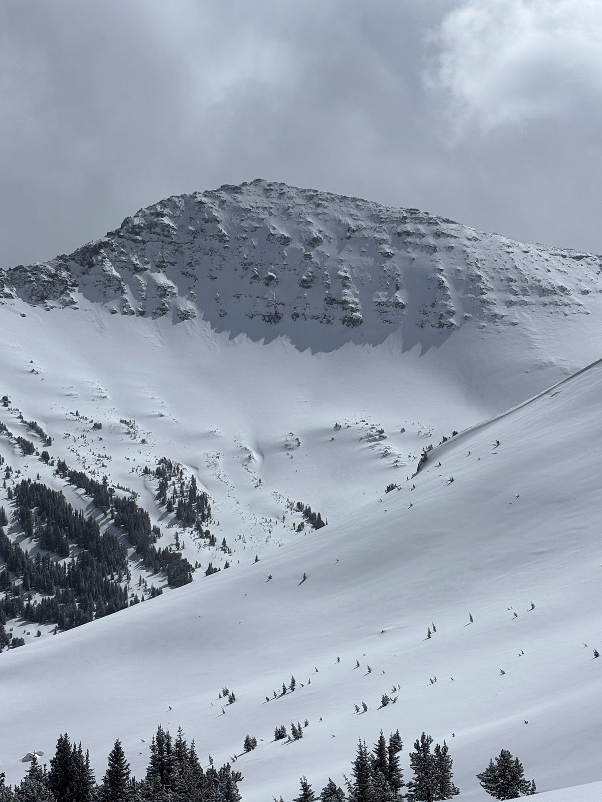

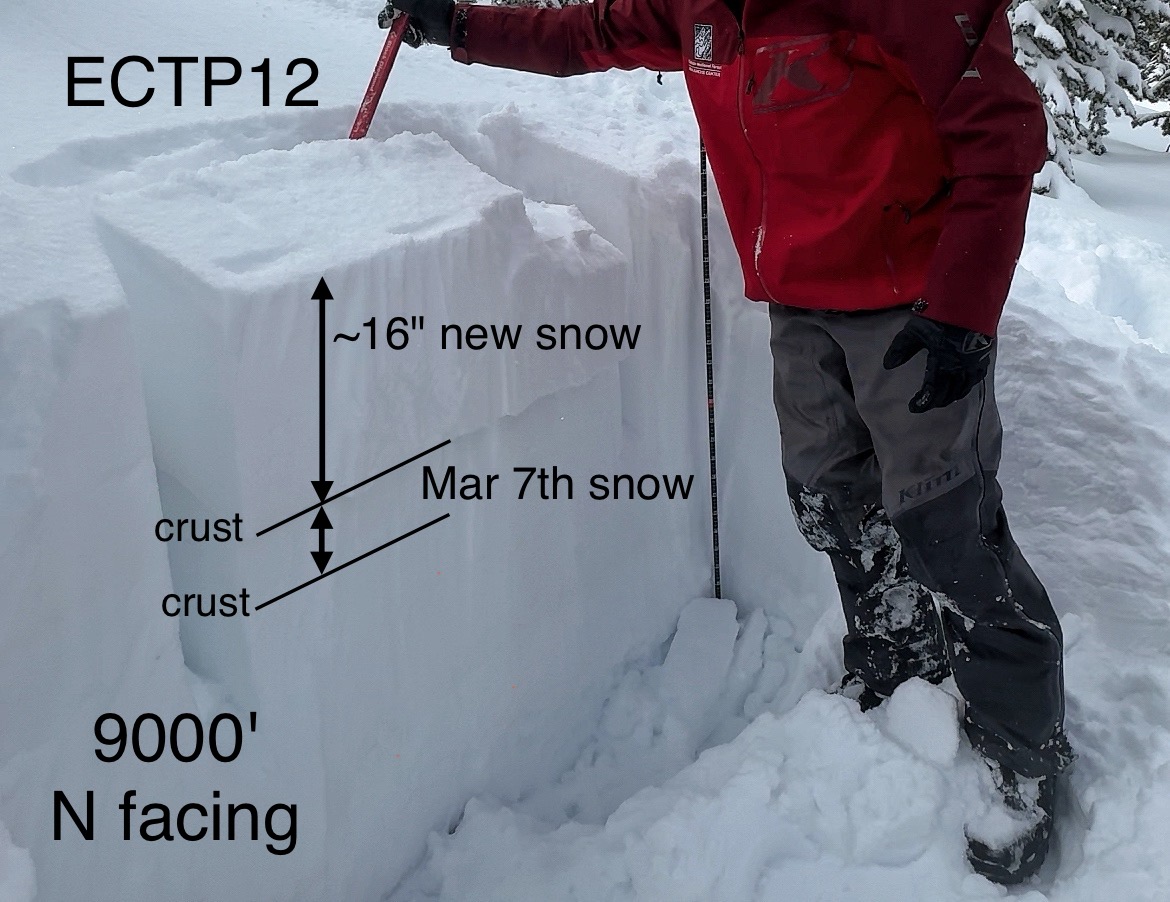
We rode to the top of Sawtelle to de-rime the anemometer (wind sensor) and then down into Rock Creek Basin under all the big north facing avalanche paths.
Key findings:
- New snow amounts ranged from 6-8" at lower elevations and 18" at higher elevations
- We did not observe any cracking or collapsing on non wind loaded slopes.
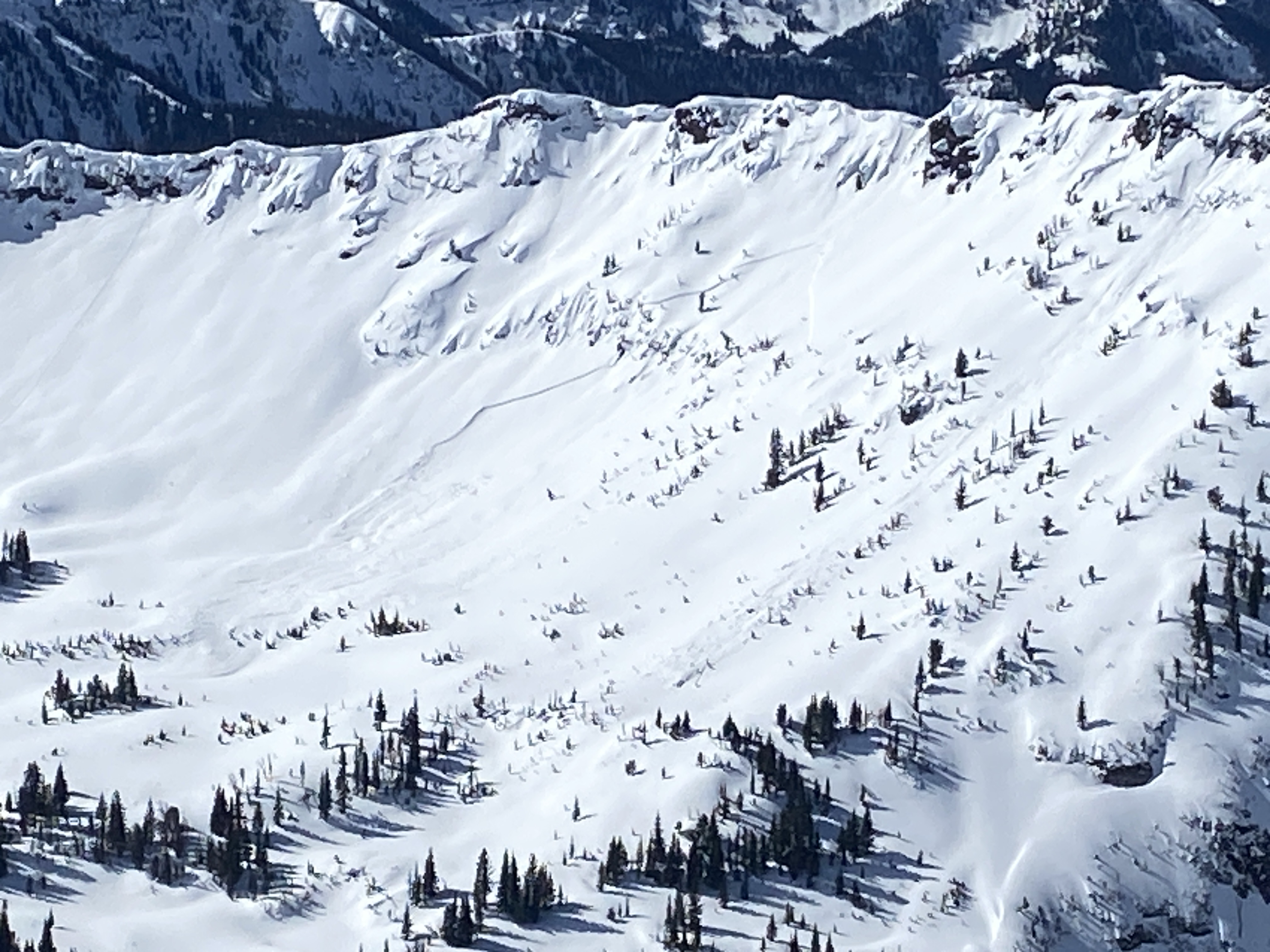
- We observed two very recent natural storm slab avalanches about a 1.5 feet deep. One of them entrained a significant amount of snow an ran a long ways.
- There has been minimal wind effect except at ridgetops
- Extended Column tests on north facing slopes continuously broke and propagated after 12 taps (ECTP12) just under a soft crust in snow that fell last weekend. These appeared to be breaking on broken stellars/snowflakes. On other aspects, the crust was much thicker and harder.
Conclusions:
The likelihood of triggering a soft slab avalanche about 1.5' deep seemed low on non-wind loaded slopes. Any amount of wind affecting a slope whether loading a slope or just stiffening the new snow, dramatically increased the odds of triggering a slide. We felt comfortable riding in avalanche runout zones and even climbing into the paths some. The main strategy was to stay out of the upper starting zones that are steeper and have seen some wind. HOWEVER - we carefully limited our exposure in big runout zones where a falling cornice could have triggered a slide that could have crashed down onto us. We did not think that we would trigger an avalanche from below
Looking ahead - Strong winds Sunday through Monday will have plenty of snow to transport along with additional snow that will fall. This should increase the danger and the size of possible avalanches.
Full Snow Observation Report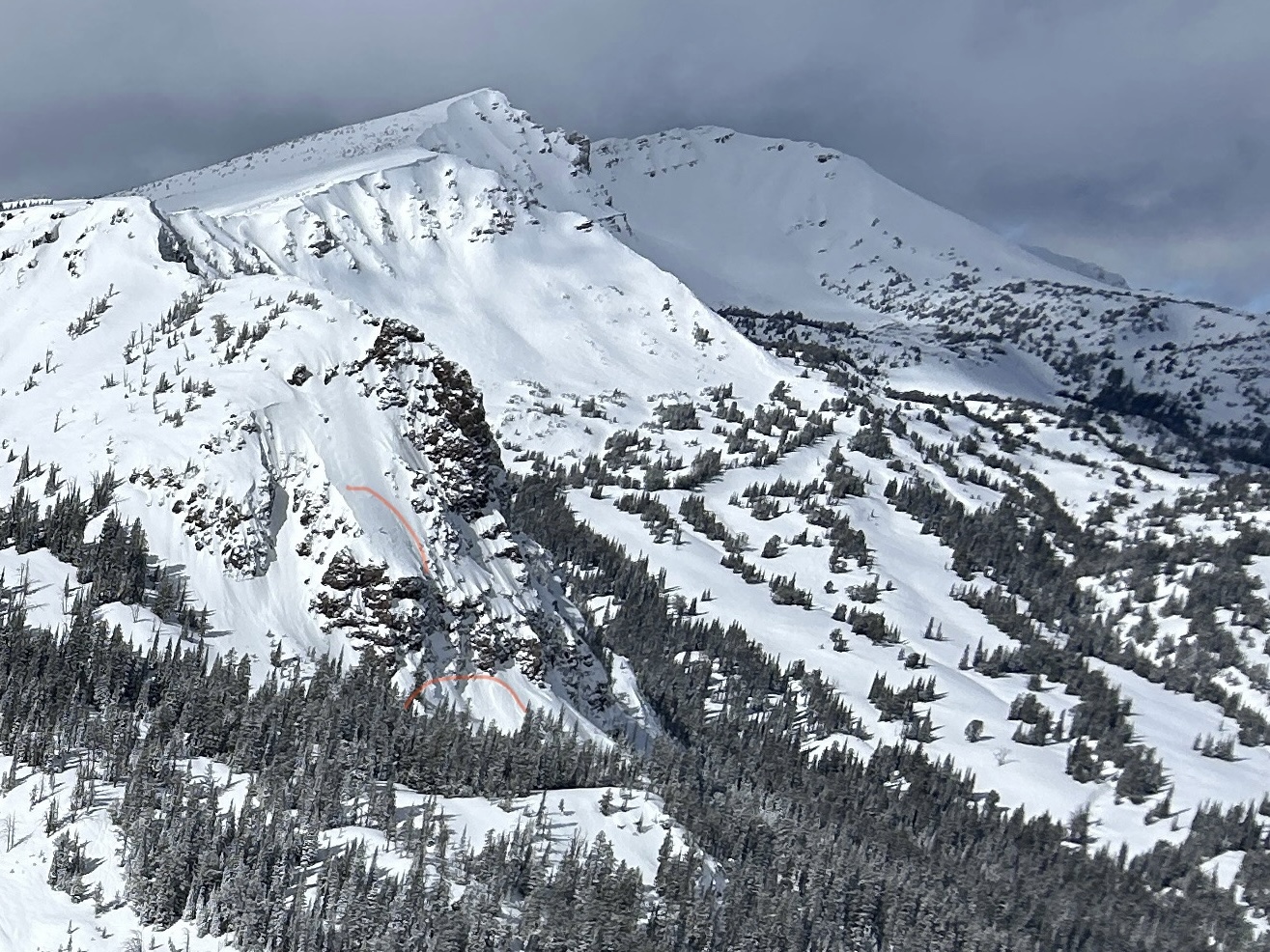

From phone call:
Kevin took a group into the Centennials.
8" of new snow at 8000'. Surface crust below the new snow was 3 CM thick. There was a facet layer below crust that was concerning. ECTN3 below crust.
Kevin found the January facet layer 90 CM down (4F hardness) a couple miles north of White Elephant at 7800-7900' (0.5-1mm size). No results in tests but was concerned about their activation if the storm snow start stacking up.
He noted that the Wind Slab and Storm Slab problems are growing. He saw shooting cracks in the new snow, several feet in front of his skis.
Winds were light to moderate but gusting into the 20s mph.
Full Snow Observation ReportWent up to Beehive Basin to check out the new snow as it was falling ---- but it wasn't, yet (between 10 am and 1 pm). There was a dusting of new snow when we arrived at the trailhead and a few flakes fell during the couple hours we were up there, but the substantial accumulations hadn't started. In fact, skies were mostly clear during our tour.
We skinned up the west facing sub-ridge to the Prayer Flags and descended via the Going Home Chute. Surface conditions were rough on any slope that wasn't shaded, with stout melt-freeze crusts. There was still a tiny bit of old, soft snow present in the shade.
No signs of instability or recent slab avalanches noted (we did see some older, wet loose slides).
Danger was LOW, while waiting for the storm to start in earnest.
Full Snow Observation Report
The winds were strong enough combined with the higher humidity snow that pinwheels were actively forming and moving on flat to slightly downhill terrain. I hadn’t seen this often, so I thought it was worth sharing.
Full Snow Observation Report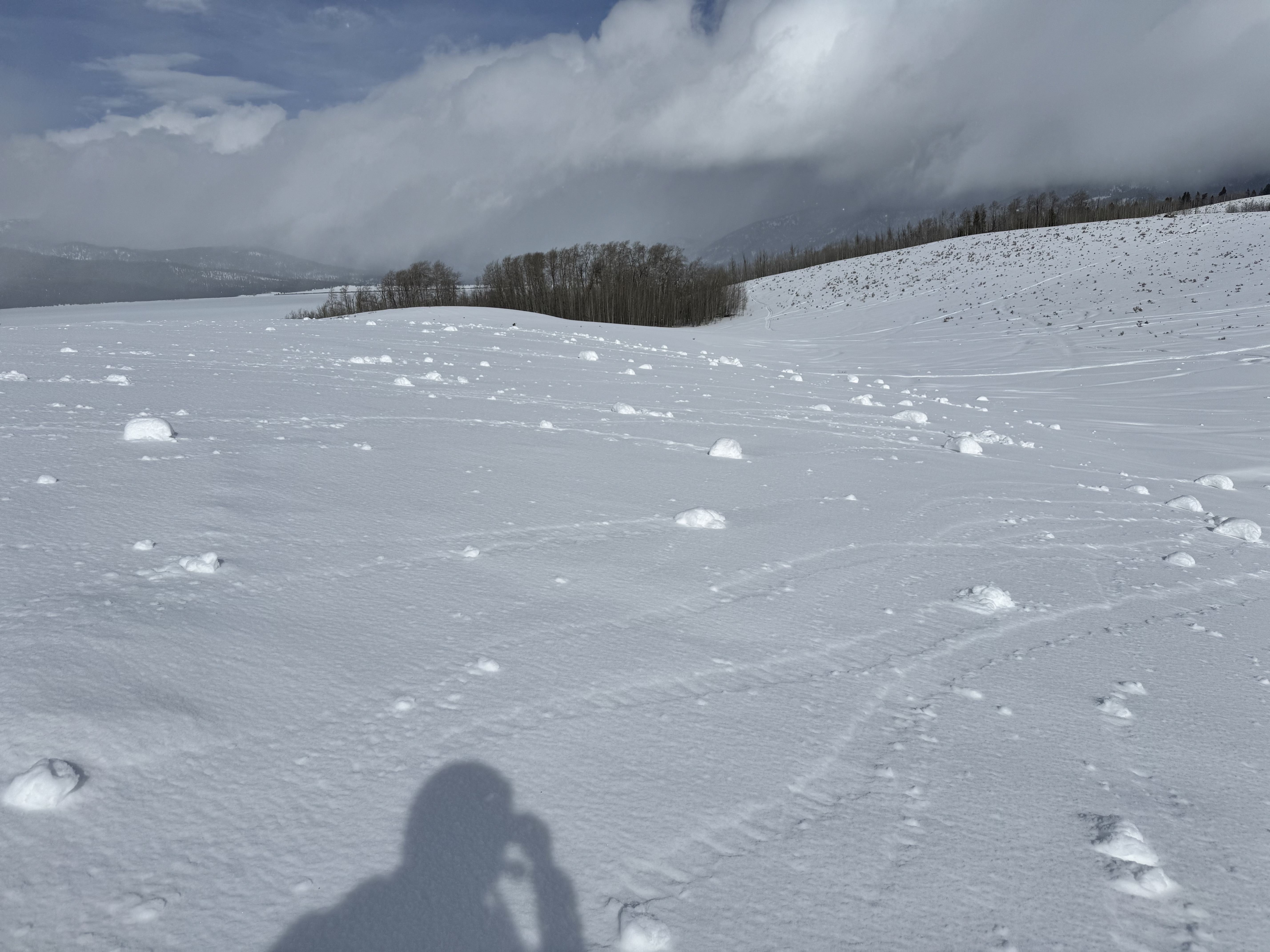
Toured into Texas Meadows this morning. No avalanche activity seen, no cracking or collapsing. Northern aspects and higher elevations holding better snow, without a wind or sun crust.
Full Snow Observation ReportRode into Fairy Lake and skinned up the east shoulder of Naya Nuki. Winds went from strong to extreme out of the south in the early afternoon and were absolutely hammering. Despite the crazy winds, there was really no snow left to transport, so there was no active windloading. Wind surfaces were highly variable, from sastrugi to windboard to meltfreeze crusts to protected powder in the trees.
Saw no signs of instability or recent slab avalanches. We did see a good bit of wet loose activity that likely happened a couple days ago.
Full Snow Observation ReportLOW danger is right.

Toured onto the west side into Jones Creek and then down Wolverine Bowl. Found lots of crusty snow, wind scoured snow, hard wind drifts, and even some warm, dry powder. No near surface facets which is a good thing for future stabilty.
Full Snow Observation Report
We rode from the Sawtelle Parking area up the shoulder of Sawtelle, across Yale Creek and above East Hotel Creek, through Jefferson Bowl, into Hellroaring Creek drainage to the base of Reas before reversing the order and heading out. We saw no avalanches and no signs of instability. Three snowpits (above East Hotel, in Jefferson Bowl, and above Hellroaring) revealed nothing remarkable - ECTXs and ECTNs in the 20s. The south-facing pit above East Hotel had many crust facet sandwiches, but none are currently an issue. It would take a significant load to bring up any concerns about avalanches breaking on persistent weak layers deeper in the storm.
Stability is good. There are tracks everywhere, and we are looking forward to a reset, hopefully arriving Wednesday night. Most slopes have a melt-freeze crust at the surface. There is no remarkable weakening at the surface to note at this point. Unless something changes between now and Wednesday, instability should be limited to the incoming snow and wind-drifted snow.
Full Snow Observation ReportDanger was LOW.

We rode out Lionhead Ridge and around the north end to the head of Targhee Creek. Skies started overcast, but cleared through the day as wind calmed from moderate to light out of the west and southwest.
There were zero recent large persistent slab avalanches, and there were two or three shallow small wind slabs below Lionhead Ridge. The snow surface became moist, but crusts from previous warm days and cold night only softened slightly. There was very little, if any, wet snow avalanche hazard today.
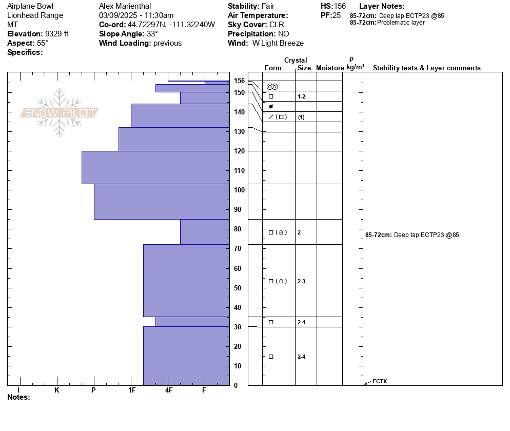
We dug at the top of Lionhead Ridge on the south side of Airplane Bowl. 9,300', NE aspect. There was a 2.5' deep very hard slab (1f to P+) above soft facets (4F-), snow depth of 5 feet. We had ECTX, but with extra hits and some removal of the slab it propagated with a clean break. The persistent slab avalanche problem is becoming more stubborn, but not going away. For now it is not likely, but there is probably an isolated slope where you could trigger an avalanche, and we could see this problem arise again with more snow next week.
Full Snow Observation Report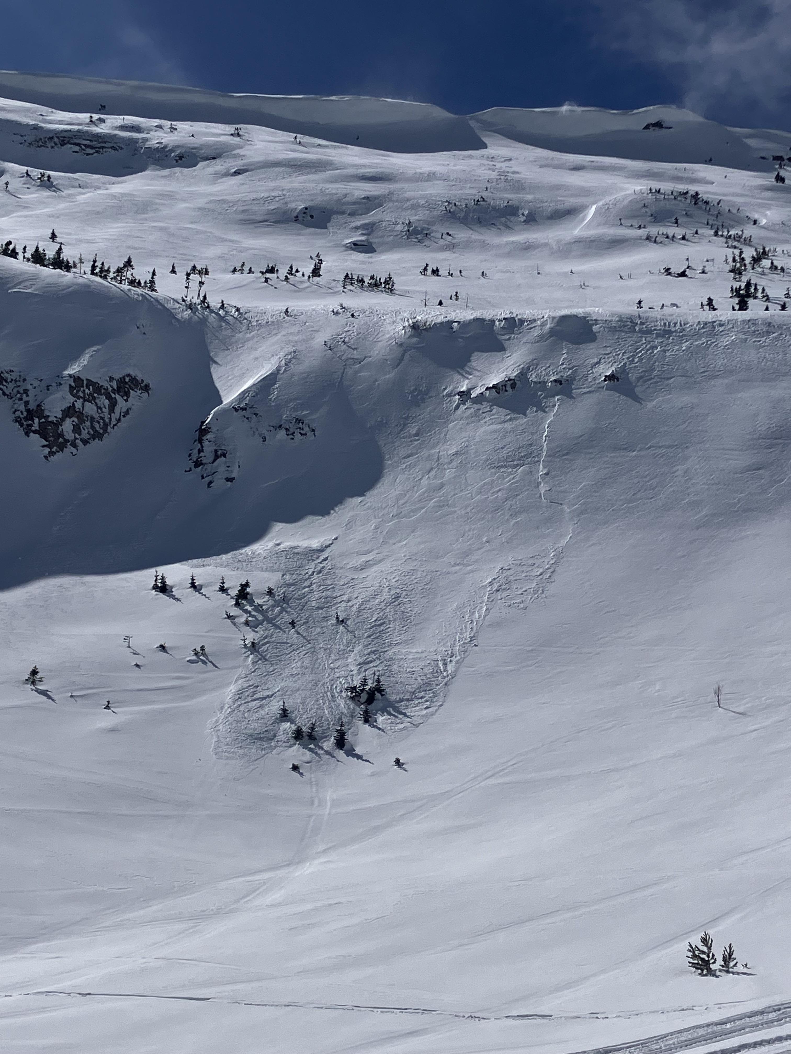

We skied to Flanders Mountain, traversed the ridgeline, and dropped into the northwest-facing terrain near the Winter Dance Buttress down to the Main Fork. Ridgelines had moderate to strong winds but minimal transport as snow at upper elevations had already moved or had hardened with recent wind and warm temperatures. Wind Slabs that we assessed were stubborn to unreactive, but there is probably one out there that could result in a small avalanche. No signs of dry snow instability during the tour or in our snowpack assessments (Flanders Bowl - ECTN Teens and 20s and Near Winter Dance Buttress - ECTN Teens and 20s). Snow surfaces were warming (wetting) in south-facing terrain and on all aspects below 8000' by 3 PM. However, we did not see any natural wet snow activity.
I would be watching out for isolated wind slab instability and wet loose avalanches for now.
Full Snow Observation ReportLOW Danger.

Somewhat fresh looking slab avalanche in upper Storm Castle Creek on an East facing slope. Looks like there might be a wet loose slide to the right of it as well. One small wet loose avalanche, probably from yesterday, in Maid of the Mist bowl.
Full Snow Observation Report