Photos

|
Northern Gallatin, 2025-04-15 |

|
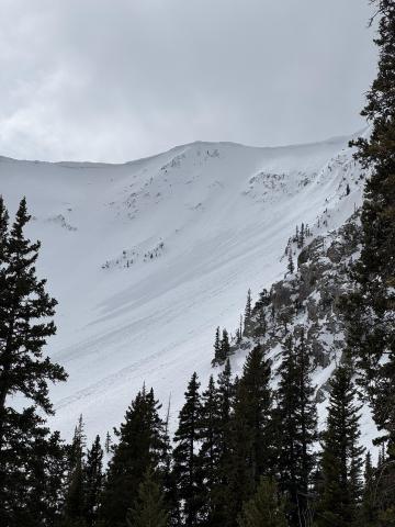
Northern Gallatin, 2025-04-15 We went through Flanders' Creek to the Flanders Weather Station to pull it for the season. We descended to the Grotto Falls TH via the Winter Dance Route. The surface snow got wet as the day progressed, but we saw no wet snow avalanche activity. I wouldn't be surprised if there was limited activity as the day progressed. Recent warm temperatures have almost universally affected snow surfaces. North-facing slopes above 9500' elevation remain dry, and pockets of dry snow exist at lower elevations on shaded slopes. South-facing slopes have cycled a few times, and the corn snow is coming in reasonably well. There were no signs of dry snow instability. Photo: GNFAC |

|
Northern Gallatin, 2025-04-15 |

|
Cooke City, 2025-04-13 Screenshot of winds from Lulu Pass wind station during the storm. |
|
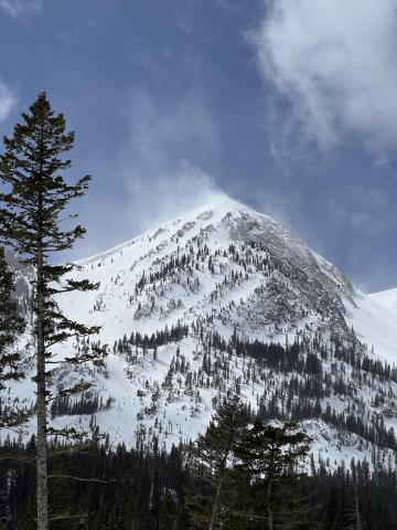
Bridger Range, 2025-04-09 Winds were cranking at ridge top elevation, transporting what soft snow there was. Minimal hazard formation. I spotted one fresh wind slab avalanche near Hardscrabble. The slide ran several hundred feet in steep terrain but was very thin (R1,D1). Photo: GNFAC Link to Avalanche Details |
|
Bridger Range, 2025-04-09 Winds were cranking at ridge top elevation, transporting what soft snow there was. Minimal hazard formation. I spotted one fresh wind slab avalanche near Hardscrabble. Photo: GNFAC Link to Avalanche Details |
|
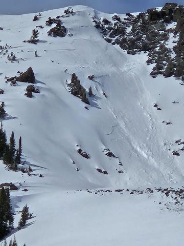
Cooke City, 2025-04-09 Old wind slab, South East on Scotch Bonnet. Photo: Anonymous
|

|
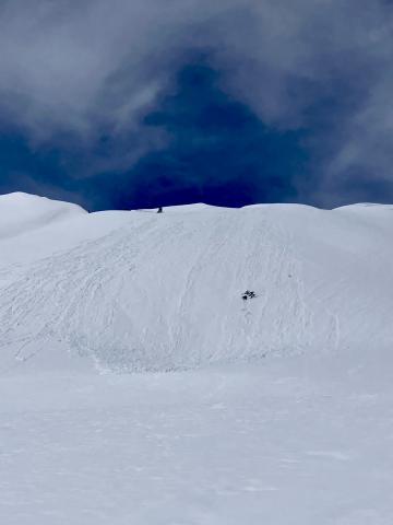
Cooke City, 2025-04-07 |
|
Cooke City, 2025-04-07 |
|
Cooke City, 2025-04-07 |

|
, 2025-04-07 For years, the avalanche community has worked to understand and address the human factors that influence decision-making in the backcountry. With decades of research as their foundation, Sara Boilen and Ian McCammon are developing an open-source tool to help individuals mitigate risk in avalanche terrain. The project's first stage involves interviewing backcountry recreationalists who have been traveling in avalanche terrain for at least one season. All participants will be entered to win amazing raffle prizes (from Jones Snowboards, BCA, and more!). If you’re curious about being involved, please take 1-2 minutes to fill out their basic initial survey! |

|
Cooke City, 2025-04-06 Apr 5 Wind slabs were still reactive. We triggered 3 small, 3-8" deep x 5-15' wide, hard wind (1F+) slabs on convex test slopes well below the main ridgelines. 9,800', NE aspects. Photo: GNFAC Link to Avalanche Details |

|
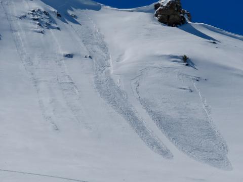
Cooke City, 2025-04-06 Apr 5 Wind slabs were still reactive. We triggered 3 small, 3-8" deep x 5-15' wide, hard wind (1F+) slabs on convex test slopes well below the main ridgelines. 9,800', NE aspects. Also triggered one softer (4F) wind slab just below the high ridgeline, 10,200', NE aspect. 10-15' wide x 6-8" deep (Pictured). Photo: GNFAC Link to Avalanche Details |
|
Cooke City, 2025-04-06 Apr 5 We saw a couple 3-6" deep natural wind slab avalanches and a few dry loose slides that looked to have happened within the last 24 hours. Photo: GNFAC Link to Avalanche Details |

|
Bridger Range, 2025-04-06 "We went on a tour in the Bridgers today [Apr 5], we ascended the east ridge of Naya Nuki to the entrance of the Great One. Wind was blowing and we were being careful about potential wind slabs up high. Skier 1 ski cut the top of the chute and produced a small wind slab that ran to the break in the chute and continued another 100 vert down the east apron. After all meeting up halfway down, skier 2 proceeded to ski the E facing apron. A wind slab propagated and carried skier 2 roughly 300 vert down the apron where skier 2 was able to swim out of the fall line and came to a rest on top of the debris. Everyone was okay aside two missing ski poles." Link to Avalanche Details |

|
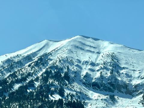
Bridger Range, 2025-04-06 From BBSP: " At 2.45?pm [Apr 5] a... solo skier triggered a wind loaded pocket on the main face of Saddle Peak that ran down over the cliff and produced an impressive powder cloud.... I met him... and confirm he was alone and no one was in front of him. The avalanche looked to be 2' deep on the southern flank and 5" deep on the northern flank... It entrained more snow on the way down, one 2' deep downhill wind loaded pocket and some loose wet snow. It ran into the bottom of the going home chute, gouging a large hole and then 100ft downhill left a 200ft by 30ft wide shallow debris pile." Link to Avalanche Details |
|
Bridger Range, 2025-04-06 (Apr 5) "...Also observed one small wind slab occurring between Saddle & the Football Field, possibly skier-triggered." Photo: G. Antonioli Link to Avalanche Details |

|
Bridger Range, 2025-04-06 (Apr 5 ) "Observed multiple D1-1.5 natural dry loose avalanches (and some tiny wind slab pockets under the ridge cornice) that likely occurred during peak warming around 2-3 PM. North/sheltered aspects from ~9- 8.5k held an average of 8+ inches of dry, drifted snow...." Photo: G. Antonioli Link to Avalanche Details |

|
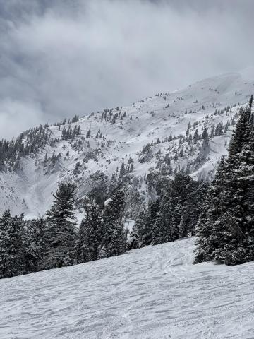
Cooke City, 2025-04-04 Wind slab near Cooke City from yesterday. Intentionally triggered. North aspect, 10,100'. 1' deep, 20' wide. Photo: B Fredlund Link to Avalanche Details |
|
Bridger Range, 2025-04-03 There was a pair of R1, D1 avalanches on Saddle Peak. One appears to be a loose snow avalanche triggered by a skier coming off of north Saddle Peak That ran a couple hundred feet. The second was a small slab coming out of Spencer’s with debris running into Going Home Chute. Photo: GNFAC Link to Avalanche Details |
