Photos

|
Northern Gallatin, 2025-03-01 A massive cornice had cracked and was slowly making its way towards falling down. Cornice was around 50 feet long, and largely overhanging. Photo: S Lipsteuer |

|
Northern Gallatin, 2025-03-01 A massive cornice that has cracked and is slowly making its way towards falling down. Cornice was around 50 feet long, and largely overhanging. On the standard ascent of the East Ridge of Alex Lowe, the skin track usually travels below this cornice while ascending to the ridge. Photo S Lipsteuer |

|
Northern Madison, 2025-03-01 Natural point release avalanche observed from the YC. Occurred out of bounds on the South side of Pioneer Mountain. Photo: YC Ski Patrol Link to Avalanche Details |

|
Bridger Range, 2025-03-01 Observed multiple wet loose slides naturally triggering and running on south facing slopes beyond bradleys and on the south facing aspects of hourglass chute. Link to Avalanche Details |

|
Bridger Range, 2025-03-01 Observed multiple wet loose slides naturally triggering and running on south facing slopes beyond bradleys and on the south facing aspects of hourglass chute. Photo: T McGarry Link to Avalanche Details |

|
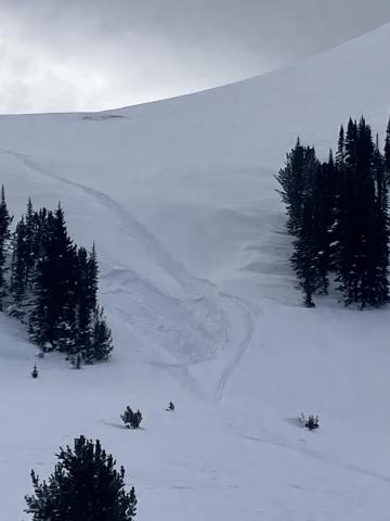
Lionhead Range, 2025-02-28 Airplane bowl this afternoon after a rider triggered slide. There is a down track in the middle of the crown face Link to Avalanche Details |

|
Lionhead Range, 2025-02-28 Airplane bowl this morning, no avalanche Link to Avalanche Details |

|
Lionhead Range, 2025-02-28 A rider triggered a huge avalanche in the uppermost reaches of Targhee creek on a north facing slope at 9200' Link to Avalanche Details |

|
Lionhead Range, 2025-02-28 A rider triggered a huge avalanche in the uppermost reaches of Targhee creek on a north facing slope at 9200' Link to Avalanche Details |

|
Lionhead Range, 2025-02-28 A rider triggered a huge avalanche in the uppermost reaches of Targhee creek on a north facing slope at 9200' Link to Avalanche Details |

|
Southern Madison, 2025-02-28 From IG message: "Getting word that a group triggered a decent slide today out at cabin creek. I’ll attach the coordinates to the general area, to the best of my knowledge. No burials. They were able to outride if. But thought I’d send coordinates in case you guys were gonna be in the area and wanted to check it out." Link to Avalanche Details |

|
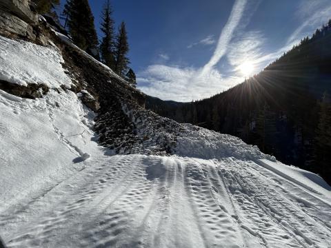
Northern Gallatin, 2025-02-27 This older wet slide is a good example of what to look out for especially at low elevations. |

|
Northern Gallatin, 2025-02-27 This older wet slide is a good example of what to look out for especially at low elevations. |

|
Northern Gallatin, 2025-02-27 Cornice release above the headwaters of storm castle creek which triggered a slab, east facing aspect. Looked to be several feet deep and ran a long way.
Link to Avalanche Details |

|
Northern Gallatin, 2025-02-27 |

|
Cooke City, 2025-02-25 Fresh wind slab avalanche seen this afternoon, possibly rider triggered. Photo: N. Meyers Link to Avalanche Details |

|
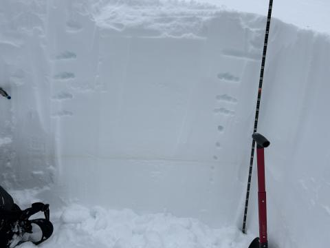
Northern Gallatin, 2025-02-25 Total snow depth on a NE aspect was 230 cm (7.5 ft). Right side up and strong. Dust layer from Feb 4th was 70 cm deep (28 inches) with no facets under it. |

|
Cooke City, 2025-02-24 On Feb 24 we saw at least 3 rider triggered wind slabs, 4-5 natural wind slab avalanches, and a couple large cornice falls. Strong wid had affected almost every piece of terrain, scouring some slopes, loading others, just stiffening the slab in many areas, and forming fresh drifts on every convex roll and along the edges of trails. Riding was still soft and fairly consistent in many areas. Photo GNFAC Link to Avalanche Details |

|
Cooke City, 2025-02-24 On Feb 24 we saw at least 3 rider triggered wind slabs, 4-5 natural wind slab avalanches, and a couple large cornice falls. Strong wid had affected almost every piece of terrain, scouring some slopes, loading others, just stiffening the slab in many areas, and forming fresh drifts on every convex roll and along the edges of trails. Riding was still soft and fairly consistent in many areas. Photo GNFAC |
