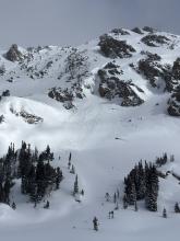
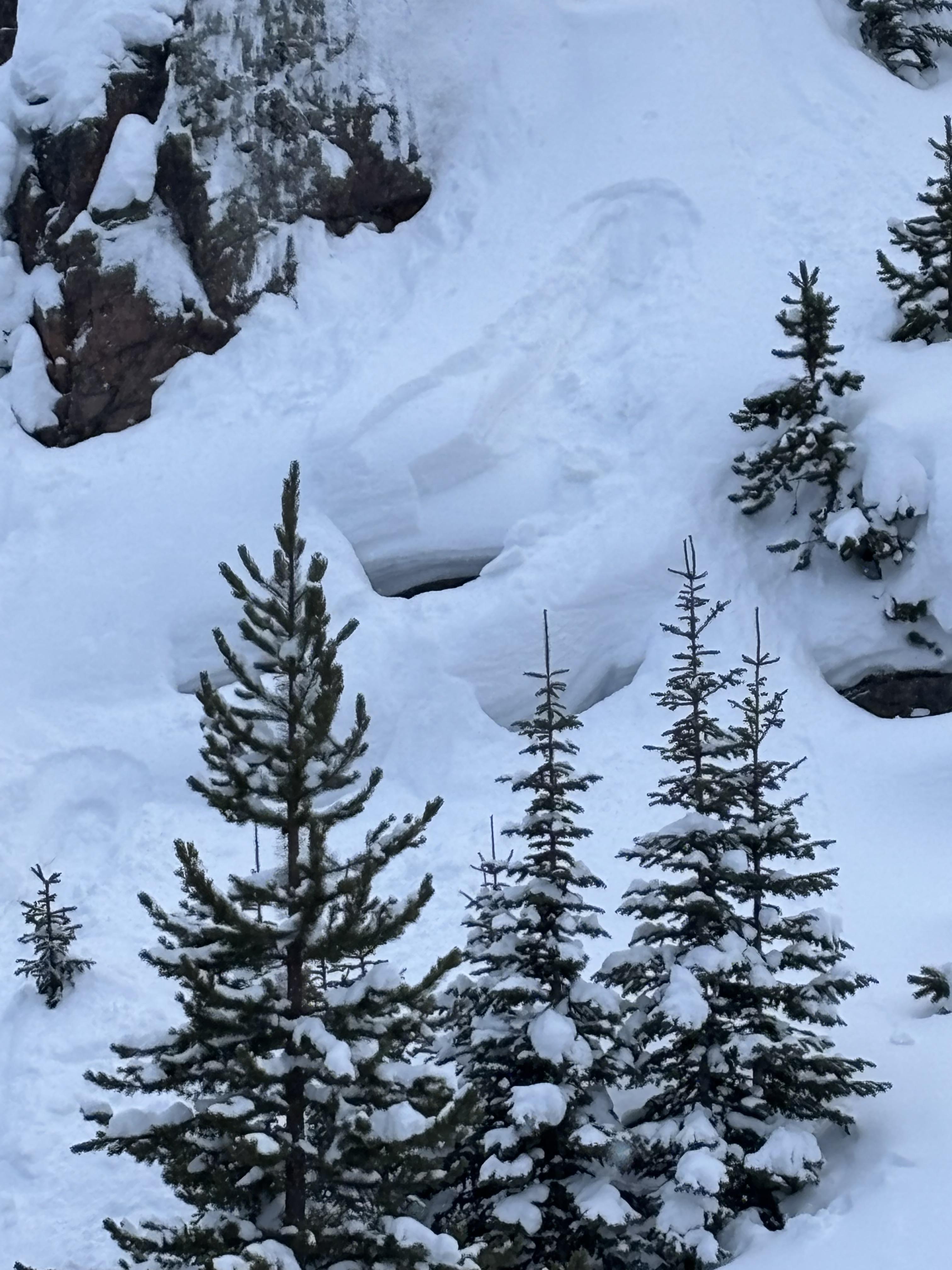
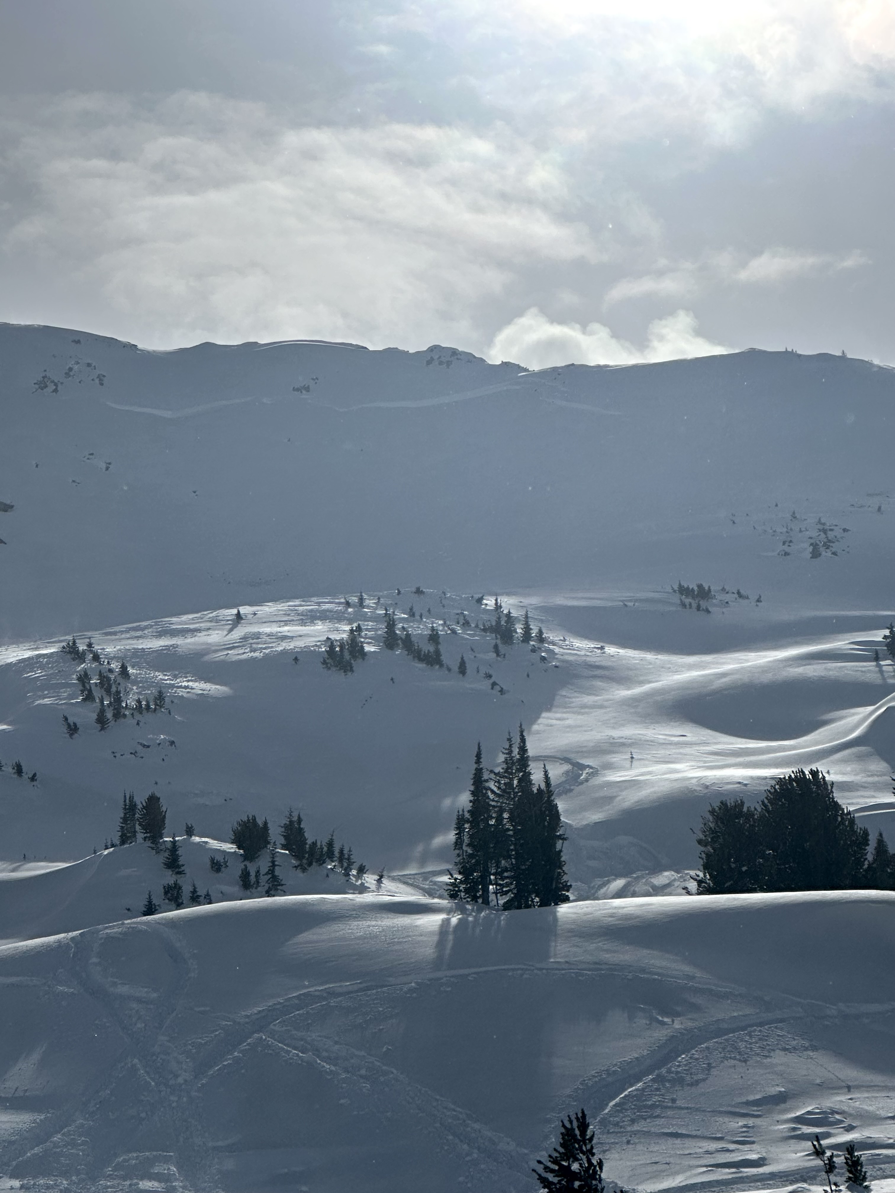
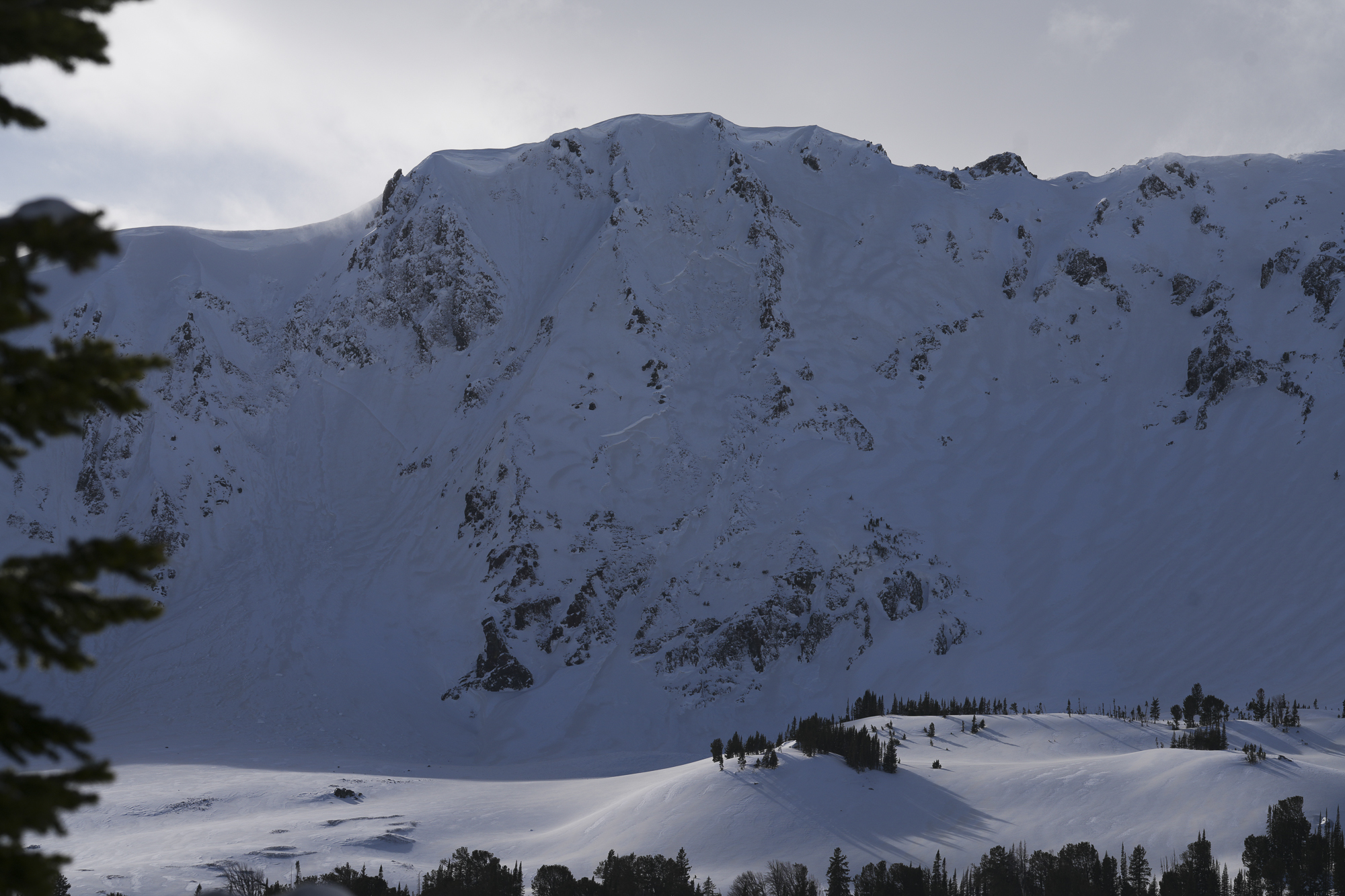
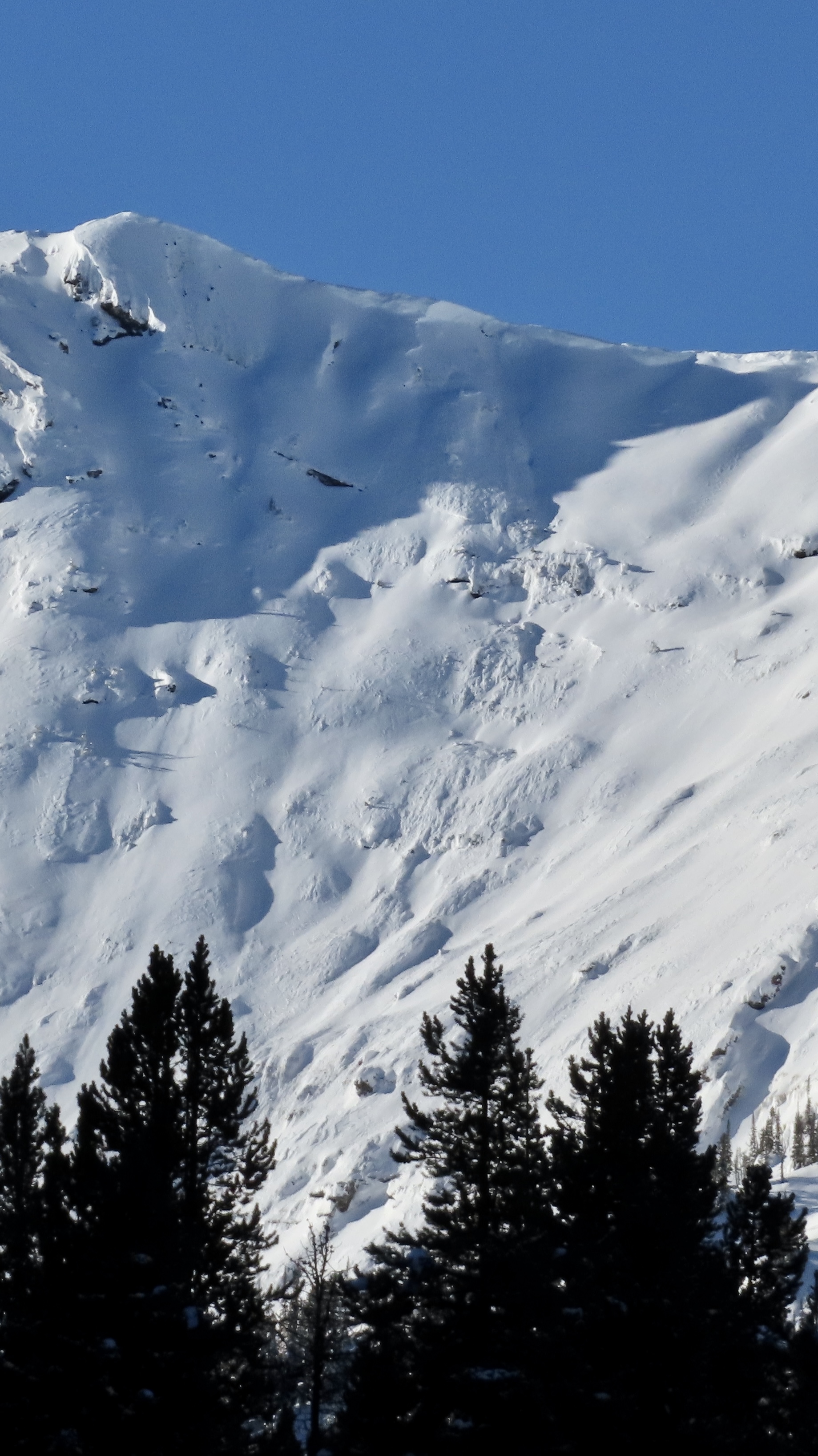
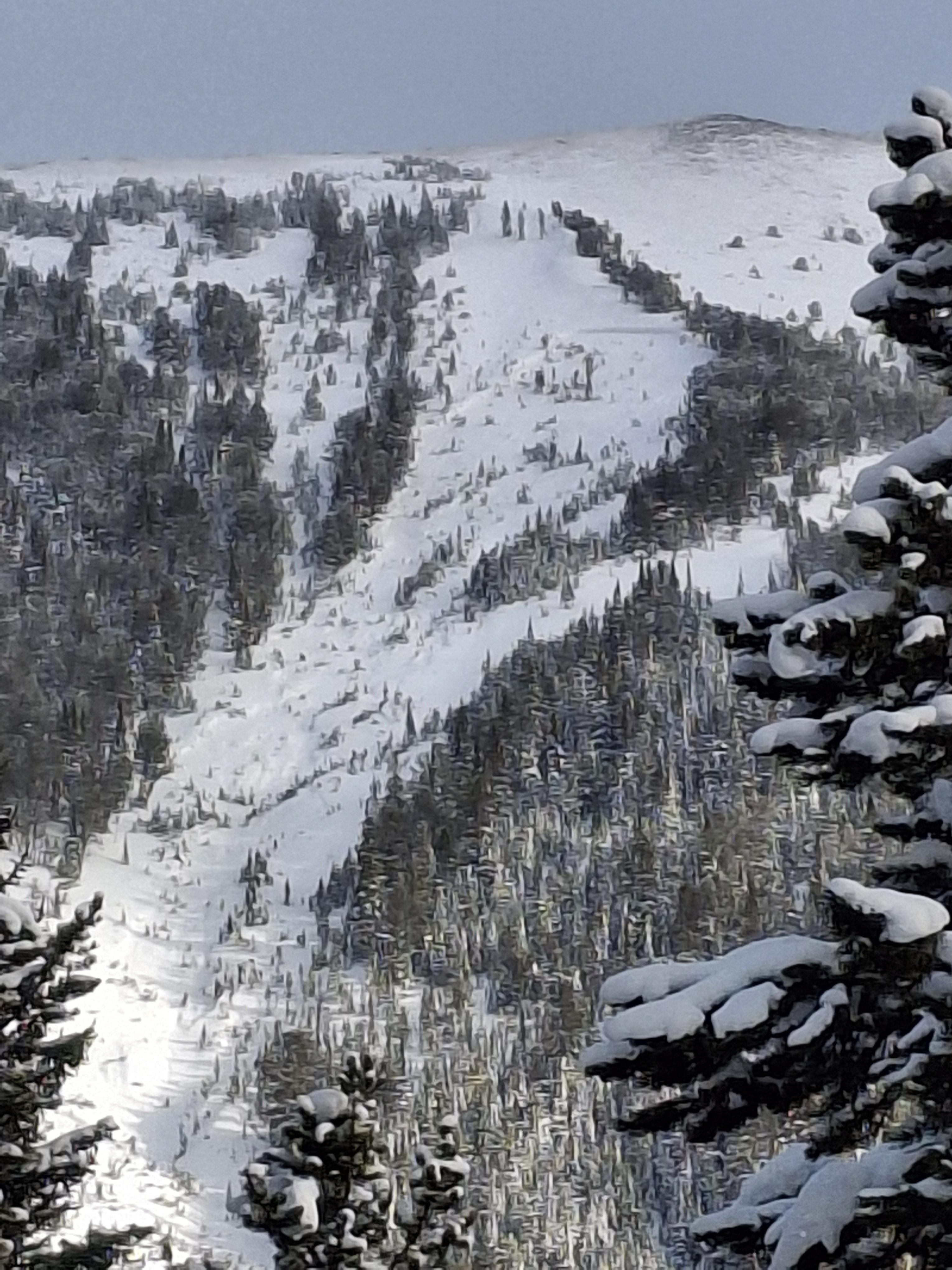
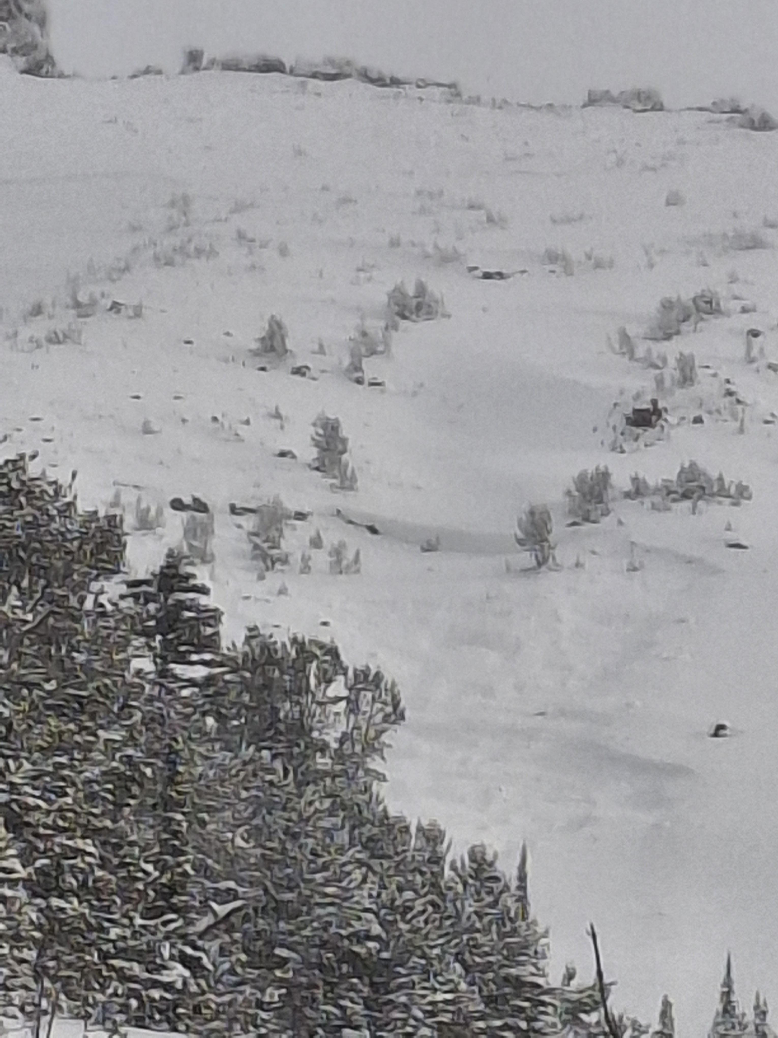
Today we observed a couple day old wind slabs in steep SW facing terrain on Mt Zimmer. Photo: BPG


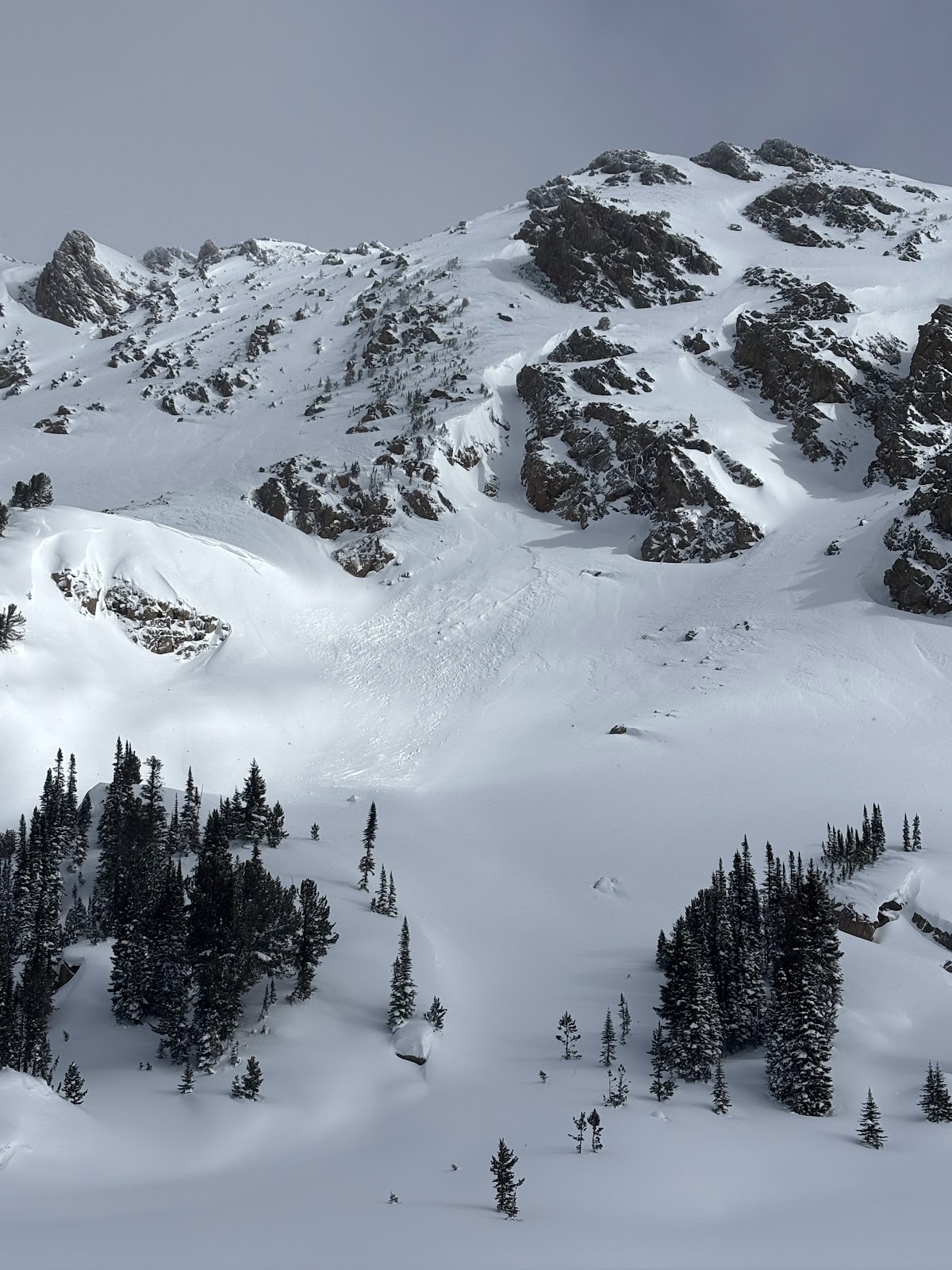
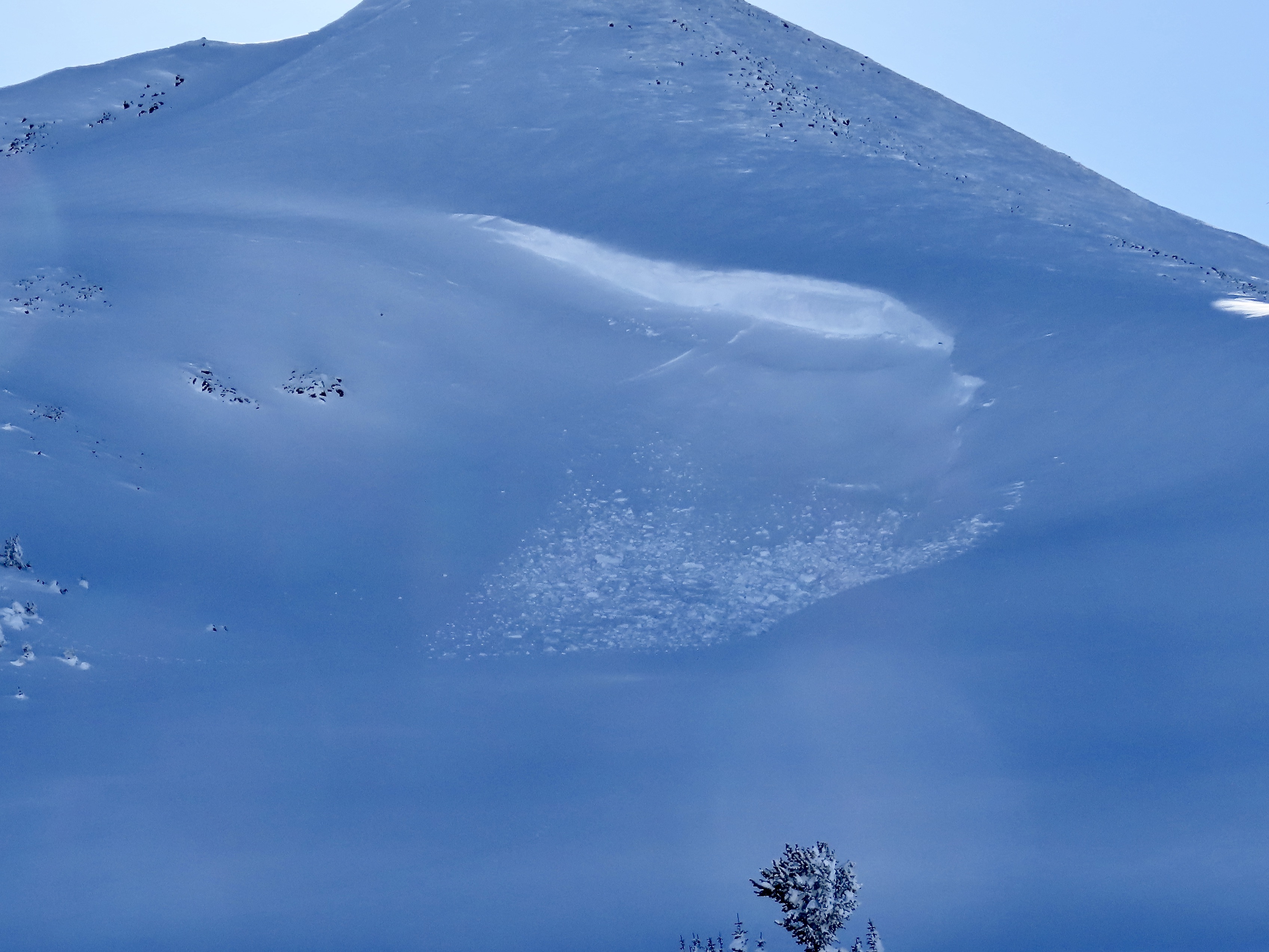
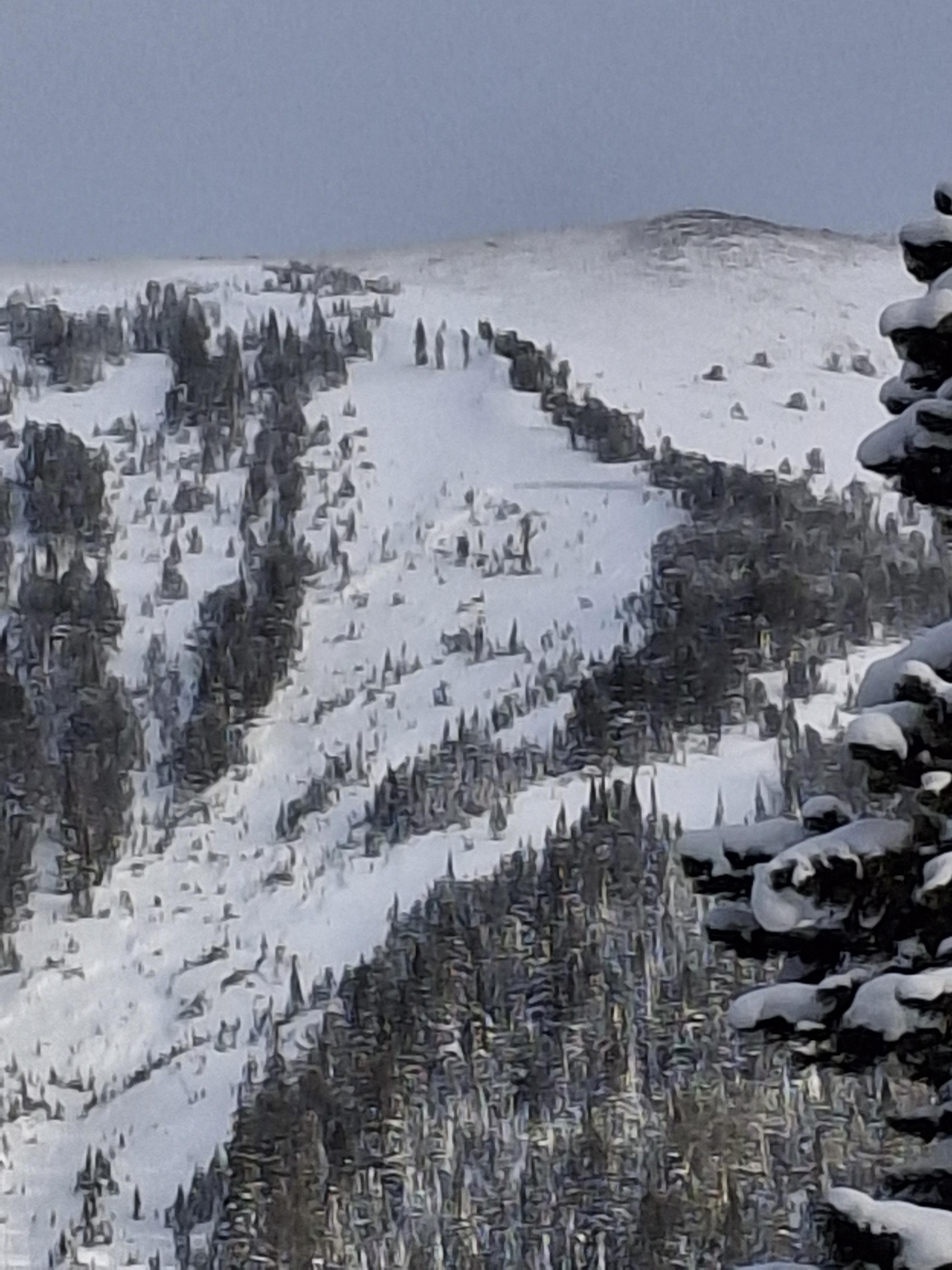
A wet loose avalanche occurred sometime today between 11-2 pm on S facing terrain nearby
Today we observed a couple day old wind slabs in steep SW facing terrain on Mt Zimmer. Also, a wet loose occurred sometime today between 11-2 pm on S facing terrain nearby
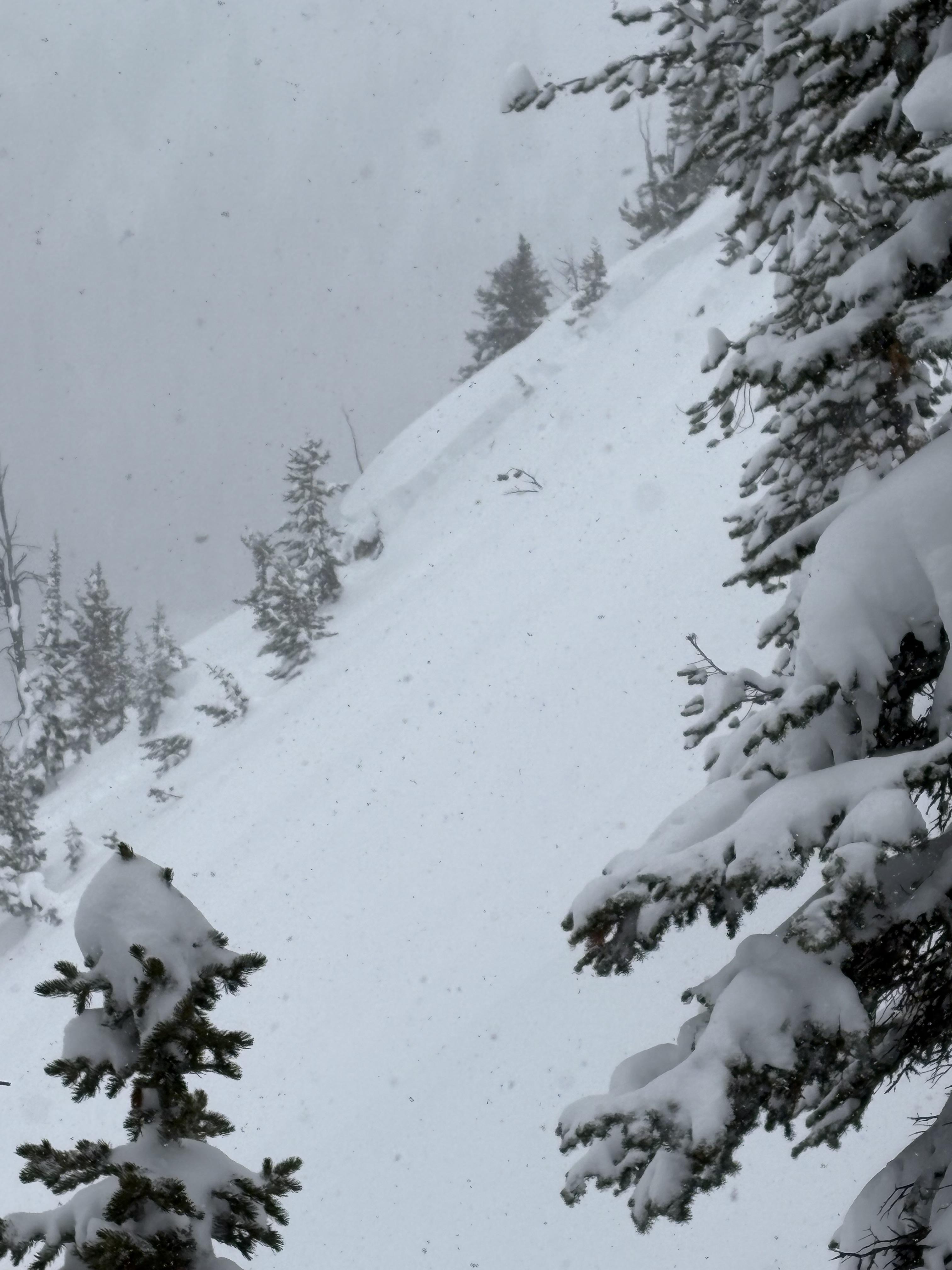
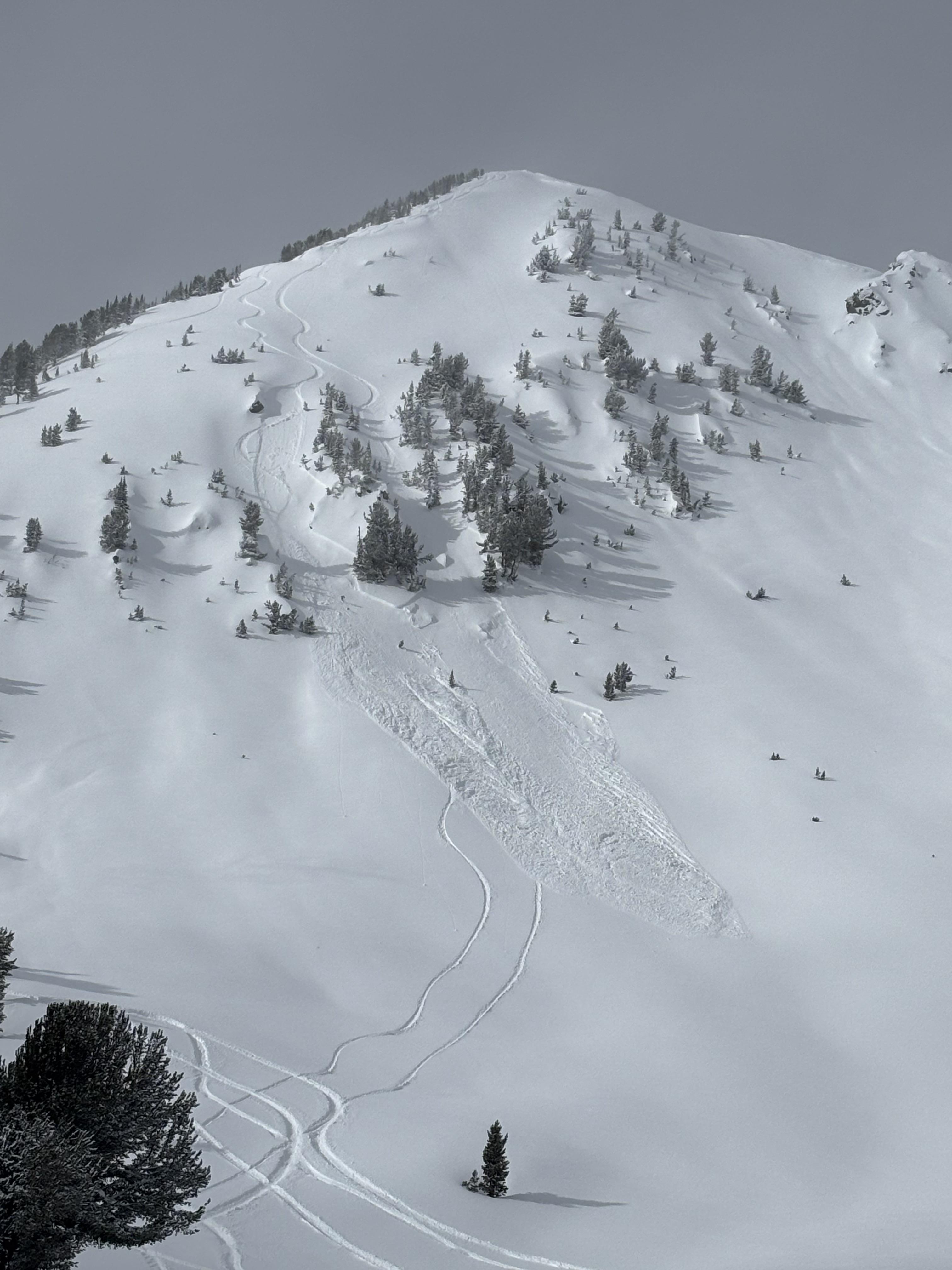
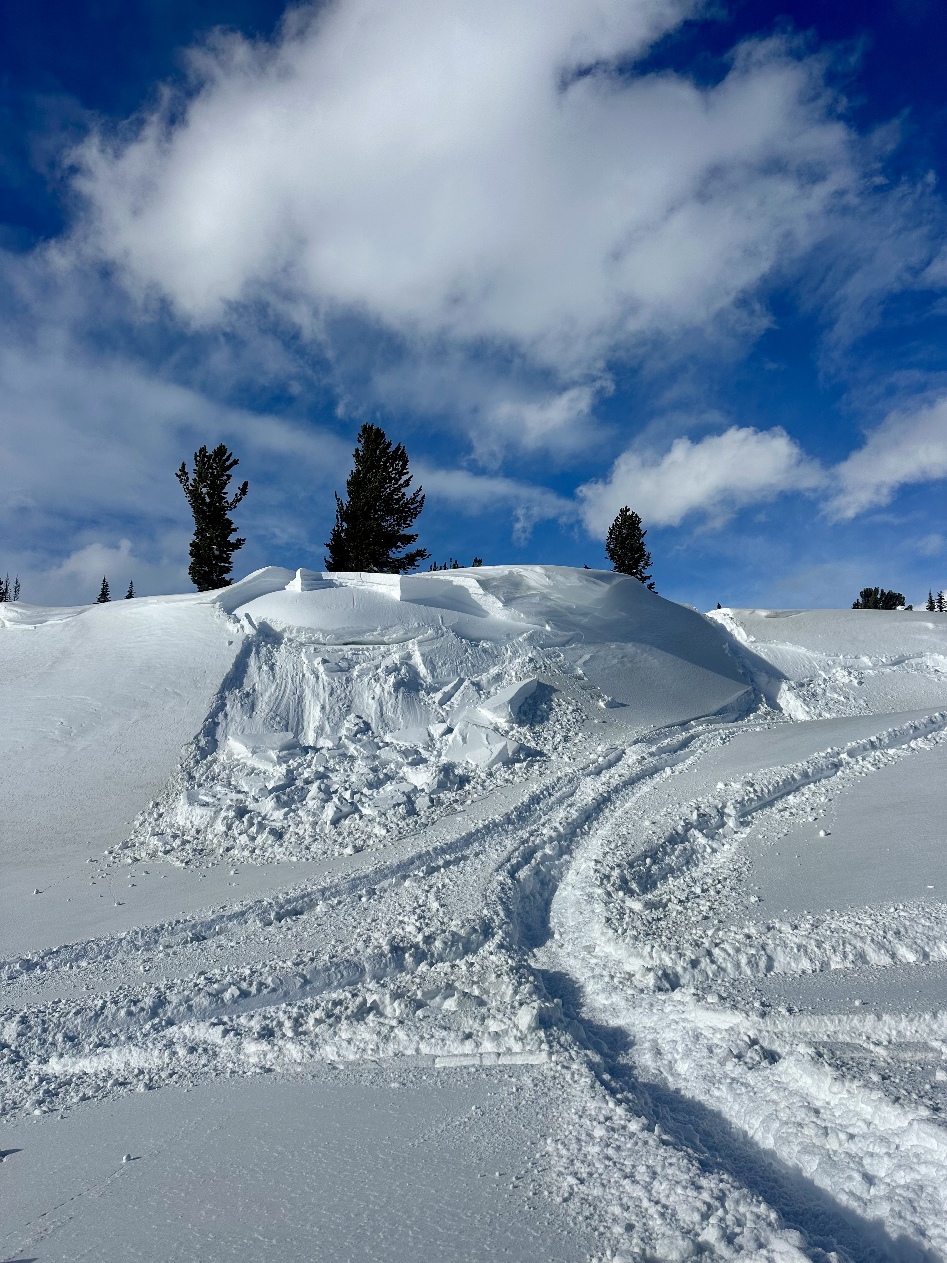
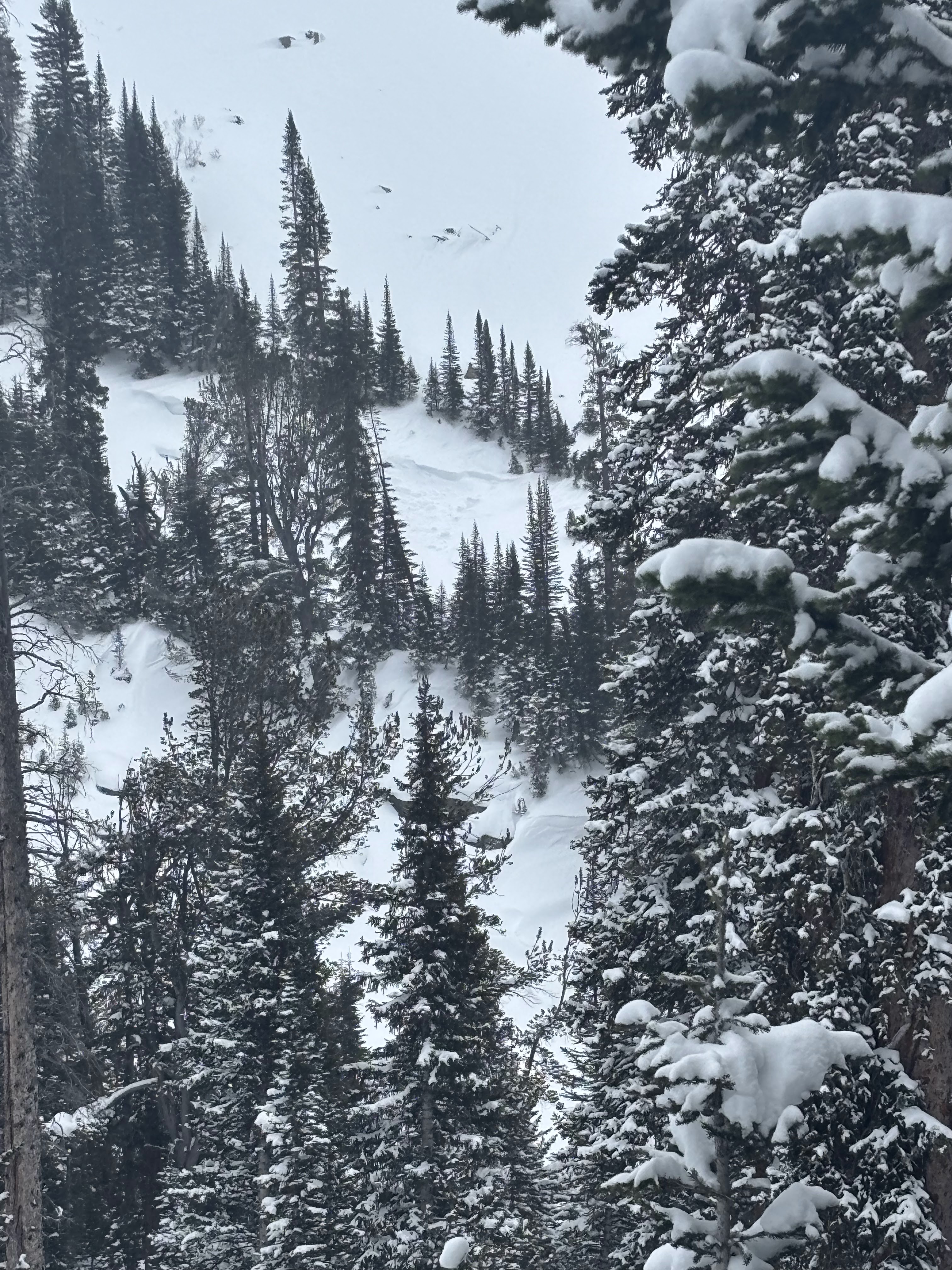
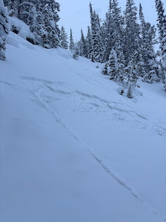
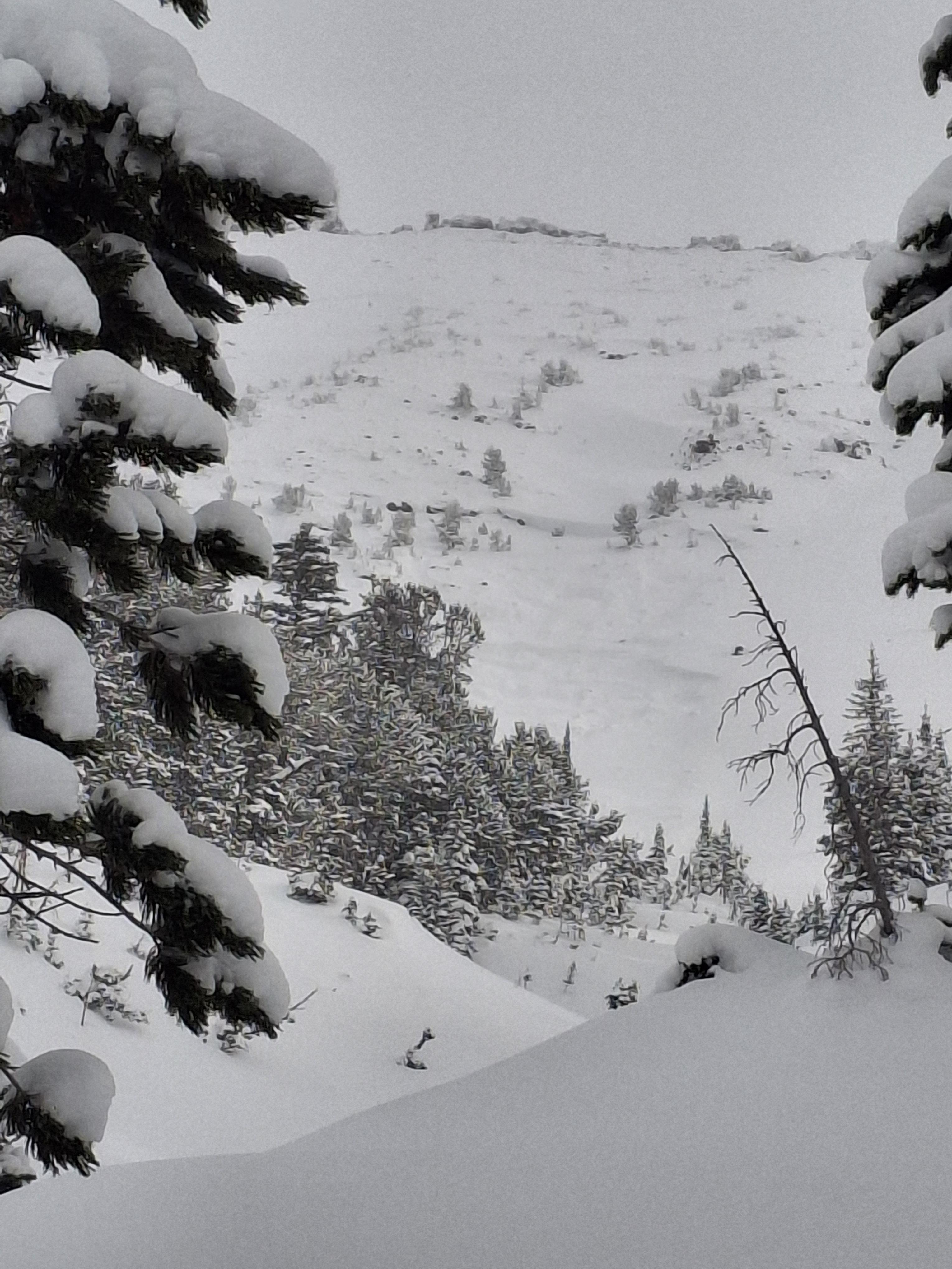
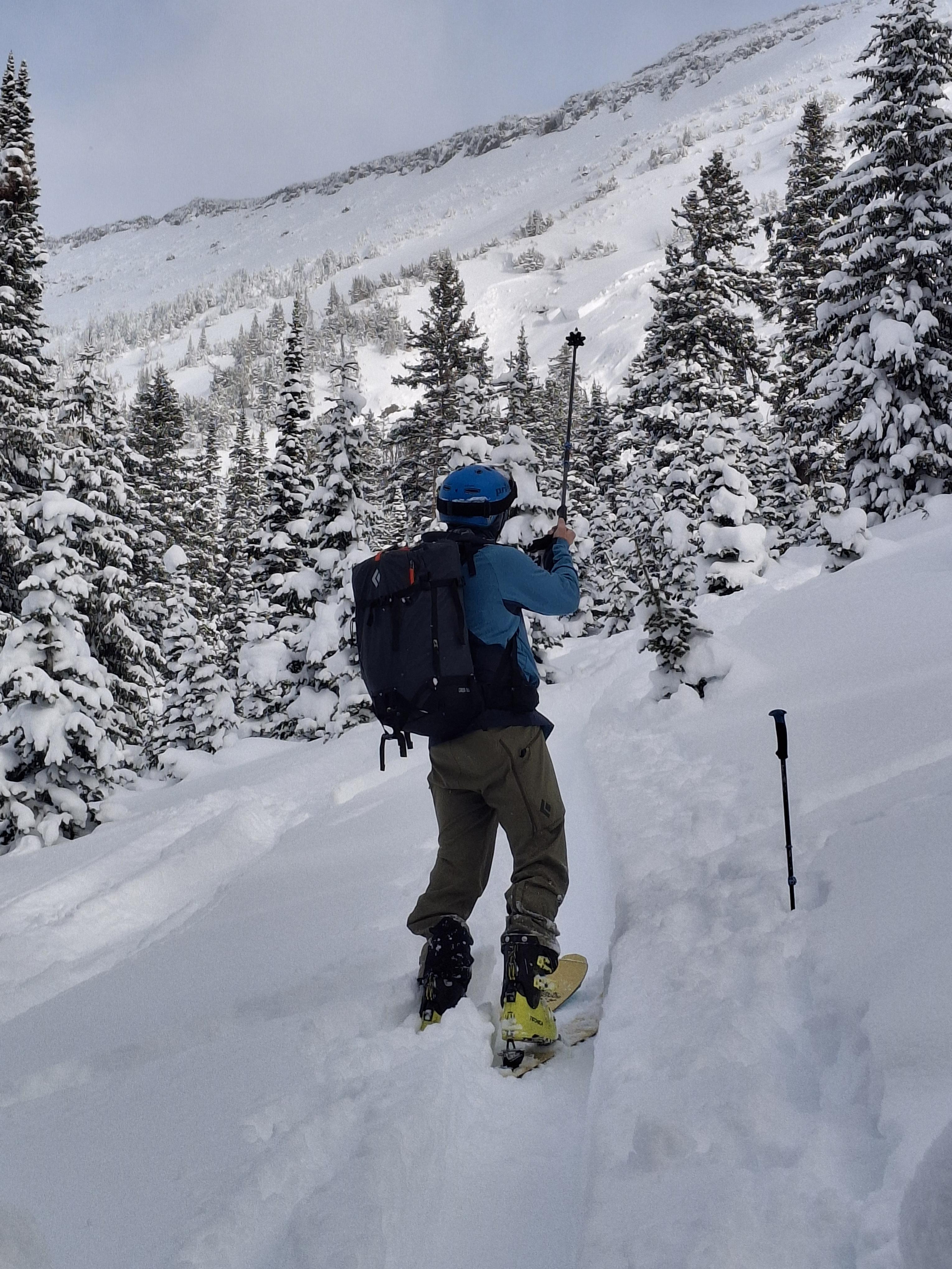
A member of our party intentionally triggered a 30-40cm storm slab on a small convexity in treed terrain in Wyoming Creek.
Today we observed a couple day old wind slabs in steep SW facing terrain on Mt Zimmer. Photo: BPG
Wet loose occurred sometime today between 11-2 pm on S facing terrain nearby. Photo: BPG
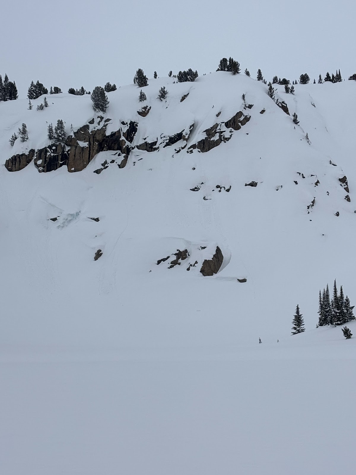
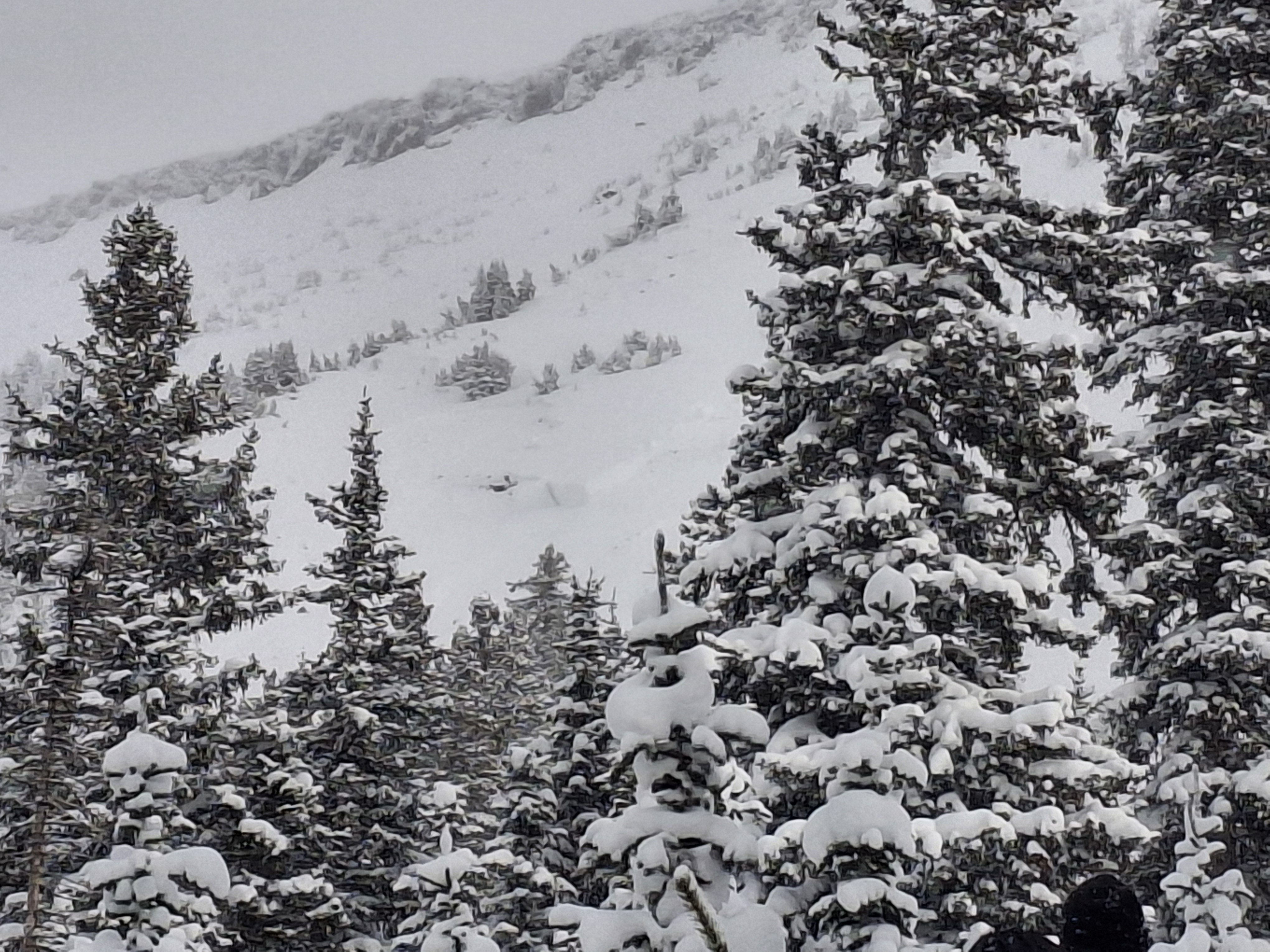
Skier in Republic Creek observed a natural (wind/storm slab) avalanche on an east aspect at ~9200ft. Photo: R. Minton
I could visibly see some layer distinction about 8-12” deep. This is the same weakish layer we found in our column test, where we got ect16 just below robs knob. This was on a north facing aspect. Photo: I Tuttle

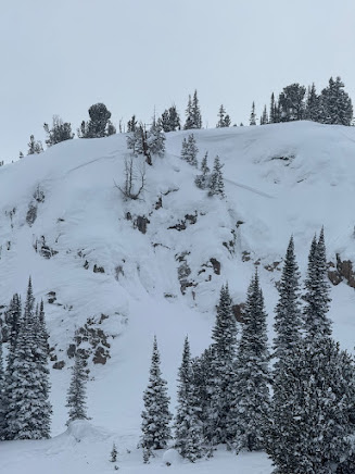
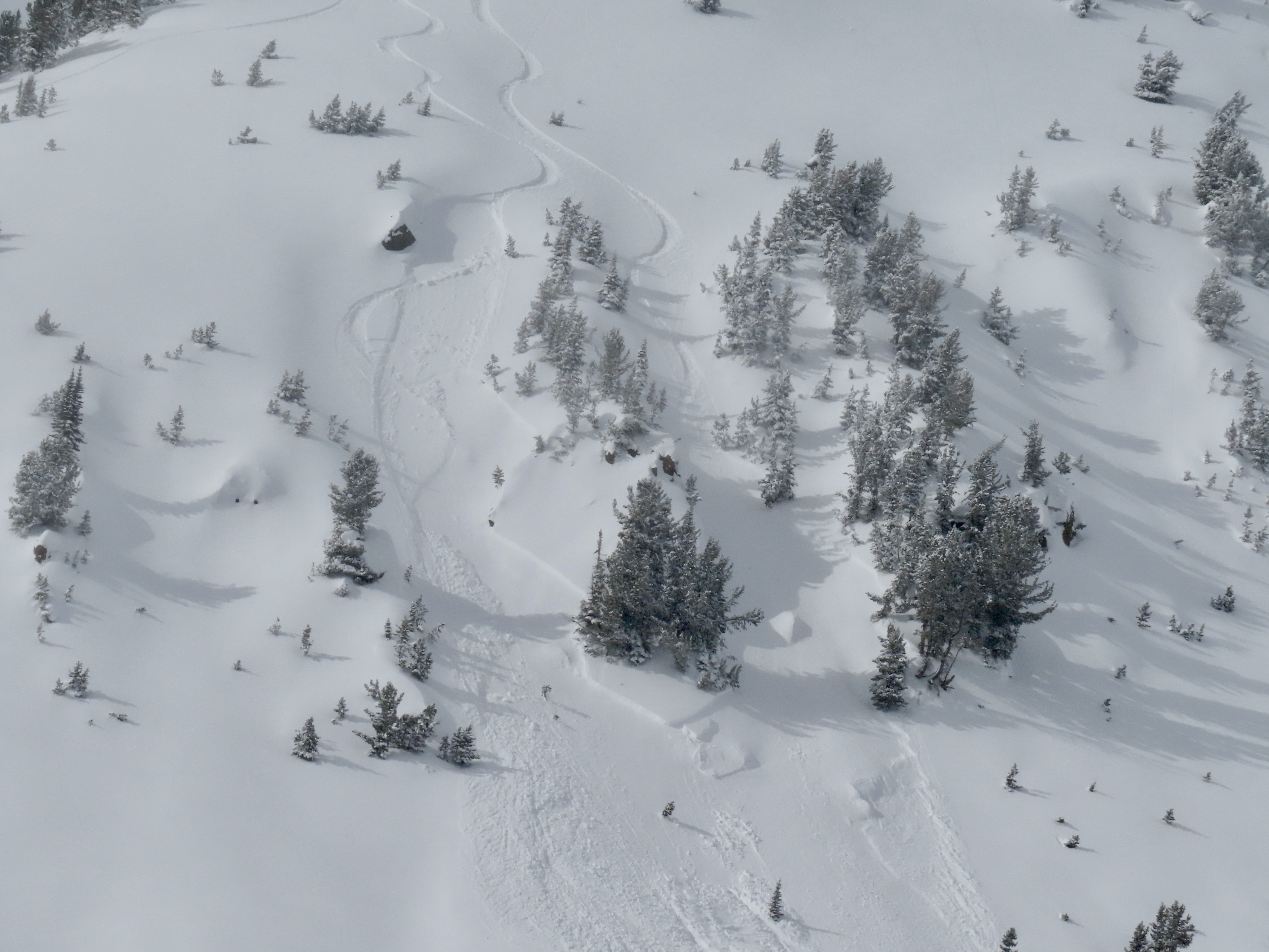
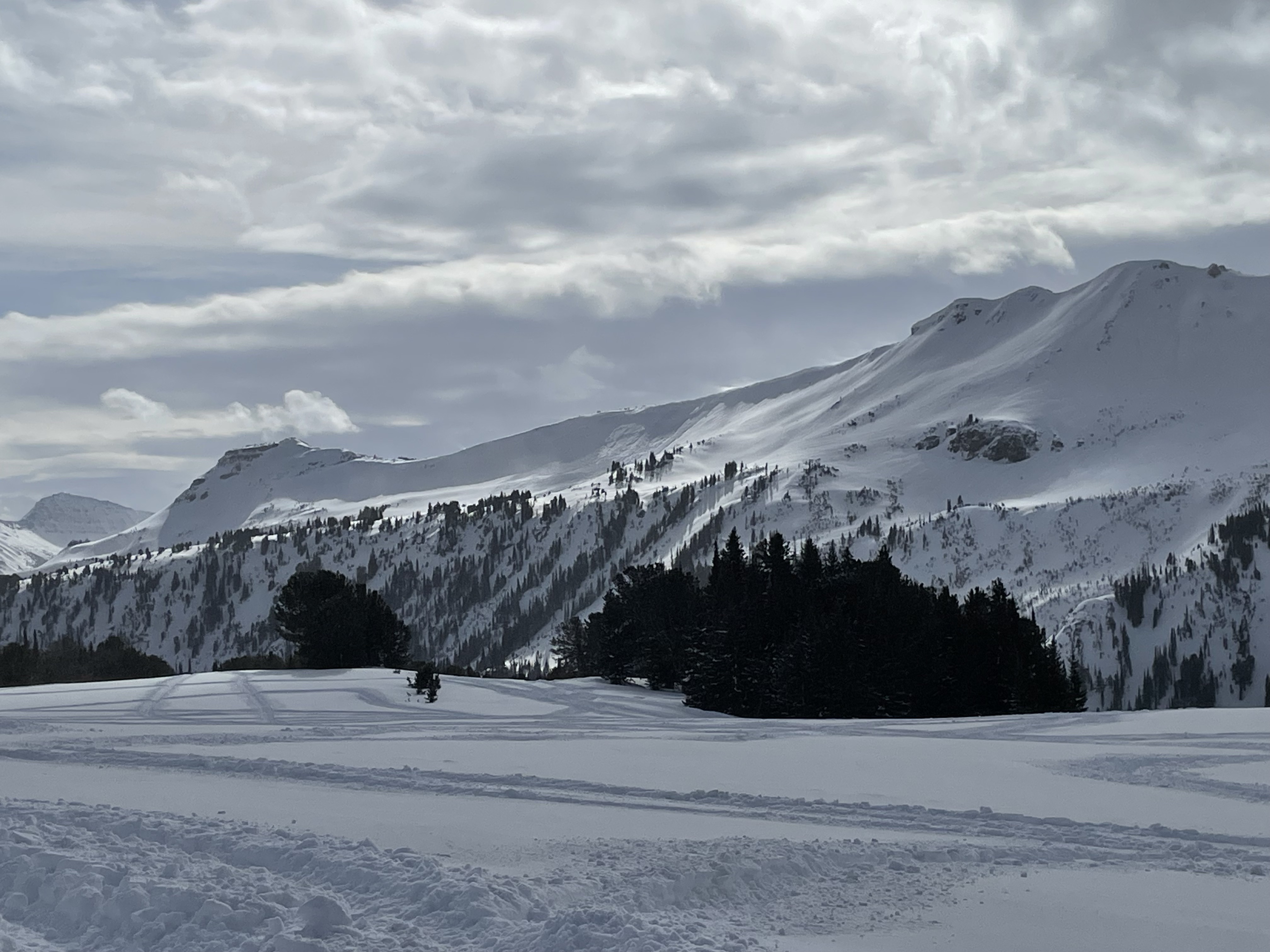
In Hayden Creek, we saw many D1-D1.5 wind slab avalanches seen on leeward slopes- east and northeast slopes at and above treeline. Photo: N. Mattes (Beartooth Powder Guides)
In Hayden Creek, we saw many D1-D1.5 wind slab avalanches seen on leeward slopes- east and northeast slopes at and above treeline. Photo: N. Mattes (Beartooth Powder Guides)
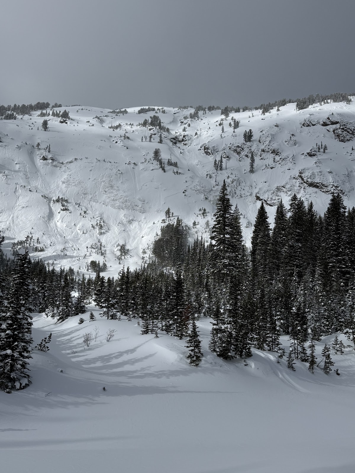
In Hayden Creek, we saw many D1-D1.5 wind slab avalanches seen on leeward slopes- east and northeast slopes at and above treeline. Photo: N. Mattes (Beartooth Powder Guides)
In Hayden Creek, we saw many D1-D1.5 wind slab avalanches seen on leeward slopes- east and northeast slopes at and above treeline. Photo: N. Mattes (Beartooth Powder Guides)
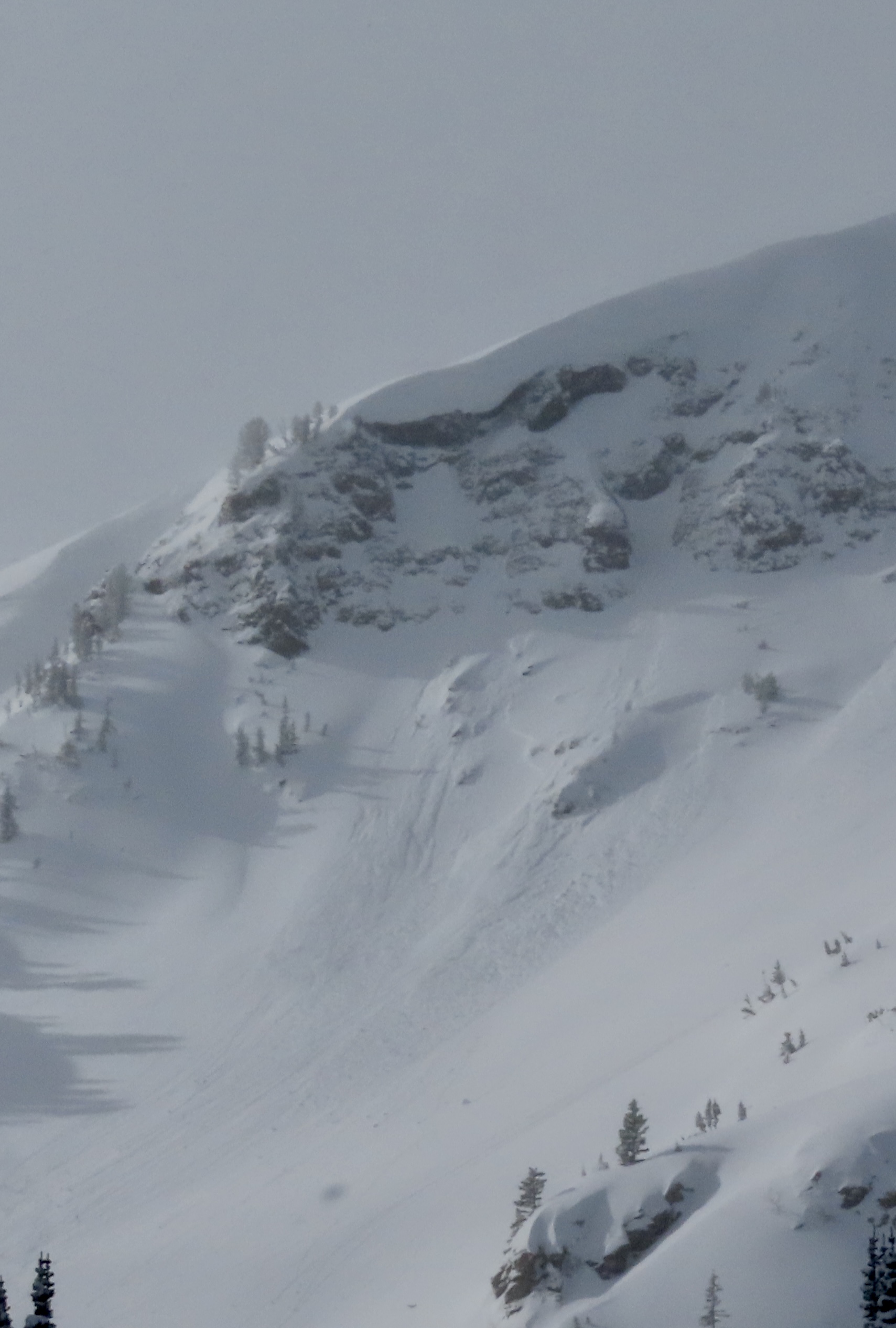
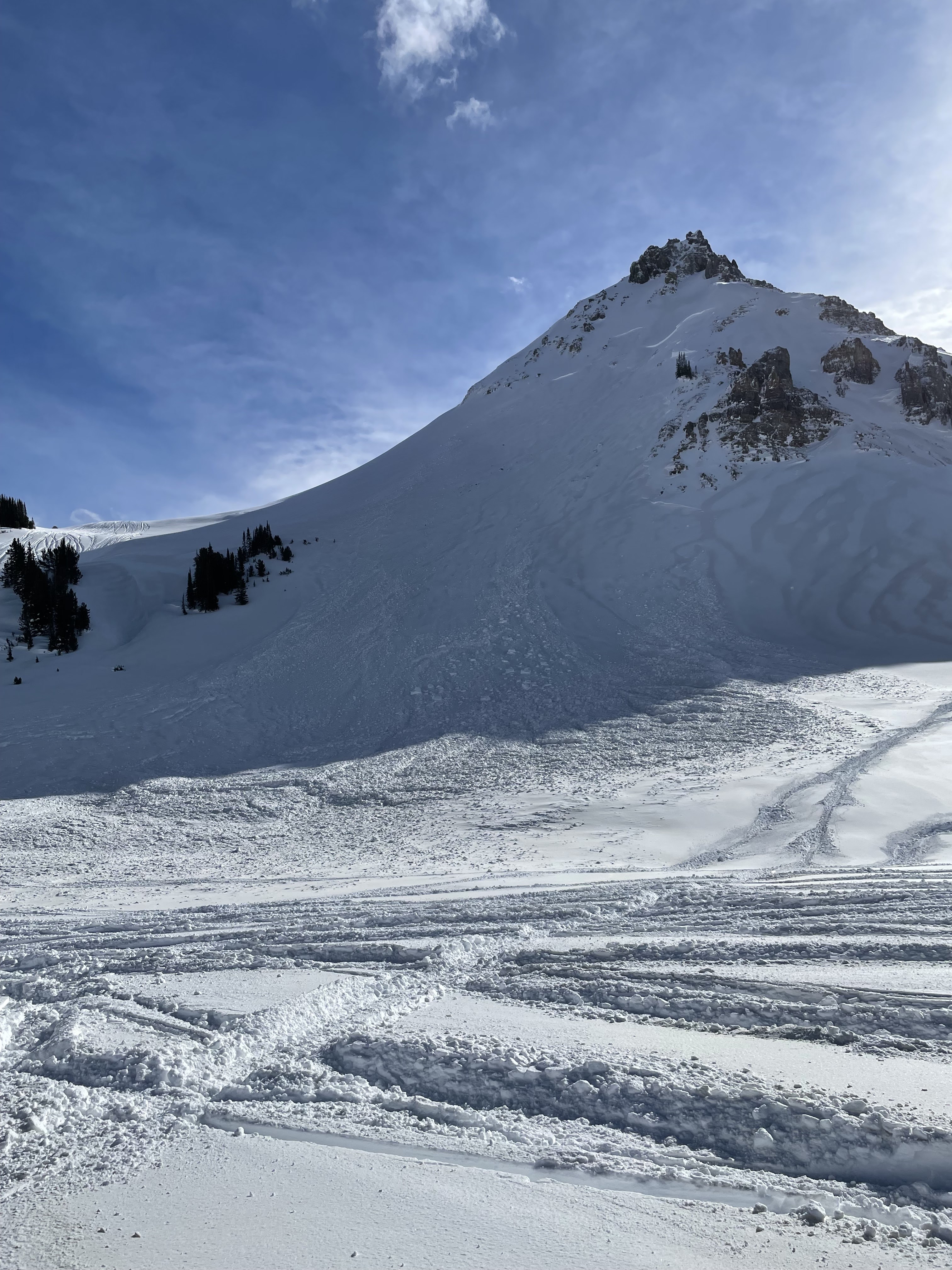
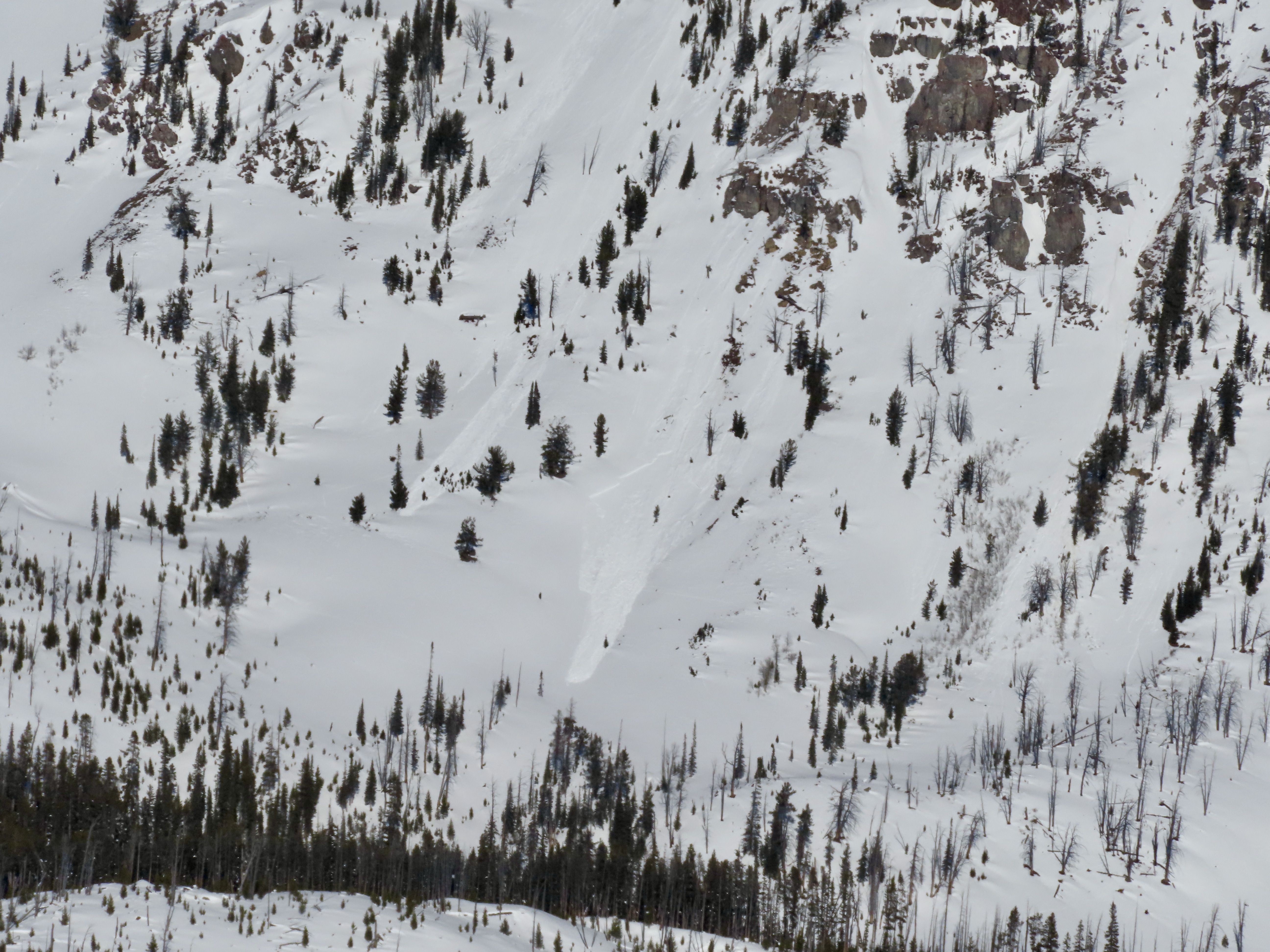
Noticed a large cornice triggered avalanche on Mineral Mtn today. Likely broke on 2/12 or early am 2/13. E aspect ran almost to the valley floor. Photo: BPG
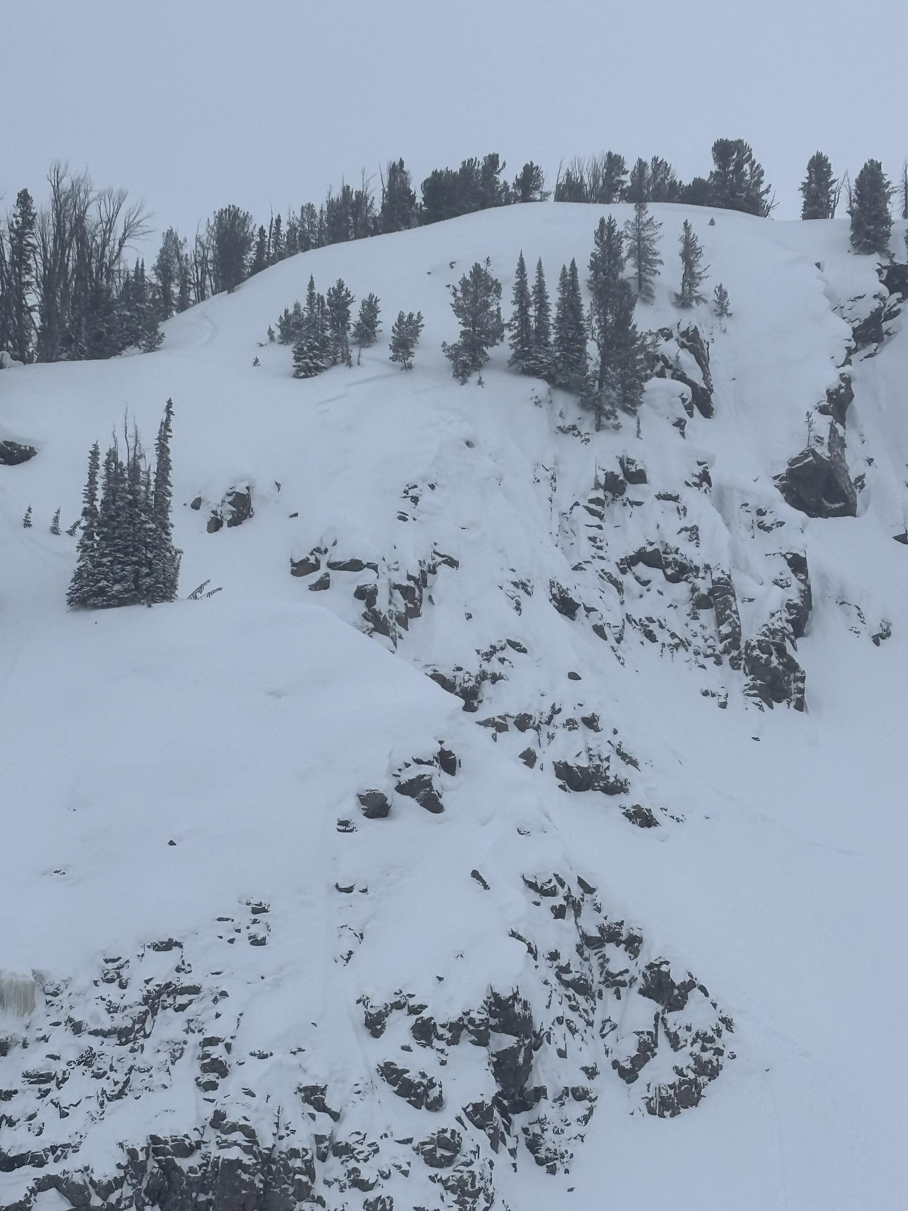
Saw what looked to be a small wind slab or cornice fall on South Siren in Republic Creek. SE facing, 10100 ft. Photo: BPG

Saw a few wind slabs. Some appeared to be skier triggered, some were natural. Photo: BPG
Saw a few wind slabs. Some appeared to be skier triggered, some were natural. Photo: BPG
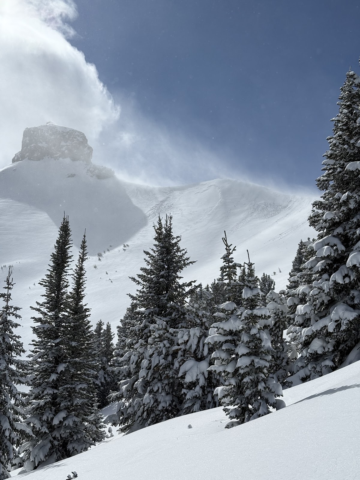
On Feb 9 we watched two snowboarders trigger separate wind slabs, while riding one at a time in avalanche terrain, on the south side of Scotch Bonnet. Photo: J. Mancey
On Feb 9 we watched two snowboarders trigger separate wind slabs, while riding one at a time in avalanche terrain, on the south side of Scotch Bonnet. Photo: GNFAC
On Feb 9 we saw a fresh natural wind slab near Wolverine, R1-D1.5. Photo: GNFAC
Saw this small soft slab above Round Lake today. SE facing, 9500 ft. Likely skier triggered, there were lots of ski tracks on that hill. Photo: J Mundt
A little wind load cornice break, but it broke while I was coming down that track to the right. Photo: S Strenge
This is the N side of scotch bonnet, looks like a big break, didn’t get any closer than this however. Photo: S Strenge

N face of crown butte, looks like it slid before the dirt event (we think the end of the storm yesterday/ or last night must have been dirty snow?). Photo: S Strenge
Avalanche east aspect of Henderson. This slid sometime between 11:30 - 12:30 on 2/4/24. Photo: BPG

Avalanche on north aspect of Fisher Mountain. This likely slid sometime between 2/2-2/3. Photo: BPG
Avalanche north aspect of Crown Butte. This likely slid sometime between 2/2-2/3. Photo: BPG
Some recent avalanche activity noted on east Mt. Henderson. Photo: B Fredlund
Some recent avalanche activity noted on Miller Ridge. Photo: B Fredlund
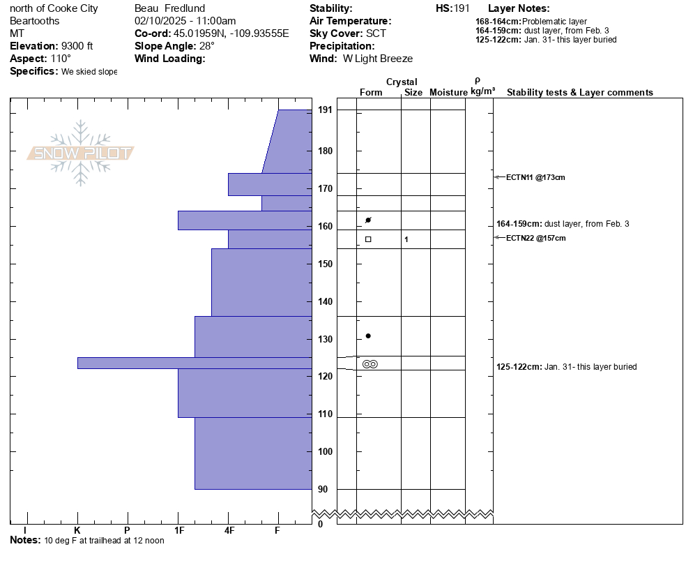
Skied north of Cooke City. Lots of cracking and small slabs on pillows. Observed one small wind slab on NW facing slope 9200 ft. Photo: BPG

Skied north of Cooke City. Lots of cracking and small slabs on pillows. Photo: BPG
On Jan 30 we spotted several loose wet avalanches that occurred yesterday in steep, rocky terrain up Sheep Creek. Photo: GNFAC
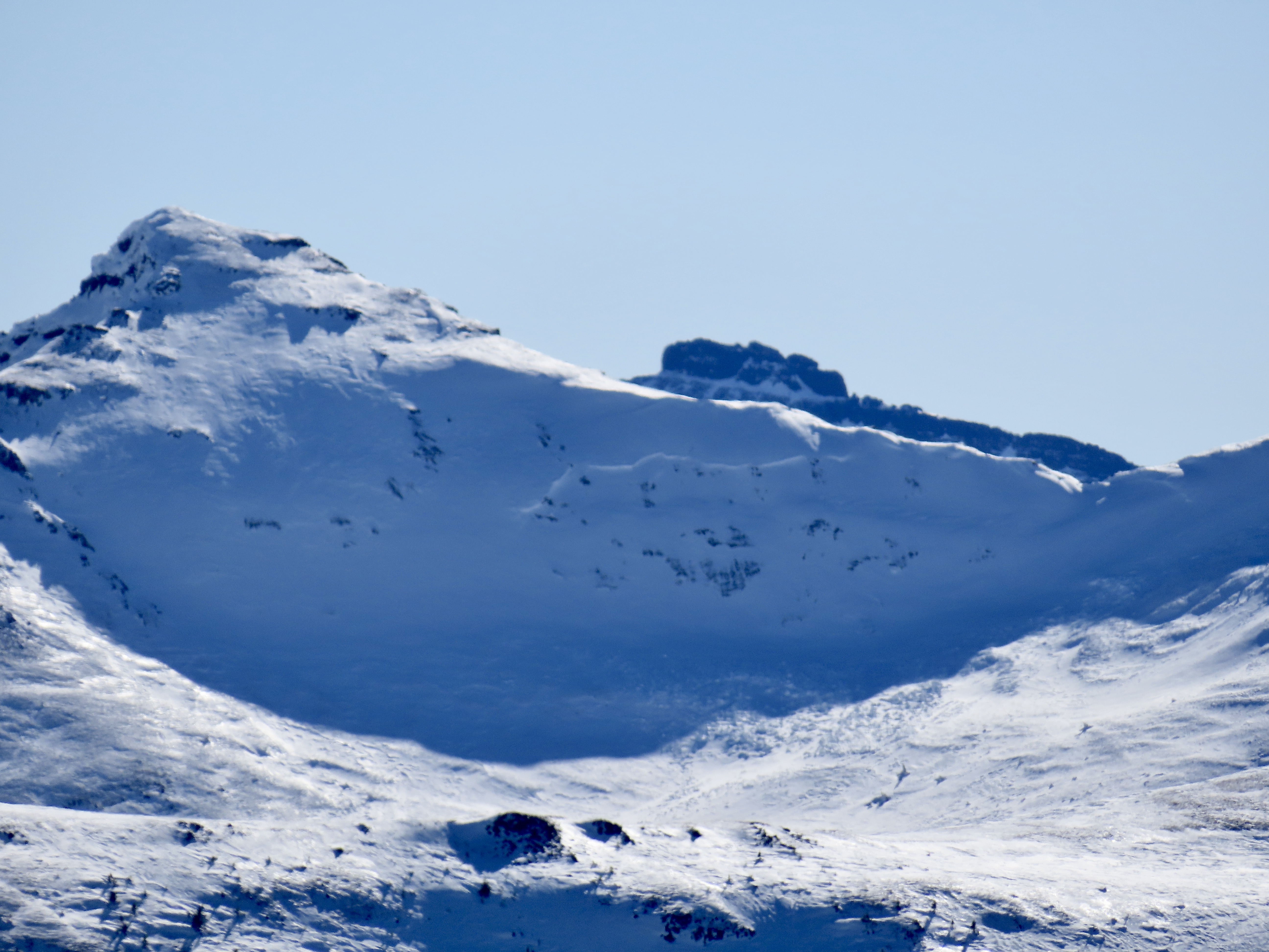
On Jan 30 we noted an old, deep persistent slab avalanche on a NW' aspect near the south end of the Republic Creek drainage. This likely broke around a week ago. Photo: GNFAC
On Jan 27 we saw a cornice fall on a very big steep slope up Republic Creek which did not trigger anything large or deeper, but entrained some snow and ran over a thousand feet vertical. Photo: GNFAC

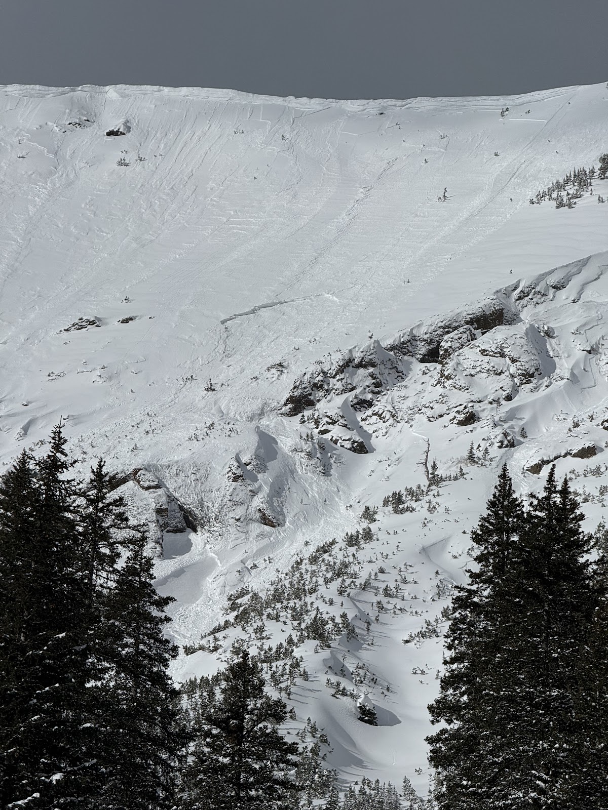
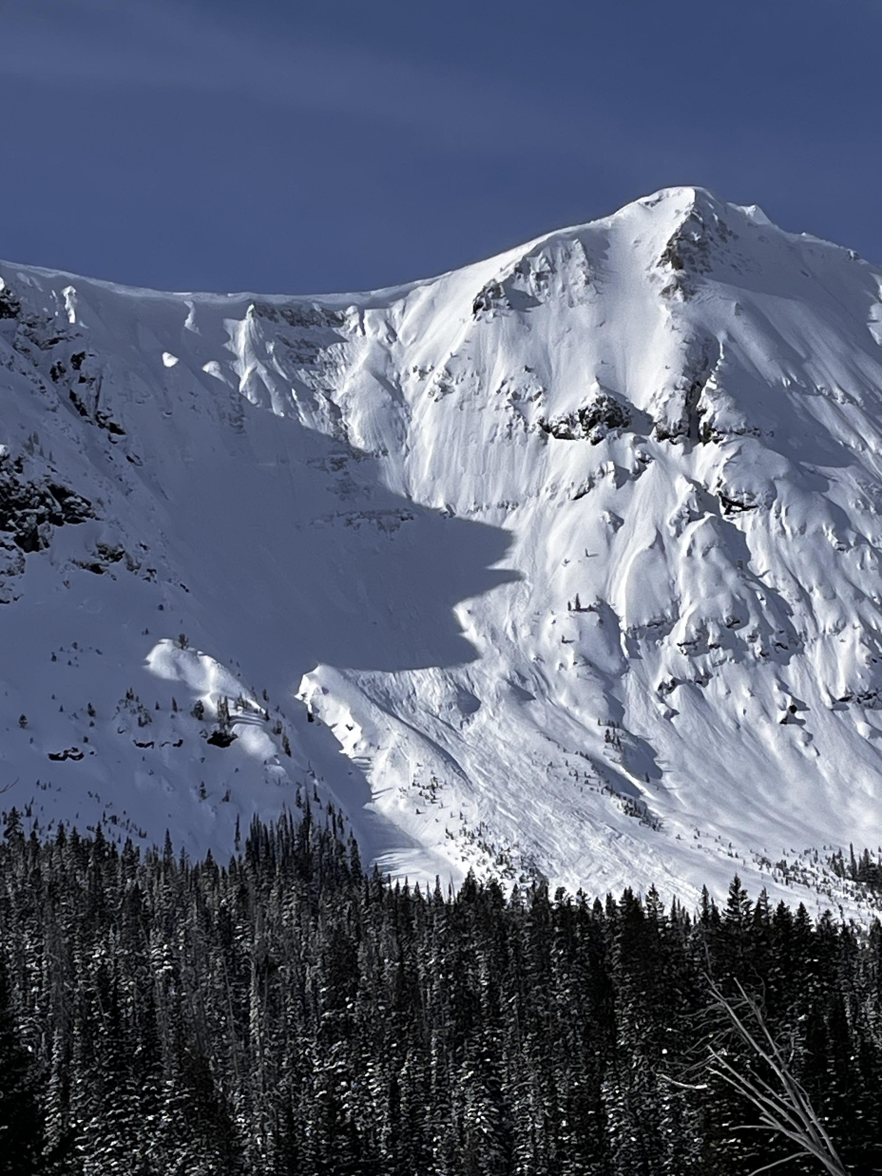
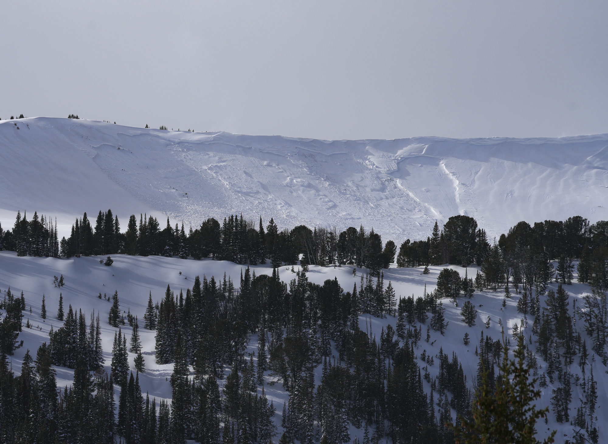
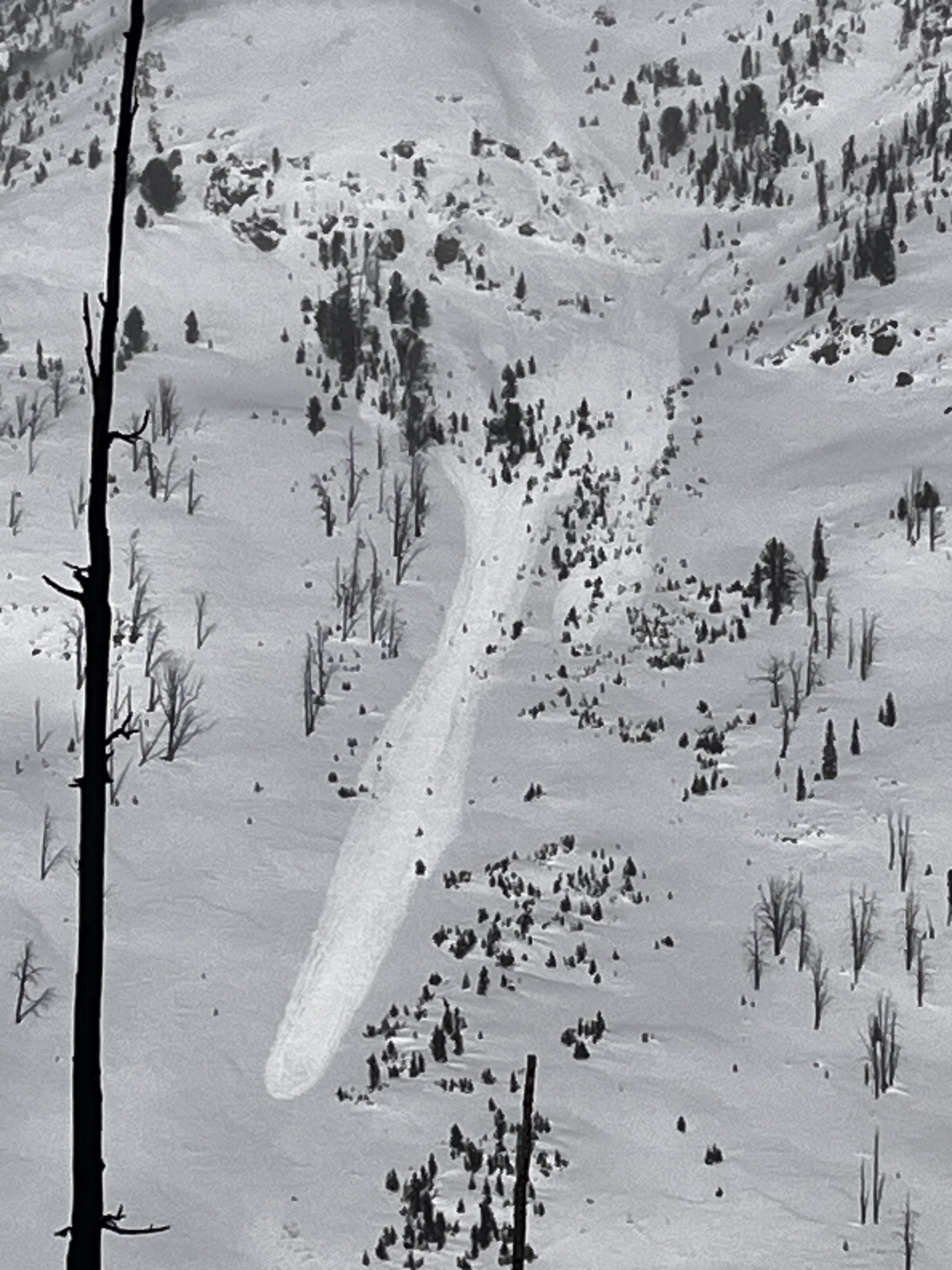
On Jan 27 We saw one old, but very large persistent slab avalanche further up Republic Creek (pictured). It was on similar aspect and elevation as a somewhat more recent persistent slab in nearby Hayden Creek, North-northeast, 10,000'. It appeared to be 6'+ deep and 500'+ wide. The bed surface and crown had been partially drifted in, so it seemed it was probably at least a week old...? Photo: GNFAC
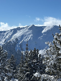
On January 26 we saw a handful (4-6?) of old wind slab avalanches of various ages. The most recent and largest appearing, but still not very fresh, was on the north side of Scotch Bonnet (attached photo). Most were D1-D1.5, the slide pictured was D1.5-2. Photo: GNFAC

While touring today, we saw a deep slab avalanche at the southern end of the Hayden Creek drainage. NE aspect. It seemed to be recent, likely in the last day or so. Photo: N Mattes
Wind slab avalanche on E Henderson North of the large slide path close to Fisher Pk. R1 D2,1-2' deep, 200' wide. It broke aprx 200' below the summit mid slope. It looked like it broke on the 19th. Photo: BPG
On 1/12 observed a D .5 soft slab near Long Lake above the snowmobile trail. Also saw some small dry loose activity on E facing terrain in Zimmer Creek. Photo: BPG
Woody Ridge north of the "KNBs." Northwest facing slope, crown elevation approx 9600'. Ran 1000 to 1200'. Photo: N Gaddy
Woody Ridge north of the "KNBs." Northwest facing slope, crown elevation approx 9600'. Ran 1000 to 1200'. Unsure of when it went, we did not notice it this morning only this afternoon on the hike out. Photo: N Gaddy
Observed a large avalanche on a west facing slope approx 10000ft, with a higher crown at 10200'. Crown depth 4-6'. HS-Ns-D2-R2-O . Ran 1000ft and into terrain I had previously considered safe. Photo: N Gaddy
Observed a large avalanche on a west facing slope approx 10000ft, with a higher crown at 10200'. Crown depth 4-6'. HS-Ns-D2-R2-O . Ran 1000ft and into terrain I had previously considered safe. Photo: N Gaddy
Observed a large avalanche on a west facing slope approx 10000ft, with a higher crown at 10200'. Crown depth 4-6'. HS-Ns-D2-R2-O . Ran 1000ft and into terrain I had previously considered safe. Photo: N Gaddy
Observed a large avalanche on a west facing slope approx 10000ft, with a higher crown at 10200'. Crown depth 4-6'. HS-Ns-D2-R2-O . Ran 1000ft and into terrain I had previously considered safe. Photo: N Gaddy
Tonight

Low: 23 °F
Mostly Cloudy
Sunday

High: 30 °F
Snow Likely
and Patchy
Blowing Snow
Sunday Night

Low: 29 °F
Heavy Snow
and Patchy
Blowing Snow
Monday

High: 33 °F
Chance Snow
and Patchy
Blowing Snow
Monday Night

Low: 30 °F
Snow Showers
Likely and
Patchy
Blowing Snow
Tuesday

High: 28 °F⇓
Snow Showers
Likely and
Patchy
Blowing Snow
Tuesday Night
Low: 14 °F
Chance Snow
Showers and
Patchy
Blowing Snow
Wednesday

High: 31 °F
Mostly Sunny
Wednesday Night

Low: 16 °F
Mostly Clear