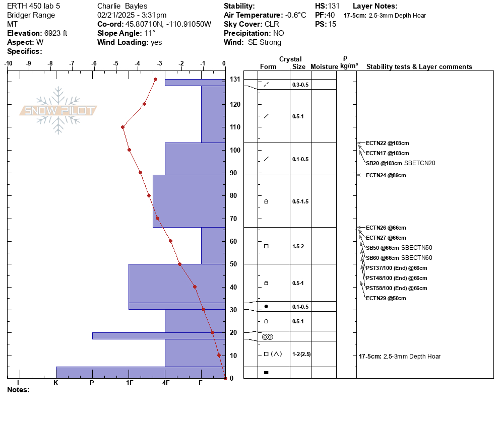
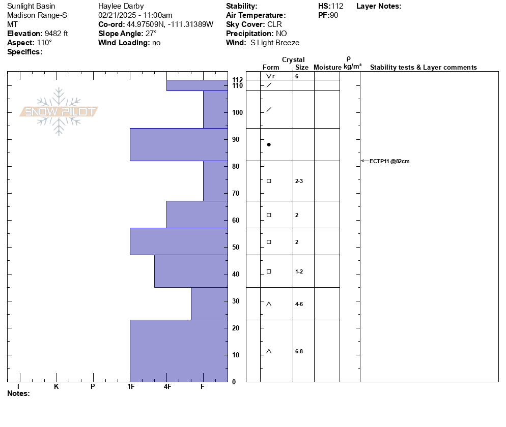
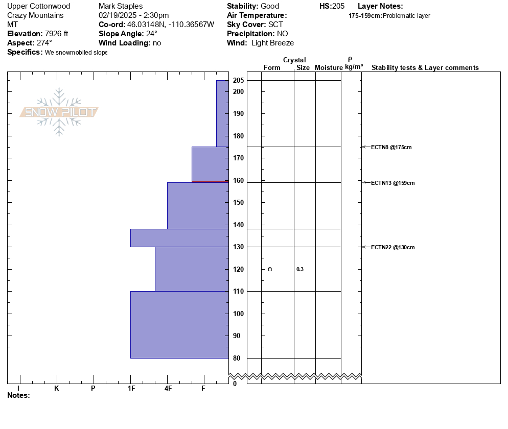
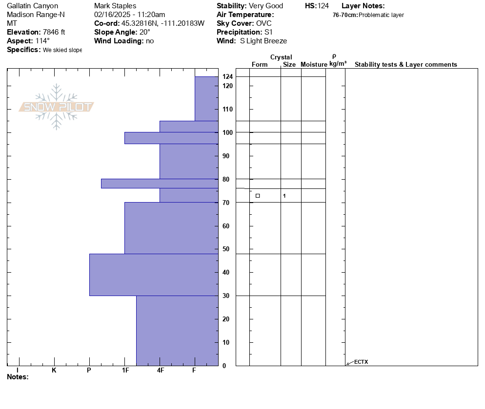
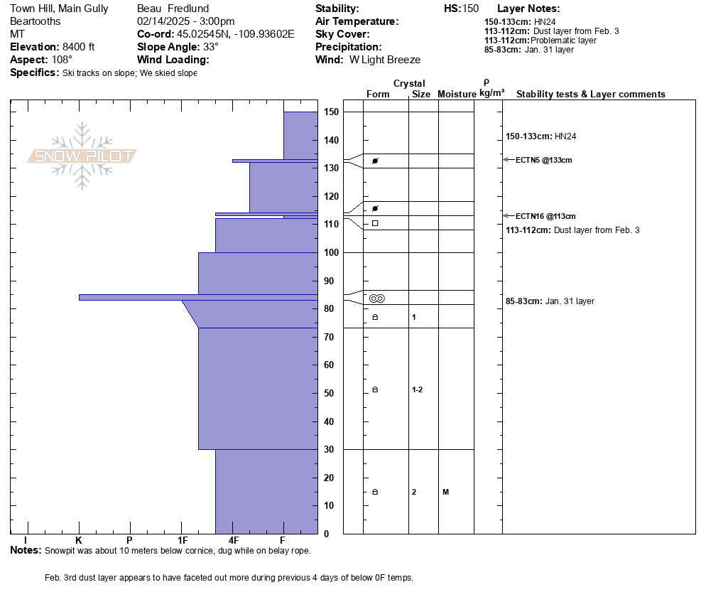
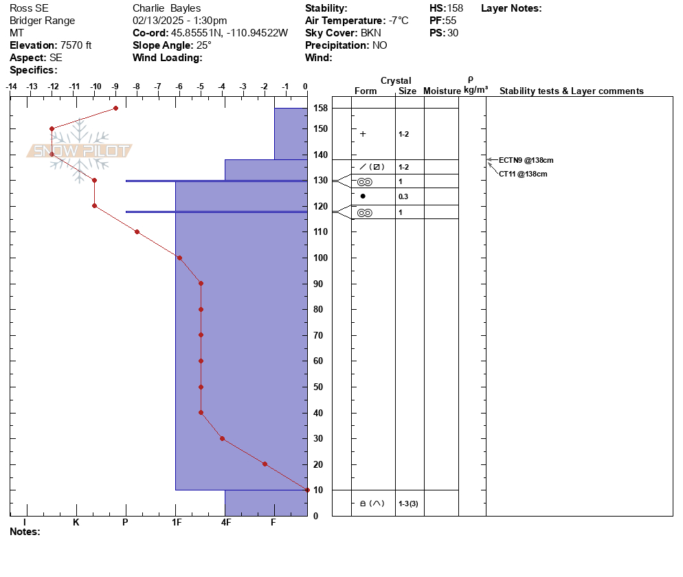
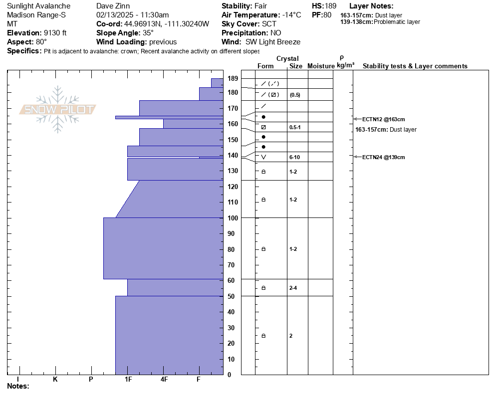
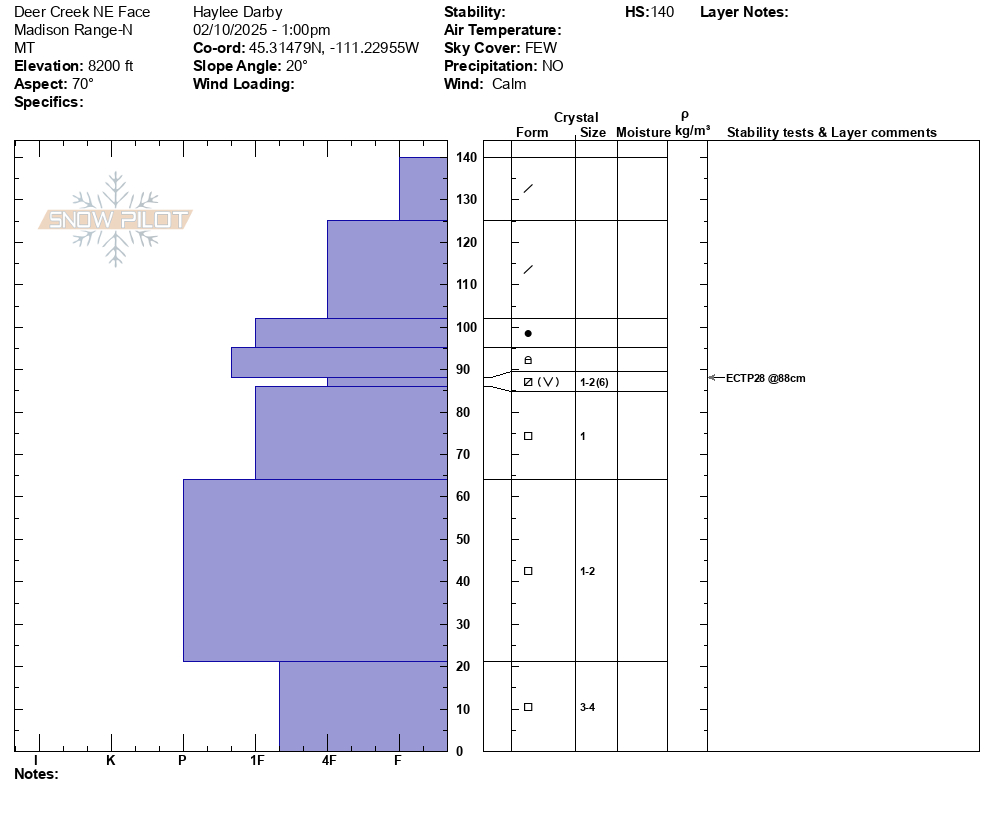
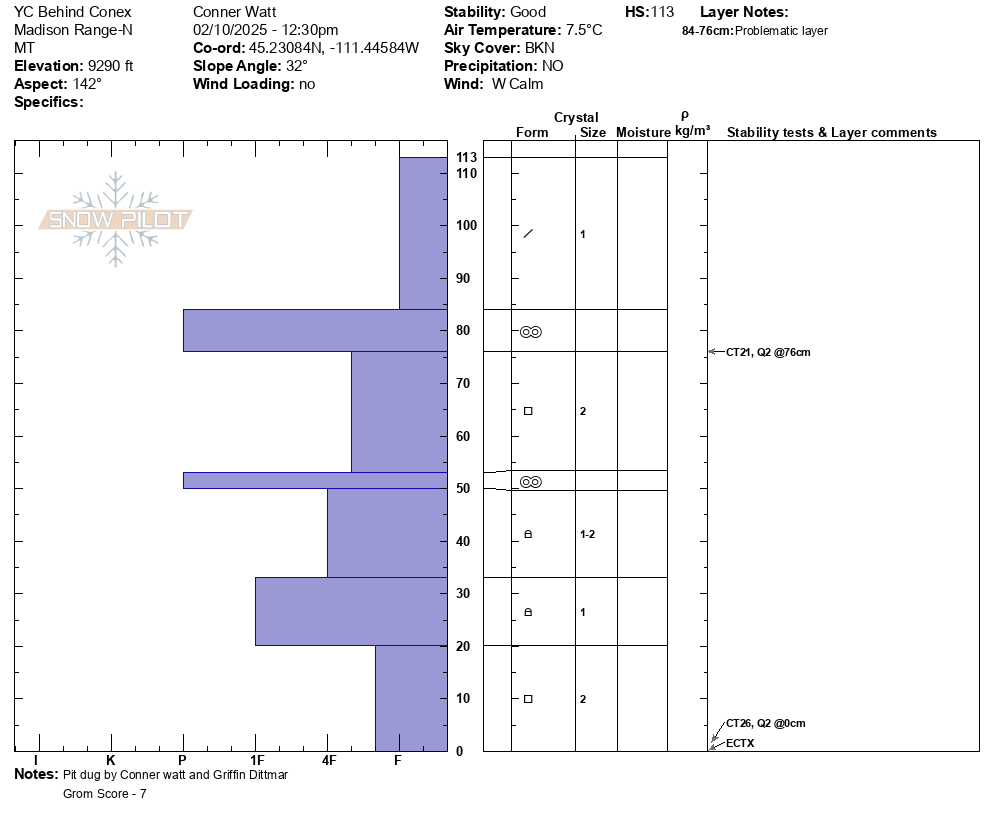
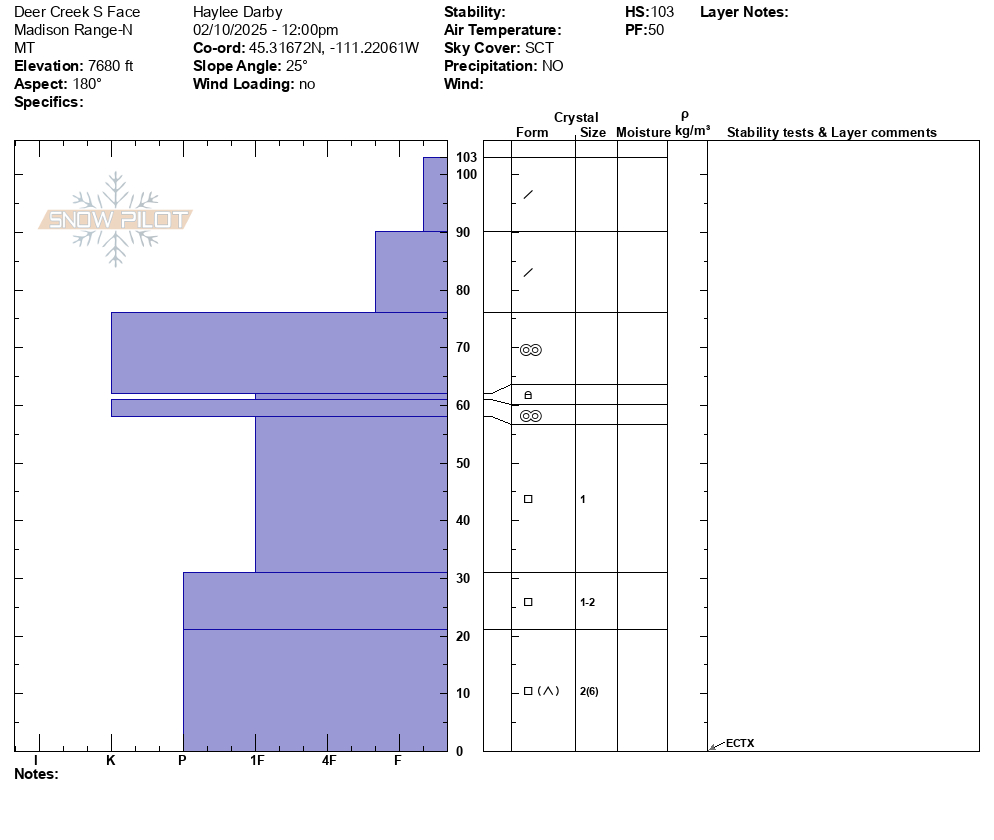
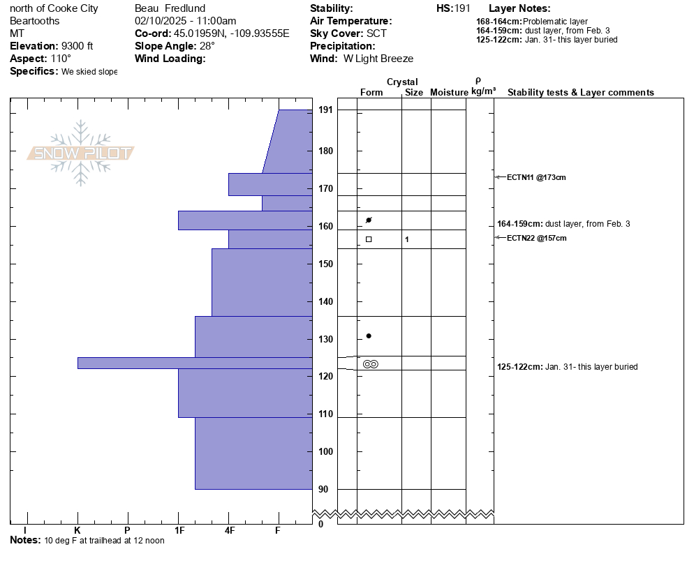
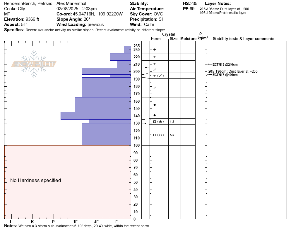
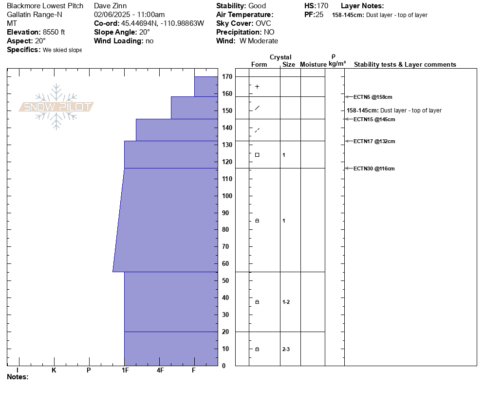
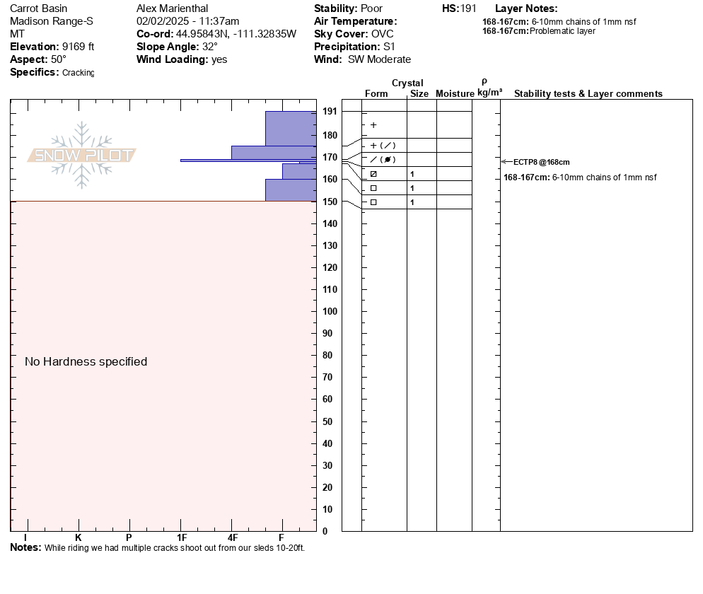
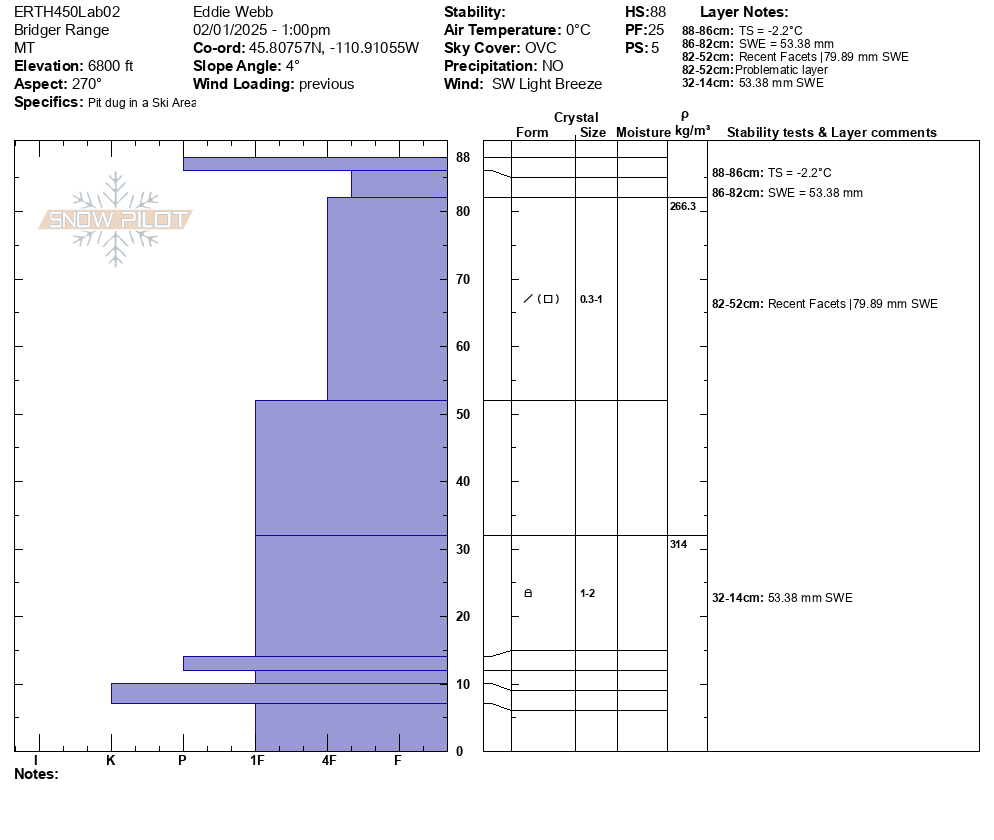
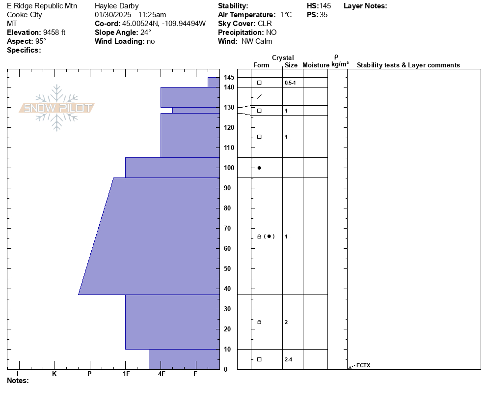
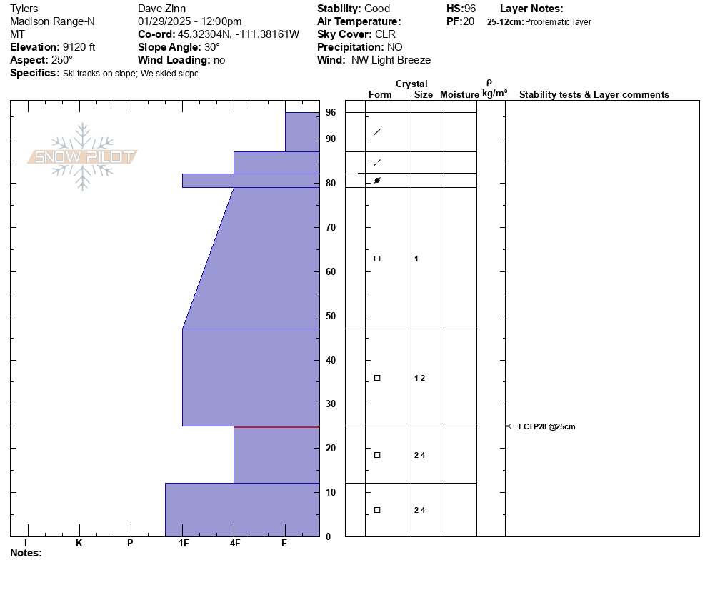
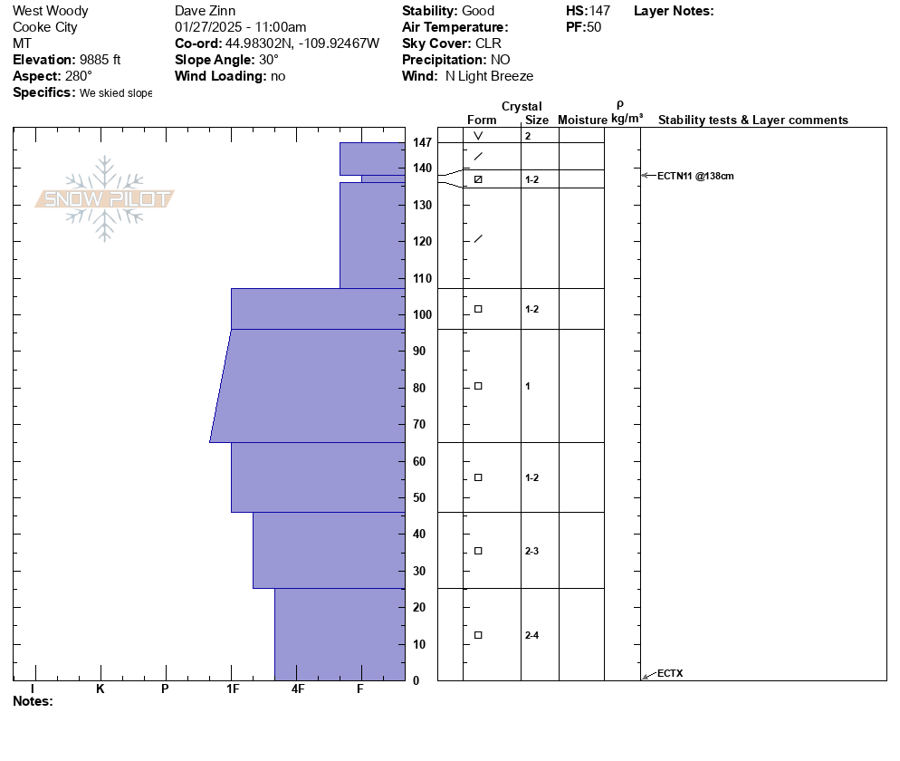
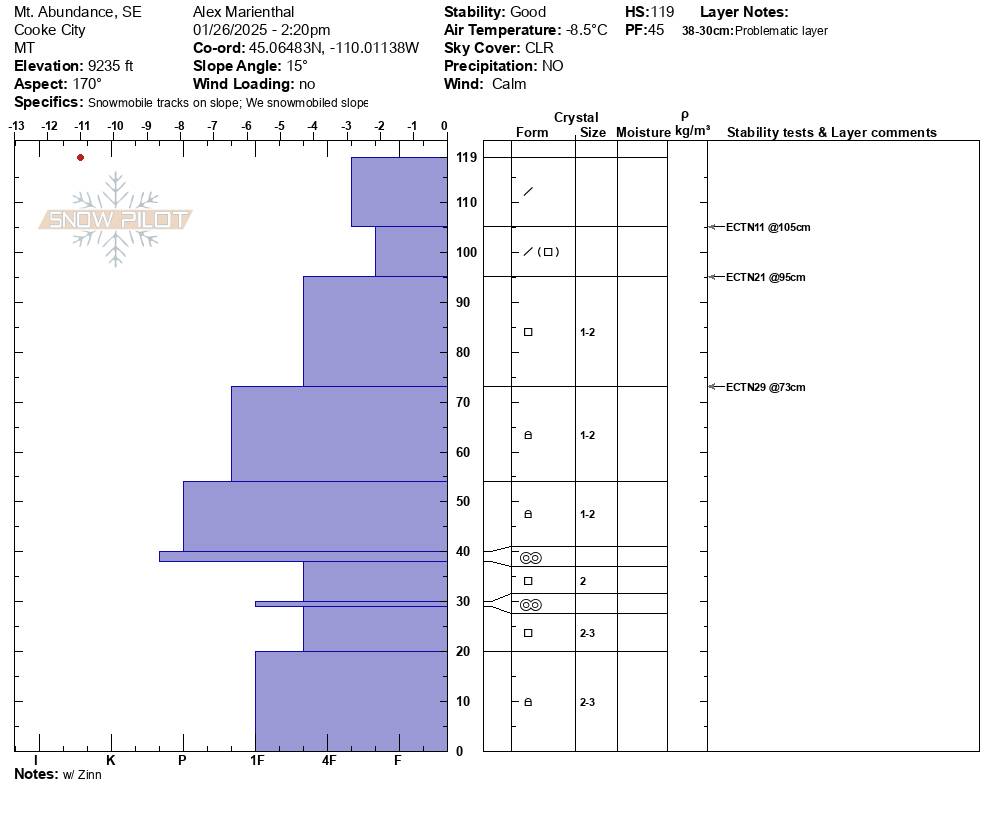
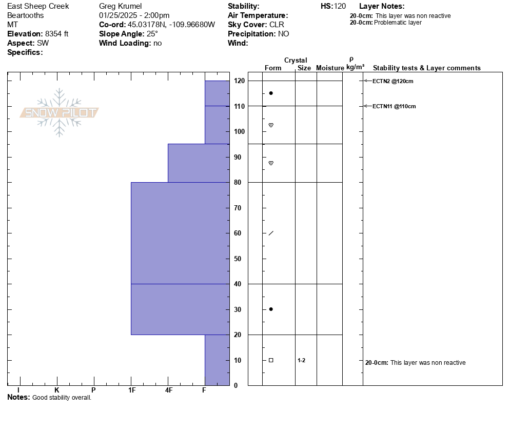
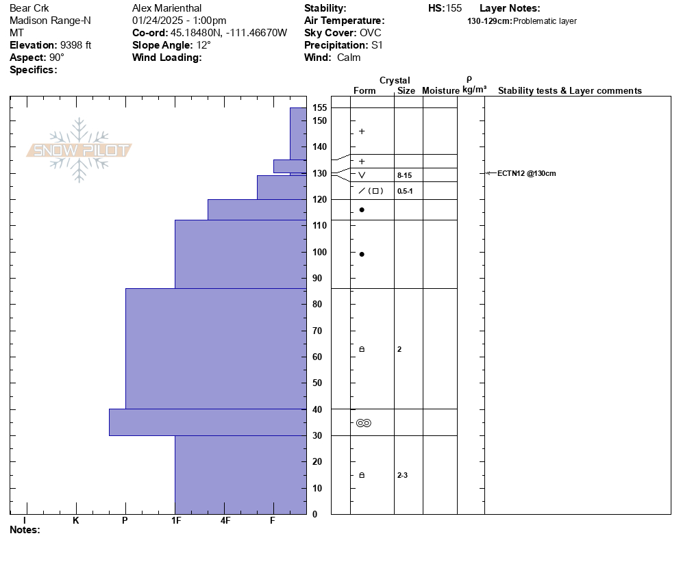
At Lionhead a weak layer generally 2-3 feet deep is obvious in this snowpit wall.
Trip Planning for Lionhead Range
Past 5 Days

Considerable

Considerable

Considerable

Considerable

Considerable
Relevant Avalanche Activity
SS-AMr-R3-D2-O
Elevation: 8,600
Aspect: SE
Coordinates: 44.7145, -111.3180
Caught: 0 ; Buried: 0
As we approached our second pit site on the lip of Moto Hill (southeast aspect at 8600'), I stopped and looked back in time to see avalanche debris slamming into the trees on a connected slope below. We remotely triggered the avalanche from 150 feet away. It broke 200' wide and 1-3 feet deep. It ran an estimated 200' vertical feet (based on a slope map. We couldn't safely access the toe of the debris). The avalanche failed on a layer of Fist hard facets. This is interesting because it is these mid-elevation slopes in the LH area that seemed really weak on previous visits to the area. The slope may have some wind-loading, but it was minimal and not the cause of this avalanche.
We dug a pit on an east aspect around the corner and down from Airplane Bowl (before the avalanche) and found a similar snowpack setup. 150 cm of total snow and half was composed of weak facets. ECTP22 and P24 on the mid-pack January layer of Fist hard facets and surface hoar.
Take Homes:
- Lionhead seems to be the epicenter of persistent slab instability. It is the weakest I have seen. Southern Madison and Southern Gallatin seem to be similar and I would group them together when describing conditions.
- Mid-elevation slopes are thin and weak and can clearly avalanche. This is problematic because many folks play in lower elevation terrain when conditions are dangerous... While small compared to the upper bowl, the avalanche we triggered would have been deadly. It was deep and it would have strained its victim through trees.
- We heard about a similar remote-triggered avalanche in Black Canyon today. This has me nervous that I missed something in the Centennials. While we didn't see anything too concerning there yesterday outside of wind-loaded slope, I am not happy about two remotely triggered slides less than 20 mile away.
More Avalanche Details
SS-AMr-R3-D2-O
Elevation: 8,000
Coordinates: 44.4780, -111.1350
Caught: 0 ; Buried: 0
From SnoWest Forums FB Page:
“Just getting word of a LARGE Remote Rider Triggered Slab Avalanche down inside of Black Canyon itself just off the Black Canyon Loop Trail in Island Park.
A 3-4ft thick slab broke loose and filled the bottom of the canyon with 12-15 FEET of debris, completely blocking off the canyon itself. Rider was NOT caught in it!! Had the rider been caught, there would have been ZERO chance of rescue under such a deep slide!”
More Avalanche Details
AM
Coordinates: 44.7254, -111.3320
Caught: 0 ; Buried: 0
Avalanche in Lionhead. Broke on wind slab then triggered persistent slab underneath.
More Avalanche Details
Relevant Photos
-
-
Remotely triggered the avalanche from 150 feet away. It broke 200' wide and 1-3 feet deep. It ran an estimated 200' vertical feet
-
Remotely triggered the avalanche from 150 feet away. It broke 200' wide and 1-3 feet deep. It ran an estimated 200' vertical feet
-
From FB message: "Small slide in lower elevation back by lionshead"
-
From obs: "We saw this today after it happened. Looked like a snowmobile triggered it. I believe it is mostly south facing." Photo: D. Haluptzok
-
We saw two recent shallow wind slab avalanches. No recent slides breaking deeper.
This one at NE 9000' -
Plenty of wind slabs ranging in size on Lionhead ridge and on surrounding slopes. Photo: Riley
-
Plenty of wind slabs ranging in size on Lionhead ridge and on surrounding slopes. Photo: Riley
-
Plenty of wind slabs ranging in size on Lionhead ridge and on surrounding slopes. Photo: Riley
-
1 meter deep snowpack showing the obvious facets in the bottom third
-
We dug a pit on an East facing aspect below the slope we had planned to ride. The height of snow was about 110 cm and there was a very concerning layer of large facets at 75cm deep going to the ground. Photo: C Culver
-
Our results were CT17 SPQ2 and ECTP26 SCQ1. Bother failures during tests were on the layer of facets and on the CT and ECT our columns easily separated from the facet layer after failure. Photo: C Culver
-
On Jan 12, we saw 4-5 avalanche crowns that were up to a week old, some had been reported and a few we had not heard of. Two were ~2' deep on less wind affected slopes lower down in the trees, but probably had some previous wind-loading. Photo: GNFAC
-
On Jan 12, we saw 4-5 avalanche crowns that were up to a week old, some had been reported and a few we had not heard of. Two were ~2' deep on less wind affected slopes lower down in the trees, but probably had some previous wind-loading. Photo: GNFAC
-
On Jan 12 We saw 4-5 avalanche crowns that were up to a week old, some had been reported and a few we had not heard of. The pictured one was a 3-4'+thick slab on a rocky heavily wind-loaded slope off Lionhead ridge. Photo: GNFAC
-
-
From IG Jan4, Photo: J. Urell
-
From IG Message Jan 4."They happened today because I did not see the debris on way in". Photo: T. Urell
-
Remote triggered this avalanche at Lionhead. We were snowmobiling to the left of where the avalanche occurred. No one was caught.
Coordinates: 44°43'36.8"N 111°19'05.0"W
Photo: Ben
-
Settling and collapsing on E-NE slopes above Hebgen. Full slope collapses and cracks, approximately 28 degree slope pictured.
Photo: C Koch
-
While touring up a low-angle ridge in the northern Lionhead, I experienced several large collapses, notably one that triggered a cornice fall from 50’ away. Another remote collapse caused about 500’ of an E facing bowl to propagate, but not slide. ~9200’ E-SE
Photo: N Sramek
-
While touring up a low-angle ridge in the northern Lionhead, I experienced several large collapses, notably one that triggered a cornice fall from 50’ away. Another remote collapse caused about 500’ of an E facing bowl to propagate, but not slide. ~9200’ E-SE
Photo: N Sramek
-
There was a natural avalanche on the landslide face above quake lake. The avalanche failed on a weak layers near the ground and broke several hundred feet wide.
-
From obs on 12/29: "On our way out near the cabin I cut a line close to a creek to see if I could trigger something."
-
From obs on 12/29: "On our way out near the cabin I cut a line close to a creek to see if I could trigger something."
-
Occurred during the day on 12/28 Photo: GNFAC
-
-
Plumes of drifting snow in the Bridger Range as strong winds blasted the mountains. Photo: GNFAC
-
From IG: On 12/15 "Storm slab broke about 200’ above us as skinning up the hallway coming from the north side on the throne." Photo: Anonymous
-
Gusty winds transporting snow in Taylor Fork on Saturday. Triggered a 4-5 inch deep wind slab that propagated about 50 ft at the top of a north east facing slope at 9,500 ft.
Photo: JP
-
WE facing snow at 8100 ft Cabin Ck
-
Cabin Creek snow cover
-
SE facing snow Cabin Creek
-
N facing snow Cabin Creek, 9000 ft
-
Big Sky Ski Patrol triggered this avalanche during mitigation work in The Wave on 11/26/24... "2-3' deep on an ice crust just above the ground with a 2# shot in the Upper rodeo. Volume was limited as most of the snow was loaded just underneath the cornice, but still produced a sizeable size 2... Other paths in the Lenin region ran meaty wind slabs, full track with no significant step downs." Photo: BSSP
-
Cracking on old, faceted, October snow hundreds of feet long. North facing near treeline. Photo: BSSP
-
Intentional, human-triggered avalanche by a ski patrol breaking at the ground on a north facing slope near treeline. Photo: BSSP
-
Snowpack on Ski Hill at Lionhead. Photo: GNFAC
-
Snowpit at Bridger Bowl on 11/5. Photo: B. VandenBos
-
From e-mail: "Photo attached from near top of hyalite peak, 11/2. Cracking in recent hard wind slab, I had to really jump hard to make this. Walked on many other hard slabs that were well bonded. Highly variable snowpack. I think you'd be most likely to get into trouble by popping out a small hard slab pocket like this and getting magic carpeted into some thinly covered terrain." Photo: B. VandenBos
Videos- Lionhead Range
Weather Stations- Lionhead Range
Weather Forecast Lionhead Range
Extended Forecast for10 Miles WNW West Yellowstone MT
Overnight

Low: 15 °F
Patchy
Blowing Snow
and BreezySunday

High: 26 °F
Snow Likely
and Patchy
Blowing SnowSunday Night

Low: 23 °F
Snow and
Patchy
Blowing SnowMonday

High: 29 °F
Chance Snow
and Patchy
Blowing SnowMonday Night

Low: 22 °F
Snow and
Patchy
Blowing SnowTuesday

High: 25 °F
Snow Likely
and BreezyTuesday Night
Low: 11 °F
Slight Chance
Snow then
Partly CloudyWednesday

High: 27 °F
Mostly Sunny
Wednesday Night

Low: 14 °F
Mostly Clear


